Search
Kizárt szavak
Tiltott szavak
- cialis
- viagra
- php
- sql
- html
- https
- http
- chr
- script
- sex
- porn
- sexmassage
Alternatív kifejezések
- =
41. Cserszegtomaj Delights
Last modification: 2025. November. 26. 09:41
Pickles, fermented vegetables, smoky zakuska, homemade jams, and roasted hazelnuts — all crafted from homegrown produce, free of additives, just like grandma used to make.
Találati relevancia adatok
Tárolt adatok:
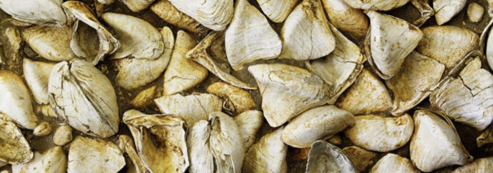
Imagine a vast body of water — over 1,000 meters deep and more than 400 times the size of Lake Balaton — once rippling across this land. The story of the Pannonian Lake is not just a fascinating chapter of geological history, but a legacy that continues to shape the region: it left behind mineral resources, fertile soils, and even inspired legends. Discover how an ancient lake transformed Transdanubia — and why its impact is still felt today.
An Inland Sea for Millions of Years
At its greatest extent, the Pannonian Lake covered an enormous area, far surpassing the size of today’s Balaton. For millions of years (approximately 12 to 8.5 million years ago), it dominated the region. As surrounding mountain ranges gradually rose, the lake became cut off from the world’s oceans. Its water slowly turned fresh, and its basin began to fill with sediments. Because of its isolation, the lake developed a unique ecosystem with many endemic species.
The Lake Didn’t Appear Overnight
The Pannonian Lake didn’t simply “appear” in the Carpathian Basin. Its formation was the result of millions of years of tectonic activity and shifting climate. It emerged as an independent, enclosed body of water — no longer connected to the open seas.
Deep Waters, Varied Shores
In some areas, the lake reached depths of over 1,000 meters. Elsewhere, shallower zones supported lagoons, river deltas, and small, isolated lakes. During high water periods, rocky shorelines formed along the mountain fringes — traces of which can still be found today in the Keszthely Hills and the Mecsek Mountains.
The Lake’s Retreat — and Sediment Legacy
Despite its size, the lake was eventually filled in by immense volumes of sediment, carried mainly by rivers flowing from the Alps and the Carpathians. Over the course of 6.5 million years, it gradually disappeared from the landscape.
What did it leave behind?
Its sediments — composed mostly of sand, clay, and fine silt — became the so-called “Pannonian formations,” which today hold key mineral resources (such as petroleum) and aquifers. These formations define much of the surface geology of Transdanubia, including the Zala Hills.
Fertile soils later formed on the laminated silty and clay-rich deposits of the Somló Formation. Even the legendary “Tihany goat’s hoof” fossils — actually worn shell fragments of the Congeria ungulacaprae mollusk — can still be found embedded in these ancient layers.
The Final Lakes and a Gradual Goodbye
Because most of the sediment entered from the northwest, north, and northeast, the lake slowly retreated toward the south and southeast — as if it were “withdrawing” from what is now Hungary.
Small remnant lakes persisted for much longer in areas of present-day Slavonia (Croatia) and northern Serbia, but due to their different scale, character, and fauna, they are not considered true successors of the ancient Pannonian Lake.
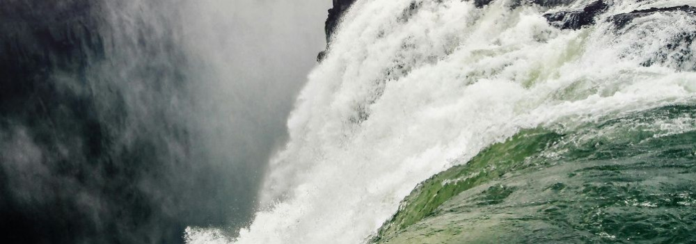
About 10,000 years ago, rapid climate warming triggered a cascade of natural responses: torrential floods, landslides, and intense rock weathering. The landscape we walk on today was not shaped over mere centuries, but by the dramatic forces of climate and water, working together. Did you know that the Zala Valley floor is made up of sediments deposited by a kind of "river of time"? Discover how the Earth’s surface became one of the most sensitive indicators of climate change.
Climate Change: Not Just a Modern Phenomenon
We often associate climate change with contemporary issues, but Earth’s climate has shifted many times throughout its history — sometimes quite rapidly. Within large-scale climatic cycles, alternating periods of warming and cooling have long been part of the planet’s natural rhythm.
When Climate Changes, Everything Reacts
A change in climate sets off a chain reaction of environmental processes. It’s not just animals and plants that respond — so does the landscape itself.
Around 10,000 years ago, as the climate warmed significantly, rainfall became more intense.
More rain meant more erosion: stormwater began washing away sediment from hills and valleys into riverbeds. The rivers, now carrying more water and more sediment, flooded more often and spread these materials across the landscape.
Shaping the Terrain
This had a major impact on topography: the land surface became more fragmented and dynamic. Warming temperatures also sped up chemical and physical weathering, breaking down bedrock and helping fertile soil layers to develop.
In short, natural geological processes that had long been underway suddenly accelerated — and reshaped the surface of the land.
Young Sediments at the Base of the Slopes
Today, in many areas of the region, the lower slopes and valley edges are coated with sediment — debris washed down from higher ground, largely within the last 10,000–20,000 years. In the Zala Valley, for instance, these deposits have spread so far that they now reach the center of the valley floor.
The original bedrock source of these sediments varies: in Zala, it’s typically Pannonian sand (Somló Formation), while in the Keszthely Hills, marine-origin carbonates dominate — mostly dolomite, with some limestone. These sediments now appear as fine gravel, pebbles, or coarse sand, quietly recording the environmental changes of the recent past.
42. Csizmás Syrup
Last modification: 2025. November. 26. 09:42
The unique highlight of Csizmás Syrup is their lightly herbal syrup made from homegrown hemp, but their raspberry, strawberry, and sour cherry syrups are also well worth a taste.
Találati relevancia adatok
Tárolt adatok:
Imagine a vast body of water — over 1,000 meters deep and more than 400 times the size of Lake Balaton — once rippling across this land. The story of the Pannonian Lake is not just a fascinating chapter of geological history, but a legacy that continues to shape the region: it left behind mineral resources, fertile soils, and even inspired legends. Discover how an ancient lake transformed Transdanubia — and why its impact is still felt today.
An Inland Sea for Millions of Years
At its greatest extent, the Pannonian Lake covered an enormous area, far surpassing the size of today’s Balaton. For millions of years (approximately 12 to 8.5 million years ago), it dominated the region. As surrounding mountain ranges gradually rose, the lake became cut off from the world’s oceans. Its water slowly turned fresh, and its basin began to fill with sediments. Because of its isolation, the lake developed a unique ecosystem with many endemic species.
The Lake Didn’t Appear Overnight
The Pannonian Lake didn’t simply “appear” in the Carpathian Basin. Its formation was the result of millions of years of tectonic activity and shifting climate. It emerged as an independent, enclosed body of water — no longer connected to the open seas.
Deep Waters, Varied Shores
In some areas, the lake reached depths of over 1,000 meters. Elsewhere, shallower zones supported lagoons, river deltas, and small, isolated lakes. During high water periods, rocky shorelines formed along the mountain fringes — traces of which can still be found today in the Keszthely Hills and the Mecsek Mountains.
The Lake’s Retreat — and Sediment Legacy
Despite its size, the lake was eventually filled in by immense volumes of sediment, carried mainly by rivers flowing from the Alps and the Carpathians. Over the course of 6.5 million years, it gradually disappeared from the landscape.
What did it leave behind?
Its sediments — composed mostly of sand, clay, and fine silt — became the so-called “Pannonian formations,” which today hold key mineral resources (such as petroleum) and aquifers. These formations define much of the surface geology of Transdanubia, including the Zala Hills.
Fertile soils later formed on the laminated silty and clay-rich deposits of the Somló Formation. Even the legendary “Tihany goat’s hoof” fossils — actually worn shell fragments of the Congeria ungulacaprae mollusk — can still be found embedded in these ancient layers.
The Final Lakes and a Gradual Goodbye
Because most of the sediment entered from the northwest, north, and northeast, the lake slowly retreated toward the south and southeast — as if it were “withdrawing” from what is now Hungary.
Small remnant lakes persisted for much longer in areas of present-day Slavonia (Croatia) and northern Serbia, but due to their different scale, character, and fauna, they are not considered true successors of the ancient Pannonian Lake.
43. Dédi nyomában Biogarden
Last modification: 2025. November. 26. 09:43
Homemade delicacies made from sun-ripened, chemical-free vegetables — straight from the pantry.
Találati relevancia adatok
Tárolt adatok:
About 10,000 years ago, rapid climate warming triggered a cascade of natural responses: torrential floods, landslides, and intense rock weathering. The landscape we walk on today was not shaped over mere centuries, but by the dramatic forces of climate and water, working together. Did you know that the Zala Valley floor is made up of sediments deposited by a kind of "river of time"? Discover how the Earth’s surface became one of the most sensitive indicators of climate change.
Climate Change: Not Just a Modern Phenomenon
We often associate climate change with contemporary issues, but Earth’s climate has shifted many times throughout its history — sometimes quite rapidly. Within large-scale climatic cycles, alternating periods of warming and cooling have long been part of the planet’s natural rhythm.
When Climate Changes, Everything Reacts
A change in climate sets off a chain reaction of environmental processes. It’s not just animals and plants that respond — so does the landscape itself.
Around 10,000 years ago, as the climate warmed significantly, rainfall became more intense.
More rain meant more erosion: stormwater began washing away sediment from hills and valleys into riverbeds. The rivers, now carrying more water and more sediment, flooded more often and spread these materials across the landscape.
Shaping the Terrain
This had a major impact on topography: the land surface became more fragmented and dynamic. Warming temperatures also sped up chemical and physical weathering, breaking down bedrock and helping fertile soil layers to develop.
In short, natural geological processes that had long been underway suddenly accelerated — and reshaped the surface of the land.
Young Sediments at the Base of the Slopes
Today, in many areas of the region, the lower slopes and valley edges are coated with sediment — debris washed down from higher ground, largely within the last 10,000–20,000 years. In the Zala Valley, for instance, these deposits have spread so far that they now reach the center of the valley floor.
The original bedrock source of these sediments varies: in Zala, it’s typically Pannonian sand (Somló Formation), while in the Keszthely Hills, marine-origin carbonates dominate — mostly dolomite, with some limestone. These sediments now appear as fine gravel, pebbles, or coarse sand, quietly recording the environmental changes of the recent past.
44. Emese Cheese Workshop
Last modification: 2025. November. 26. 09:45
High-quality, artisanal goat milk products straight from sunny Cserszegtomaj — available in both savory and sweet varieties. Find your favorite!
Találati relevancia adatok
Tárolt adatok:
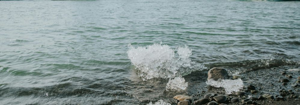
The Life-Giving Winds of the Ice Age: How Loess Shaped the Land
Did you know that Transdanubia’s rich, golden soils are actually a gift from the winds of the Ice Age? Loess isn’t just a dry geological term — it’s an ancient natural recipe that gave rise to some of the most fertile soils in the Carpathian Basin. Where vineyards grow today and birds nest in loess cliffs, strong winds once carried yellow dust across the landscape — for thousands of years. Learn how this unique sediment shaped the land and why loess is still essential for sustainable farming today.
What Is Loess and How Did It Form?
The term loess comes from the German word lose, meaning "loose." Loess is a fine-grained, yellowish sediment that was deposited during the Pleistocene epoch (2.58–0.01 million years ago), particularly during glacial periods. It formed in periglacial environments south of the great Scandinavian ice sheet — cold, dry landscapes with little or no vegetation.
The dust was carried by strong Ice Age winds from floodplains and barren steppes, and slowly accumulated over tens of thousands of years. Eventually, calcium carbonate cemented these layers into loess, which developed characteristic vertical fissures.
It’s important to note that the Pleistocene wasn't a single “Ice Age,” but a period that included alternating cold and warm phases — some even warmer than today.
Loess and the Landscape
Loess gave the Carpathian Basin — especially Transdanubia — its distinct terrain.
Steep loess cliffs (sometimes up to 10 meters high), caves that provide nesting sites for bee-eaters and sand martins, centuries-old sunken roads carved into hillsides, and exposed root systems are all part of the landscape’s geological legacy.
Together, they define the unique character of this region — shaped by time, wind, and stone.
Fertility and Water Retention
Loess-rich areas have produced some of the most fertile soils in the region. Many local producers farm on land that sits atop loess. This creates an excellent foundation for agriculture — not just because of the high humus content, but also because loess has outstanding water-holding capacity. Its vertical pores allow moisture to penetrate deeply and remain in the soil, even during dry periods.
A Modern Echo — Dust from the Sahara
Interestingly, the fine Saharan dust that now reaches Central Europe more frequently can be seen as a modern counterpart to loess-forming material. It’s a reminder that the powerful natural forces that shaped the land long ago are still at work today — just on a different scale.
45. GM Design
Last modification: 2025. November. 26. 09:57
In the heart of the “capital of Lake Balaton,” a small artisan workshop in Keszthely crafts handmade chocolates from premium Belgian ingredients. One of their most unique creations features sea buckthorn.
Találati relevancia adatok
Tárolt adatok:
46. KakasBonbon
Last modification: 2025. November. 26. 10:01
If you’ve never loved chocolate before, KakasBonbon is the place that will change your mind. Just follow the weathercock.
Találati relevancia adatok
Tárolt adatok:
Imagine a vast body of water — over 1,000 meters deep and more than 400 times the size of Lake Balaton — once rippling across this land. The story of the Pannonian Lake is not just a fascinating chapter of geological history, but a legacy that continues to shape the region: it left behind mineral resources, fertile soils, and even inspired legends. Discover how an ancient lake transformed Transdanubia — and why its impact is still felt today.
An Inland Sea for Millions of Years
At its greatest extent, the Pannonian Lake covered an enormous area, far surpassing the size of today’s Balaton. For millions of years (approximately 12 to 8.5 million years ago), it dominated the region. As surrounding mountain ranges gradually rose, the lake became cut off from the world’s oceans. Its water slowly turned fresh, and its basin began to fill with sediments. Because of its isolation, the lake developed a unique ecosystem with many endemic species.
The Lake Didn’t Appear Overnight
The Pannonian Lake didn’t simply “appear” in the Carpathian Basin. Its formation was the result of millions of years of tectonic activity and shifting climate. It emerged as an independent, enclosed body of water — no longer connected to the open seas.
Deep Waters, Varied Shores
In some areas, the lake reached depths of over 1,000 meters. Elsewhere, shallower zones supported lagoons, river deltas, and small, isolated lakes. During high water periods, rocky shorelines formed along the mountain fringes — traces of which can still be found today in the Keszthely Hills and the Mecsek Mountains.
The Lake’s Retreat — and Sediment Legacy
Despite its size, the lake was eventually filled in by immense volumes of sediment, carried mainly by rivers flowing from the Alps and the Carpathians. Over the course of 6.5 million years, it gradually disappeared from the landscape.
What did it leave behind?
Its sediments — composed mostly of sand, clay, and fine silt — became the so-called “Pannonian formations,” which today hold key mineral resources (such as petroleum) and aquifers. These formations define much of the surface geology of Transdanubia, including the Zala Hills.
Fertile soils later formed on the laminated silty and clay-rich deposits of the Somló Formation. Even the legendary “Tihany goat’s hoof” fossils — actually worn shell fragments of the Congeria ungulacaprae mollusk — can still be found embedded in these ancient layers.
The Final Lakes and a Gradual Goodbye
Because most of the sediment entered from the northwest, north, and northeast, the lake slowly retreated toward the south and southeast — as if it were “withdrawing” from what is now Hungary.
Small remnant lakes persisted for much longer in areas of present-day Slavonia (Croatia) and northern Serbia, but due to their different scale, character, and fauna, they are not considered true successors of the ancient Pannonian Lake.
47. MézÉdes Műhely
Last modification: 2025. November. 26. 10:36
Crumbly, fragrant, and spiced — MézÉdes Műhely’s honey gingerbread cookies bring back childhood memories, grandma’s kitchen, and the festive spirit with every bite.
Találati relevancia adatok
Tárolt adatok:
Imagine a vast body of water — over 1,000 meters deep and more than 400 times the size of Lake Balaton — once rippling across this land. The story of the Pannonian Lake is not just a fascinating chapter of geological history, but a legacy that continues to shape the region: it left behind mineral resources, fertile soils, and even inspired legends. Discover how an ancient lake transformed Transdanubia — and why its impact is still felt today.
An Inland Sea for Millions of Years
At its greatest extent, the Pannonian Lake covered an enormous area, far surpassing the size of today’s Balaton. For millions of years (approximately 12 to 8.5 million years ago), it dominated the region. As surrounding mountain ranges gradually rose, the lake became cut off from the world’s oceans. Its water slowly turned fresh, and its basin began to fill with sediments. Because of its isolation, the lake developed a unique ecosystem with many endemic species.
The Lake Didn’t Appear Overnight
The Pannonian Lake didn’t simply “appear” in the Carpathian Basin. Its formation was the result of millions of years of tectonic activity and shifting climate. It emerged as an independent, enclosed body of water — no longer connected to the open seas.
Deep Waters, Varied Shores
In some areas, the lake reached depths of over 1,000 meters. Elsewhere, shallower zones supported lagoons, river deltas, and small, isolated lakes. During high water periods, rocky shorelines formed along the mountain fringes — traces of which can still be found today in the Keszthely Hills and the Mecsek Mountains.
The Lake’s Retreat — and Sediment Legacy
Despite its size, the lake was eventually filled in by immense volumes of sediment, carried mainly by rivers flowing from the Alps and the Carpathians. Over the course of 6.5 million years, it gradually disappeared from the landscape.
What did it leave behind?
Its sediments — composed mostly of sand, clay, and fine silt — became the so-called “Pannonian formations,” which today hold key mineral resources (such as petroleum) and aquifers. These formations define much of the surface geology of Transdanubia, including the Zala Hills.
Fertile soils later formed on the laminated silty and clay-rich deposits of the Somló Formation. Even the legendary “Tihany goat’s hoof” fossils — actually worn shell fragments of the Congeria ungulacaprae mollusk — can still be found embedded in these ancient layers.
The Final Lakes and a Gradual Goodbye
Because most of the sediment entered from the northwest, north, and northeast, the lake slowly retreated toward the south and southeast — as if it were “withdrawing” from what is now Hungary.
Small remnant lakes persisted for much longer in areas of present-day Slavonia (Croatia) and northern Serbia, but due to their different scale, character, and fauna, they are not considered true successors of the ancient Pannonian Lake.
48. Osgyán Mustard
Last modification: 2025. November. 26. 10:38
Bold flavors, daring spices — mustard like you’ve never tasted before.
Találati relevancia adatok
Tárolt adatok:
About 10,000 years ago, rapid climate warming triggered a cascade of natural responses: torrential floods, landslides, and intense rock weathering. The landscape we walk on today was not shaped over mere centuries, but by the dramatic forces of climate and water, working together. Did you know that the Zala Valley floor is made up of sediments deposited by a kind of "river of time"? Discover how the Earth’s surface became one of the most sensitive indicators of climate change.
Climate Change: Not Just a Modern Phenomenon
We often associate climate change with contemporary issues, but Earth’s climate has shifted many times throughout its history — sometimes quite rapidly. Within large-scale climatic cycles, alternating periods of warming and cooling have long been part of the planet’s natural rhythm.
When Climate Changes, Everything Reacts
A change in climate sets off a chain reaction of environmental processes. It’s not just animals and plants that respond — so does the landscape itself.
Around 10,000 years ago, as the climate warmed significantly, rainfall became more intense.
More rain meant more erosion: stormwater began washing away sediment from hills and valleys into riverbeds. The rivers, now carrying more water and more sediment, flooded more often and spread these materials across the landscape.
Shaping the Terrain
This had a major impact on topography: the land surface became more fragmented and dynamic. Warming temperatures also sped up chemical and physical weathering, breaking down bedrock and helping fertile soil layers to develop.
In short, natural geological processes that had long been underway suddenly accelerated — and reshaped the surface of the land.
Young Sediments at the Base of the Slopes
Today, in many areas of the region, the lower slopes and valley edges are coated with sediment — debris washed down from higher ground, largely within the last 10,000–20,000 years. In the Zala Valley, for instance, these deposits have spread so far that they now reach the center of the valley floor.
The original bedrock source of these sediments varies: in Zala, it’s typically Pannonian sand (Somló Formation), while in the Keszthely Hills, marine-origin carbonates dominate — mostly dolomite, with some limestone. These sediments now appear as fine gravel, pebbles, or coarse sand, quietly recording the environmental changes of the recent past.
49. Skapér Apiary
Last modification: 2025. November. 26. 11:11
Over fifty years of beekeeping expertise, apitherapy knowledge, and pure Hungarian honey from Zalaszentgrót — at Skapér Apiary, every drop matters.
Találati relevancia adatok
Tárolt adatok:
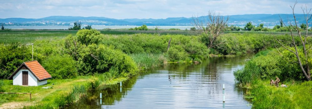
Did you know the Zala River once flowed into the Drava and only later “found” Lake Balaton?
The history of western Hungary’s water systems is not just a fascinating geological puzzle — it reads like an epic of Earth history: riverbeds shift, rivers “consume” one another, and even Lake Balaton doesn’t enter the scene until the final chapter. Discover how nature reshaped this landscape stroke by stroke — and how the Zala became Balaton’s most vital source of water.
The Quaternary Period and the Power of Landscape Formation
What sets the Quaternary Period (2.58 million years ago to the present) apart from earlier geological epochs is that the surface-shaping processes of this time — and the landforms they produced — continue to define our geographic environment today.
Pleistocene Changes: Riverbed Migrations and Terraces
One of the most pivotal surface processes during the Pleistocene (2.58 to 0.01 million years ago) was the migration of riverbeds and the formation of terraces and alluvial fans. These changes were closely tied to the slow retreat of the Pannonian Lake, which once filled much of the Carpathian Basin (see also: The Legacy of the Ancient Pannonian Lake).
The Ancient Danube Moves West
The early Danube initially flowed westward across what is now western Hungary, draining into the retreating Pannonian Lake. This westward course likely remained until the early Pleistocene.
A River’s Great Turning Point
The most dramatic hydrological change in the Carpathian Basin occurred between the Pliocene and Pleistocene: the formation of the Danube’s Visegrád Gorge (today’s Danube Bend), which diverted the river toward the center of the country and what is now the Pest Plain.
This shift profoundly affected all its former western tributaries — including the Zala.
The Story of the Zala: Migration and Capture
The river system of Central Transdanubia evolved in surprising ways, and the Zala’s journey is one of its most remarkable chapters. The Rába River already flowed northeastward toward the Little Hungarian Plain. The ancient Marcal, running northward, flowed into the Rába — and into it, in turn, flowed the ancient Zala.
But nature redrew the map — using the Zala as its brush. A now-vanished river flowing from north to south (its remnants visible today between Zalaszentgrót and Zalavár) cut into the landscape through a process called headward erosion — where rivers erode backward into the terrain, much like a hot knife slicing through butter. Eventually, it cut into the ancient Zala’s valley and “captured” the river, diverting it into its own course.
A New Path — and the Birth of Lake Balaton
From then on, the Zala made a sharp turn south at Türje and — with no Lake Balaton yet in existence — initially emptied into the Drava. Later, as the depression that would one day become Lake Balaton deepened, the Zala was gradually drawn toward it.
Lake Balaton, as a continuous body of water, is only about 5,000 years old — but for millions of years before, the Zala had already been on a winding journey that ultimately made it Balaton’s primary source of water, and the most life-giving river in the region today.
50. Tüskevár Kert
Last modification: 2025. November. 26. 11:13
Berry cultivation and processing are rare crafts — which makes them even more special. At Tüskevár Kert, you’ll get to taste unique creations like rosehip and Cornelian cherry preserves.
Találati relevancia adatok
Tárolt adatok:
The Life-Giving Winds of the Ice Age: How Loess Shaped the Land
Did you know that Transdanubia’s rich, golden soils are actually a gift from the winds of the Ice Age? Loess isn’t just a dry geological term — it’s an ancient natural recipe that gave rise to some of the most fertile soils in the Carpathian Basin. Where vineyards grow today and birds nest in loess cliffs, strong winds once carried yellow dust across the landscape — for thousands of years. Learn how this unique sediment shaped the land and why loess is still essential for sustainable farming today.
What Is Loess and How Did It Form?
The term loess comes from the German word lose, meaning "loose." Loess is a fine-grained, yellowish sediment that was deposited during the Pleistocene epoch (2.58–0.01 million years ago), particularly during glacial periods. It formed in periglacial environments south of the great Scandinavian ice sheet — cold, dry landscapes with little or no vegetation.
The dust was carried by strong Ice Age winds from floodplains and barren steppes, and slowly accumulated over tens of thousands of years. Eventually, calcium carbonate cemented these layers into loess, which developed characteristic vertical fissures.
It’s important to note that the Pleistocene wasn't a single “Ice Age,” but a period that included alternating cold and warm phases — some even warmer than today.
Loess and the Landscape
Loess gave the Carpathian Basin — especially Transdanubia — its distinct terrain.
Steep loess cliffs (sometimes up to 10 meters high), caves that provide nesting sites for bee-eaters and sand martins, centuries-old sunken roads carved into hillsides, and exposed root systems are all part of the landscape’s geological legacy.
Together, they define the unique character of this region — shaped by time, wind, and stone.
Fertility and Water Retention
Loess-rich areas have produced some of the most fertile soils in the region. Many local producers farm on land that sits atop loess. This creates an excellent foundation for agriculture — not just because of the high humus content, but also because loess has outstanding water-holding capacity. Its vertical pores allow moisture to penetrate deeply and remain in the soil, even during dry periods.
A Modern Echo — Dust from the Sahara
Interestingly, the fine Saharan dust that now reaches Central Europe more frequently can be seen as a modern counterpart to loess-forming material. It’s a reminder that the powerful natural forces that shaped the land long ago are still at work today — just on a different scale.
51. Zsankó family farm
Last modification: 2025. November. 26. 11:14
Ham and sausage need time — and at Zsankó Family Farm, they are given just that. You won’t find these flavors anywhere else.
Találati relevancia adatok
Tárolt adatok:
About 10,000 years ago, rapid climate warming triggered a cascade of natural responses: torrential floods, landslides, and intense rock weathering. The landscape we walk on today was not shaped over mere centuries, but by the dramatic forces of climate and water, working together. Did you know that the Zala Valley floor is made up of sediments deposited by a kind of "river of time"? Discover how the Earth’s surface became one of the most sensitive indicators of climate change.
Climate Change: Not Just a Modern Phenomenon
We often associate climate change with contemporary issues, but Earth’s climate has shifted many times throughout its history — sometimes quite rapidly. Within large-scale climatic cycles, alternating periods of warming and cooling have long been part of the planet’s natural rhythm.
When Climate Changes, Everything Reacts
A change in climate sets off a chain reaction of environmental processes. It’s not just animals and plants that respond — so does the landscape itself.
Around 10,000 years ago, as the climate warmed significantly, rainfall became more intense.
More rain meant more erosion: stormwater began washing away sediment from hills and valleys into riverbeds. The rivers, now carrying more water and more sediment, flooded more often and spread these materials across the landscape.
Shaping the Terrain
This had a major impact on topography: the land surface became more fragmented and dynamic. Warming temperatures also sped up chemical and physical weathering, breaking down bedrock and helping fertile soil layers to develop.
In short, natural geological processes that had long been underway suddenly accelerated — and reshaped the surface of the land.
Young Sediments at the Base of the Slopes
Today, in many areas of the region, the lower slopes and valley edges are coated with sediment — debris washed down from higher ground, largely within the last 10,000–20,000 years. In the Zala Valley, for instance, these deposits have spread so far that they now reach the center of the valley floor.
The original bedrock source of these sediments varies: in Zala, it’s typically Pannonian sand (Somló Formation), while in the Keszthely Hills, marine-origin carbonates dominate — mostly dolomite, with some limestone. These sediments now appear as fine gravel, pebbles, or coarse sand, quietly recording the environmental changes of the recent past.
52. Riesling Country - Czimondor Winery
Last modification: 2025. November. 26. 11:00
Találati relevancia adatok
Tárolt adatok:
Imagine a vast body of water — over 1,000 meters deep and more than 400 times the size of Lake Balaton — once rippling across this land. The story of the Pannonian Lake is not just a fascinating chapter of geological history, but a legacy that continues to shape the region: it left behind mineral resources, fertile soils, and even inspired legends. Discover how an ancient lake transformed Transdanubia — and why its impact is still felt today.
An Inland Sea for Millions of Years
At its greatest extent, the Pannonian Lake covered an enormous area, far surpassing the size of today’s Balaton. For millions of years (approximately 12 to 8.5 million years ago), it dominated the region. As surrounding mountain ranges gradually rose, the lake became cut off from the world’s oceans. Its water slowly turned fresh, and its basin began to fill with sediments. Because of its isolation, the lake developed a unique ecosystem with many endemic species.
The Lake Didn’t Appear Overnight
The Pannonian Lake didn’t simply “appear” in the Carpathian Basin. Its formation was the result of millions of years of tectonic activity and shifting climate. It emerged as an independent, enclosed body of water — no longer connected to the open seas.
Deep Waters, Varied Shores
In some areas, the lake reached depths of over 1,000 meters. Elsewhere, shallower zones supported lagoons, river deltas, and small, isolated lakes. During high water periods, rocky shorelines formed along the mountain fringes — traces of which can still be found today in the Keszthely Hills and the Mecsek Mountains.
The Lake’s Retreat — and Sediment Legacy
Despite its size, the lake was eventually filled in by immense volumes of sediment, carried mainly by rivers flowing from the Alps and the Carpathians. Over the course of 6.5 million years, it gradually disappeared from the landscape.
What did it leave behind?
Its sediments — composed mostly of sand, clay, and fine silt — became the so-called “Pannonian formations,” which today hold key mineral resources (such as petroleum) and aquifers. These formations define much of the surface geology of Transdanubia, including the Zala Hills.
Fertile soils later formed on the laminated silty and clay-rich deposits of the Somló Formation. Even the legendary “Tihany goat’s hoof” fossils — actually worn shell fragments of the Congeria ungulacaprae mollusk — can still be found embedded in these ancient layers.
The Final Lakes and a Gradual Goodbye
Because most of the sediment entered from the northwest, north, and northeast, the lake slowly retreated toward the south and southeast — as if it were “withdrawing” from what is now Hungary.
Small remnant lakes persisted for much longer in areas of present-day Slavonia (Croatia) and northern Serbia, but due to their different scale, character, and fauna, they are not considered true successors of the ancient Pannonian Lake.
53. Riesling Country - Takács Zsolt's Winery
Last modification: 2025. November. 26. 11:07
Találati relevancia adatok
Tárolt adatok:
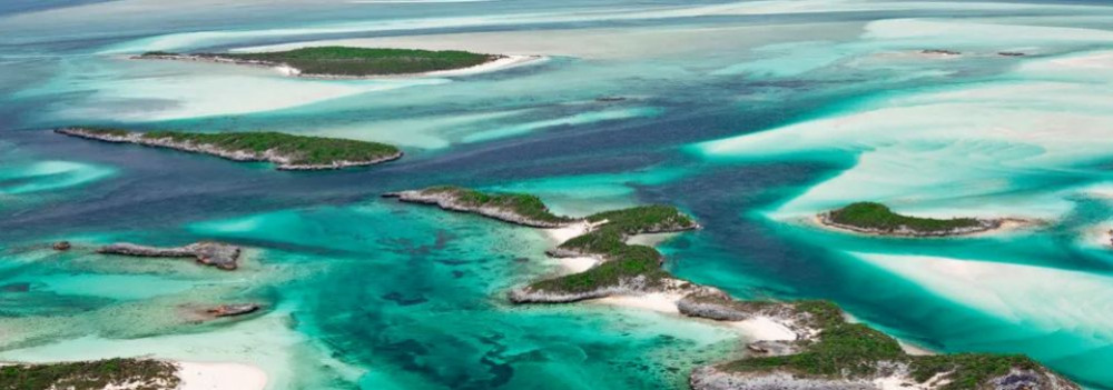
Imagine a tropical sea where the dolomitic peaks of the Keszthely Hills now rise. The landscapes we consider timeless are, in fact, fleeting guests on Earth’s ever-changing stage. How does a shallow tropical sea become Hungarian highlands? Why does dolomite crack? And how does this still influence local farming today? Travel back millions of years into a story written in stone.
The Surface: Only Seemingly Permanent
Mountains, plains, islands, seas, rivers, and lakes may appear permanent within a human lifetime — but from Earth’s perspective, they are only temporary scenes. The rocks that form our planet’s surface are constantly in motion. Like the shattered shell of a boiled egg, tectonic plates drift endlessly atop the semi-fluid mantle beneath them.
Some crash together or sink beneath one another to create towering mountain ranges, while others subside, forming deep trenches or basins that may fill with water. That’s how the dolomite and limestone now forming the Keszthely Hills were once deposited — in the shallow waters of an ancient tropical sea, thousands of kilometers from their present location and long since gone.
The scene would have resembled the crystal-clear shallows of today’s Bahamian paradise.
Volcanoes in the North, a Tropical Sea to the South
While the northern block of the Keszthely Hills is made of relatively young (a few million years old) volcanic rock, the southern section — including Rezi and Cserszegtomaj — is dominated by much older dolomite, formed in those ancient tropical seas. Alongside widespread formations of so-called Main Dolomite, small patches of Rezi Dolomite can also be found — dating back over 200 million years.
The Keszthely Plateau is dissected by a north–south valley system and crisscrossed by micro-tectonic fault lines. Due to the shallow topsoil and varied terrain, more than 70% of the area is forested. Its karst surface experiences year-round water scarcity and has unique ecological features.
The plateau is divided by intermontane basins and bordered by deep tectonic fractures (such as the Hévíz and Ederics faults), making the area seismically sensitive.
Geology and Today’s Land Use
Soils formed on the debris of weathered dolomite provide the natural foundation for land use in the region. Several of our local producers cultivate land along the western edge of the Keszthely Plateau, where farming is defined by the proximity of a highland landscape — a plateau formed of horsts rising 350–440 meters, framed by tectonic fault lines.
54. CseroSajt
Last modification: 2025. November. 26. 11:15
Smoked parenyica, spiced gomolya, sweet whey cream — if you love authentic flavors, you simply must try CseroSajt!

Találati relevancia adatok
Tárolt adatok:
Imagine a tropical sea where the dolomitic peaks of the Keszthely Hills now rise. The landscapes we consider timeless are, in fact, fleeting guests on Earth’s ever-changing stage. How does a shallow tropical sea become Hungarian highlands? Why does dolomite crack? And how does this still influence local farming today? Travel back millions of years into a story written in stone.
The Surface: Only Seemingly Permanent
Mountains, plains, islands, seas, rivers, and lakes may appear permanent within a human lifetime — but from Earth’s perspective, they are only temporary scenes. The rocks that form our planet’s surface are constantly in motion. Like the shattered shell of a boiled egg, tectonic plates drift endlessly atop the semi-fluid mantle beneath them.
Some crash together or sink beneath one another to create towering mountain ranges, while others subside, forming deep trenches or basins that may fill with water. That’s how the dolomite and limestone now forming the Keszthely Hills were once deposited — in the shallow waters of an ancient tropical sea, thousands of kilometers from their present location and long since gone.
The scene would have resembled the crystal-clear shallows of today’s Bahamian paradise.
Volcanoes in the North, a Tropical Sea to the South
While the northern block of the Keszthely Hills is made of relatively young (a few million years old) volcanic rock, the southern section — including Rezi and Cserszegtomaj — is dominated by much older dolomite, formed in those ancient tropical seas. Alongside widespread formations of so-called Main Dolomite, small patches of Rezi Dolomite can also be found — dating back over 200 million years.
The Keszthely Plateau is dissected by a north–south valley system and crisscrossed by micro-tectonic fault lines. Due to the shallow topsoil and varied terrain, more than 70% of the area is forested. Its karst surface experiences year-round water scarcity and has unique ecological features.
The plateau is divided by intermontane basins and bordered by deep tectonic fractures (such as the Hévíz and Ederics faults), making the area seismically sensitive.
Geology and Today’s Land Use
Soils formed on the debris of weathered dolomite provide the natural foundation for land use in the region. Several of our local producers cultivate land along the western edge of the Keszthely Plateau, where farming is defined by the proximity of a highland landscape — a plateau formed of horsts rising 350–440 meters, framed by tectonic fault lines.
55. Visitor Policy Hévíz
Last modification: 2025. November. 12. 13:57
Találati relevancia adatok
Tárolt adatok:
56. Lake Bath Hévíz
Last modification: 2024. August. 16. 13:37
Találati relevancia adatok
Tárolt adatok:
57. Traditional Hévíz Therapy
Last modification: 2024. April. 10. 11:10
Találati relevancia adatok
Tárolt adatok:
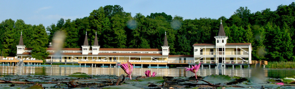
Hévíz has created its own trademark for therapies based on the healing properties of Lake Hévíz accreditation. Hévíz has been known for its excellent results in relieving musculoskeletal complaints Traditional Cure (HTK) has a 220-year spa history, thousands of cured guests and and modern medical research.
The main pillars of the Hévíz Traditional Cure are bathing in medicinal water, mud packs and weight bathing. As a complementary treatment, drinking from the medicinal water fountain is also part of the package, massages, movement therapies, physiotherapy and hydrotherapy. The ideal duration of the treatment ideally two weeks.
Institutions that have the necessary professionalism to carry the mark are eligible, medical background and medical infrastructure (e.g.: thermal pools, weight baths, mud packs). conditions are checked every two years by a professional committee. The next qualification period is May 2024.
The following institutions in Hévíz are qualified:
- Lake Bath
- Ensana Thermal Aqua****
- Ensana Thermal Hévíz**** superior
- Hotel Europa fit**** superior
- Hunguest Hotel Helios
- Kolping Hotel Spa & Family Resort ****
- NaturMed Hotel Carbona**** superior


Thermal water with a temperature of 32-34°C is ideal for the body. The water composition of the thermal water of Hévíz has proven anti-inflammatory and analgesic effects. Uniquely, the depth of the water allows the muscles to relax completely and the joints to perfectly relieve while swimming/floating in the water.
The effectiveness of the Hévíz medicinal lake is the result of a combination of several therapeutic factors
- the thermal effect of the water
- its mass and constant flow
- its gas and radium emanation content
- hydrostatic pressure
- bathing in the open air
Bathing in water at 32-34°C is the most optimal temperature for the body, as it is considered an indifferent temperature, which allows the water to effectively exert its chemical and biological properties and its calming effects on the nervous system.
The water rising from the spring cave keeps the water in constant motion and creates a vertical flow giving the bather a light, floating sensation.
The lake water is rich in gaseous substances, it contains hydrogen sulphide, carbonic acid, methane and radium gases. During bathing, gas bubbles adhere to the skin and are absorbed through it exerting their beneficial effects. The gases that escape from the water are then inhaled and enter the body through the lungs. The sulphur and radium emanations that are released promote cell regeneration, the function of certain endocrine glands, the production of immune substances and play an important role in healing.
In Lake Hévíz, unlike in most thermal waters, you bathe standing, in an upright position. This means that the legs, which are submerged deeper, are under more pressure than the upper parts of the body, which is beneficial for blood circulation: the pressure of the water drives blood from the veins in the lower limbs towards the heart.
Would you like to learn about the composition of the water?
The water of Lake Hévíz is calcium and magnesium bicarbonate-rich thermal water
|
Cation |
mg/l |
Anion |
mg/l |
Metaboric acid | 0,5 |
| Potassium | 6,8 | Chloride | 23 | Metaflinic acid | 43 |
| Sodium | 27 | Bromide | 0,11 | Free carbonic acid | 86 |
| Ammonium | 0,32 | Iodide | 0,021 | Dissolved oxygen | 3,6 |
| Calcium | 81 | Fluoride | 1,4 | ||
| Magnesium | 36 | Sulphate | 64 |
Total |
754 |
| Iron | 0,04 | Bicarbonate | 378 | ||
|
|
Sulphide | 3,2 | |||
| Total cations | 151 | Total anions | 470 |
The "speciality" of Hévíz
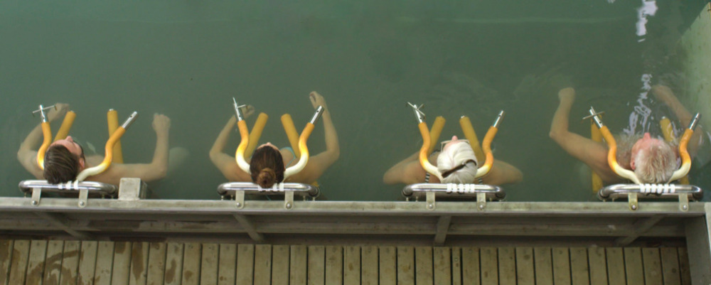
Weight bath is an underwater treatment designed to move the vertebrae of the spine away from each other, thus stretching the spinal column. The stretching allows the discs to return to their original healthy state. Weight bath is completely painless as the buoyancy of the water relaxes the body and the weights stretch the spine very gently. During the treatment, the patient "hangs" in the pool suspended by the neck and/or under the arms while weights are placed on the waist and/or ankles, depending on the condition. The weights are usually 2, 3 or 5 kilograms.
In the weight bath, the weights used can be suspended in 3 different ways:
- one-point suspension (neck only)
- two-point suspension (underarm support)
- three-point suspension (neck and underarm support)
Weights can be placed on the patient under medical instructions but not more than 20 kg at a time.
Treatment time: 20 minutes on average
Water temperature: indifferent (34-35 °C)
Indications:
- relieving pressure on discs and nerve roots
- easing of muscle spasms
- reducing ligament and muscle contractions
Contraindications:
- cardiovascular complaints
- high temperature, infectious disease
- acute musculoskeletal disease
- slipped vertebrae
- malignant tumour
- 6 weeks after disc surgery
In each case, the parameters of the weight-bath treatment, the duration, and the weight to be used are determined by the attending physician. Weight baths should only be used on the advice of a specialist. The treatments are carried out with gradual loads according to the parameters. Patients are suspended through the neck or underarm support.
Weight baths are available in the facilities of the Hévíz Spa and the St. Andrew’s Hospital for Rheumatic Diseases, such as the Rheumatology Hospital, the Lake Baths and the Festetics Bathhouse, as well as in the hotels offering the Traditional Hévíz Therapy.

Mud wraps for healing
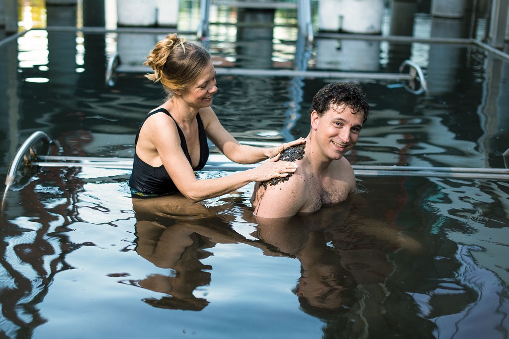
Hévíz mud is mostly peat of vegetable origin, dark grey and soft. It is unique, it has a special medicinal effect because of the radium salts and reduced sulphur compounds it contains. The medicinal water and mud from the tens of thousands of years old Pannonian Sea, together with complex physiotherapy treatments, are suitable for treating all rheumatic and musculoskeletal disorders.
The mud is used in the form of mud wraps in the course of therapies. The mud treatment lasts 20 minutes and is applied to a maximum of six body parts at a time. After the treatment, at least half an hour of rest is recommended.
It is recommended for the following diseases:
- in the treatment of chronic musculoskeletal disorders, in the case of abrasion, calcification, and inflammatory diseases
- in certain orthopaedic cases
- in some neurological problems
- for specific internal and gynaecological diseases
In Hévíz, mud baths can only be carried out on medical advice, but the mud pool of Lake Hévíz can be used with due caution.
Try it!
Pampering and health preservation at the master level: the therapeutic masseurs of Hévíz have found out how to combine the beneficial effects of therapeutic massage and medicinal mud in one treatment. This has become the Hévíz mud massage. Its main advantage is that it can be tried without a doctor's consultation. You only need to discuss with the masseur if there are any contraindications.
Try the cosmetic treatment with Hévíz mud
Today there are several types of cosmetic mud available on the beauty market - including one based on the peat mud of Hévíz. The products made from this mud make the skin velvety and soft. They also have a beneficial effect on skin and connective tissue cell renewal, reduce inflammation and the signs of ageing - as the heat dilates the capillaries, the supply of nutrients and oxygen increases and makes the skin more resistant.


All you need to know about therapeutic massage
The specialists of Hévíz recommend therapeutic massages as one of the main elements of the traditional treatments - in addition to bathing therapy. Therapeutic massage is an important treatment in physiotherapy. A 10-15 minute bath in thermal water is recommended before the massage. It relaxes the soft tissues and makes the massage more effective.
Therapeutic massages include:
- Swedish massage,
- reflex zone (segment, connective tissue, periosteal) massage,
- lymph massage,
- sports and refreshing massages.
The general effect of massage is to increase blood and lymphatic circulation. Heart rate and blood pressure change, metabolism speeds up, body temperature and breathing changes, excretion increases and thus detoxification. It also has a positive effect on the nervous system.
Click here to watch videos of several types of therapeutic and wellness massages.

Massages, including therapeutic massages, have a number of contraindications, so it is always necessary to consult a massage therapist before treatment.

Physiotherapy is an umbrella term that includes movement, electro-, and magnetic therapies.
Electrotherapy
In the course of the treatment two electrodes are used to send a low-voltage current to painful areas, and as a result, a slight tingling sensation is felt. Electrotherapy treatments are specifically designed to speed up healing and are excellent for ligament injuries.
Galvanic electrotherapy is good for pain relief and increases blood flow. Low-frequency treatments include ultrasound, magnetic resonance, diadynamic, ionomodulator, sonopuls, stymat, sonodynator, dionine, endomed, or cryotherapy, which is an excellent treatment for fresh joint injuries using cold air.
There are three types of high-frequency treatments: decimetric wave, microwave, short wave. During the treatment, high-frequency machines use the thermal effect of electricity to produce tissue engorgement.
- Electrotherapies: iontophoresis treatment, Diadynamic, Myotest, Interference treatment, Ultrasound treatment
- Magnetotherapy - magnetic ring, also known as pulsatron.
- Light therapies: Sollux, laser, evolite
- Mechanotherapy (movement therapy):
Passive: massage, therapeutic massage, andActive: physiotherapy, which can be individual or group therapy
Several of the above can be found in our video library to help you understand what they are used for and why.

Movement therapies are an effective way to achieve rapid improvement in musculoskeletal complaints and spinal problems.
During general movement development, the aim is to stimulate brain functions, increase and refine attention and concentration skills. Also, the movement therapy developments applied in Hévíz, such as physiotherapy, targeted spinal exercise, aim at healing, regeneration and prevention. These methods are particularly important in the treatment of musculoskeletal disorders.
Physiotherapy
Physiotherapy is of paramount importance in the treatment of musculoskeletal disorders, as it can effectively help to improve health conditions caused by a sedentary lifestyle.
During individual and group sessions, patients learn the movements that are important for them from qualified therapists, and can later do them at home. The aim is to restore damaged spines and joints, improve the musculoskeletal condition and correct posture.
Spinal exercise
A method used mainly to increase the range of motion of the spinal column and to mobilise the neck and waist. But successful results can be achieved by stretching muscles shortened due to incorrect posture or pain, strengthening muscles around the back, abdomen, hips, and improving coordination.
Underwater gymnastics
It combines the effects of physiotherapy with the healing and beneficial physical properties of water. The movements performed in the water are less strenuous, so they can also be done by people who find traditional gymnastics exhausting.
In addition to the traditional methods listed above, special methods can also be used to treat back problems:
• Schroth therapy
• Manual therapy
• McKenzie method
• Kinesio tape
• Spineliner treatment
Thermal water, not for external use only
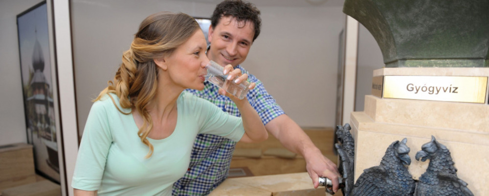
Dr Noémi Gyarmati says the following about the use of Hévíz sulphurous thermal water as a drinking cure: “It can be used successfully to increase intestinal function and stomach acid production, in cases of chronic intestinal inflammation, constipation or haemorrhoids. It relieves gall-bladder diseases and helps the healing of respiratory tract infections. Also, it can be used not as a drinking cure but as a gargle for chronic inflammation of the oral mucosa with good results."
Of course, like all medicinal waters, this one has contraindications too, so the consumption of sulphurous water should be avoided in the case of:
• acute inflammation of the liver and biliary tract,
• and increased thyroid function.
In the town, there are drinking fountains with medicinal water that can be used free of charge:
- • In the building of the indoor spa of the Hévíz Spa and St. Andrew’s Hospital for Rheumatic Diseases, opposite the entrance to Festetics Square (opening hours: 7.00 - 17.00)
- At the Kölcsey street event area
Thermal water can also be consumed at the drinking fountains in hotels where thermal water is used in therapy.
The thermal water of Hévíz cannot be bottled, so fresh water can only be consumed at the drinking fountains.
Treatment with water
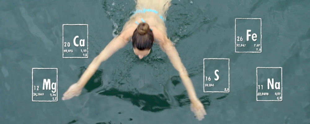
The physical properties of water are used in water therapies, and their effects are greatly enhanced by treatment with medicinal water. It mostly reduces the recovery time of people suffering from musculoskeletal disorders.
The temperature of the water - cold or hot - produces further opposite effects. In a hot bath, vasodilation occurs, blood pressure decreases and the heartbeat speeds up. In cold water baths, blood vessels constrict, causing blood pressure to rise, heart rate to fall and coronary arteries to constrict.
Types of treatment
In addition to the mud and weight bath treatments listed in the basic elements of the Traditional Hévíz Therapy, the following methods are also included in hydrotherapy, i.e. water treatments:
- Carbonic acid bath
- Electric bath
- Contrast bath therapy
- Underwater massage
- Hydroxeur-tub bath
58. The land of Rizling
Last modification: 2025. November. 26. 13:39
In “the land of Rizling”, anything can happen — but one thing is certain: an unforgettable wine tasting experience awaits in this hidden corner of the Keszthely Hills.
Találati relevancia adatok
Tárolt adatok:
Imagine a vast body of water — over 1,000 meters deep and more than 400 times the size of Lake Balaton — once rippling across this land. The story of the Pannonian Lake is not just a fascinating chapter of geological history, but a legacy that continues to shape the region: it left behind mineral resources, fertile soils, and even inspired legends. Discover how an ancient lake transformed Transdanubia — and why its impact is still felt today.
An Inland Sea for Millions of Years
At its greatest extent, the Pannonian Lake covered an enormous area, far surpassing the size of today’s Balaton. For millions of years (approximately 12 to 8.5 million years ago), it dominated the region. As surrounding mountain ranges gradually rose, the lake became cut off from the world’s oceans. Its water slowly turned fresh, and its basin began to fill with sediments. Because of its isolation, the lake developed a unique ecosystem with many endemic species.
The Lake Didn’t Appear Overnight
The Pannonian Lake didn’t simply “appear” in the Carpathian Basin. Its formation was the result of millions of years of tectonic activity and shifting climate. It emerged as an independent, enclosed body of water — no longer connected to the open seas.
Deep Waters, Varied Shores
In some areas, the lake reached depths of over 1,000 meters. Elsewhere, shallower zones supported lagoons, river deltas, and small, isolated lakes. During high water periods, rocky shorelines formed along the mountain fringes — traces of which can still be found today in the Keszthely Hills and the Mecsek Mountains.
The Lake’s Retreat — and Sediment Legacy
Despite its size, the lake was eventually filled in by immense volumes of sediment, carried mainly by rivers flowing from the Alps and the Carpathians. Over the course of 6.5 million years, it gradually disappeared from the landscape.
What did it leave behind?
Its sediments — composed mostly of sand, clay, and fine silt — became the so-called “Pannonian formations,” which today hold key mineral resources (such as petroleum) and aquifers. These formations define much of the surface geology of Transdanubia, including the Zala Hills.
Fertile soils later formed on the laminated silty and clay-rich deposits of the Somló Formation. Even the legendary “Tihany goat’s hoof” fossils — actually worn shell fragments of the Congeria ungulacaprae mollusk — can still be found embedded in these ancient layers.
The Final Lakes and a Gradual Goodbye
Because most of the sediment entered from the northwest, north, and northeast, the lake slowly retreated toward the south and southeast — as if it were “withdrawing” from what is now Hungary.
Small remnant lakes persisted for much longer in areas of present-day Slavonia (Croatia) and northern Serbia, but due to their different scale, character, and fauna, they are not considered true successors of the ancient Pannonian Lake.
Imagine a tropical sea where the dolomitic peaks of the Keszthely Hills now rise. The landscapes we consider timeless are, in fact, fleeting guests on Earth’s ever-changing stage. How does a shallow tropical sea become Hungarian highlands? Why does dolomite crack? And how does this still influence local farming today? Travel back millions of years into a story written in stone.
The Surface: Only Seemingly Permanent
Mountains, plains, islands, seas, rivers, and lakes may appear permanent within a human lifetime — but from Earth’s perspective, they are only temporary scenes. The rocks that form our planet’s surface are constantly in motion. Like the shattered shell of a boiled egg, tectonic plates drift endlessly atop the semi-fluid mantle beneath them.
Some crash together or sink beneath one another to create towering mountain ranges, while others subside, forming deep trenches or basins that may fill with water. That’s how the dolomite and limestone now forming the Keszthely Hills were once deposited — in the shallow waters of an ancient tropical sea, thousands of kilometers from their present location and long since gone.
The scene would have resembled the crystal-clear shallows of today’s Bahamian paradise.
Volcanoes in the North, a Tropical Sea to the South
While the northern block of the Keszthely Hills is made of relatively young (a few million years old) volcanic rock, the southern section — including Rezi and Cserszegtomaj — is dominated by much older dolomite, formed in those ancient tropical seas. Alongside widespread formations of so-called Main Dolomite, small patches of Rezi Dolomite can also be found — dating back over 200 million years.
The Keszthely Plateau is dissected by a north–south valley system and crisscrossed by micro-tectonic fault lines. Due to the shallow topsoil and varied terrain, more than 70% of the area is forested. Its karst surface experiences year-round water scarcity and has unique ecological features.
The plateau is divided by intermontane basins and bordered by deep tectonic fractures (such as the Hévíz and Ederics faults), making the area seismically sensitive.
Geology and Today’s Land Use
Soils formed on the debris of weathered dolomite provide the natural foundation for land use in the region. Several of our local producers cultivate land along the western edge of the Keszthely Plateau, where farming is defined by the proximity of a highland landscape — a plateau formed of horsts rising 350–440 meters, framed by tectonic fault lines.
59. Crossdest
Last modification: 2025. October. 14. 14:13
Találati relevancia adatok
Tárolt adatok:
60. Picnic Hévíz
Last modification: 2025. November. 26. 13:40
Találati relevancia adatok
Tárolt adatok:
Did you know the Zala River once flowed into the Drava and only later “found” Lake Balaton?
The history of western Hungary’s water systems is not just a fascinating geological puzzle — it reads like an epic of Earth history: riverbeds shift, rivers “consume” one another, and even Lake Balaton doesn’t enter the scene until the final chapter. Discover how nature reshaped this landscape stroke by stroke — and how the Zala became Balaton’s most vital source of water.
The Quaternary Period and the Power of Landscape Formation
What sets the Quaternary Period (2.58 million years ago to the present) apart from earlier geological epochs is that the surface-shaping processes of this time — and the landforms they produced — continue to define our geographic environment today.
Pleistocene Changes: Riverbed Migrations and Terraces
One of the most pivotal surface processes during the Pleistocene (2.58 to 0.01 million years ago) was the migration of riverbeds and the formation of terraces and alluvial fans. These changes were closely tied to the slow retreat of the Pannonian Lake, which once filled much of the Carpathian Basin (see also: The Legacy of the Ancient Pannonian Lake).
The Ancient Danube Moves West
The early Danube initially flowed westward across what is now western Hungary, draining into the retreating Pannonian Lake. This westward course likely remained until the early Pleistocene.
A River’s Great Turning Point
The most dramatic hydrological change in the Carpathian Basin occurred between the Pliocene and Pleistocene: the formation of the Danube’s Visegrád Gorge (today’s Danube Bend), which diverted the river toward the center of the country and what is now the Pest Plain.
This shift profoundly affected all its former western tributaries — including the Zala.
The Story of the Zala: Migration and Capture
The river system of Central Transdanubia evolved in surprising ways, and the Zala’s journey is one of its most remarkable chapters. The Rába River already flowed northeastward toward the Little Hungarian Plain. The ancient Marcal, running northward, flowed into the Rába — and into it, in turn, flowed the ancient Zala.
But nature redrew the map — using the Zala as its brush. A now-vanished river flowing from north to south (its remnants visible today between Zalaszentgrót and Zalavár) cut into the landscape through a process called headward erosion — where rivers erode backward into the terrain, much like a hot knife slicing through butter. Eventually, it cut into the ancient Zala’s valley and “captured” the river, diverting it into its own course.
A New Path — and the Birth of Lake Balaton
From then on, the Zala made a sharp turn south at Türje and — with no Lake Balaton yet in existence — initially emptied into the Drava. Later, as the depression that would one day become Lake Balaton deepened, the Zala was gradually drawn toward it.
Lake Balaton, as a continuous body of water, is only about 5,000 years old — but for millions of years before, the Zala had already been on a winding journey that ultimately made it Balaton’s primary source of water, and the most life-giving river in the region today.
The Life-Giving Winds of the Ice Age: How Loess Shaped the Land
Did you know that Transdanubia’s rich, golden soils are actually a gift from the winds of the Ice Age? Loess isn’t just a dry geological term — it’s an ancient natural recipe that gave rise to some of the most fertile soils in the Carpathian Basin. Where vineyards grow today and birds nest in loess cliffs, strong winds once carried yellow dust across the landscape — for thousands of years. Learn how this unique sediment shaped the land and why loess is still essential for sustainable farming today.
What Is Loess and How Did It Form?
The term loess comes from the German word lose, meaning "loose." Loess is a fine-grained, yellowish sediment that was deposited during the Pleistocene epoch (2.58–0.01 million years ago), particularly during glacial periods. It formed in periglacial environments south of the great Scandinavian ice sheet — cold, dry landscapes with little or no vegetation.
The dust was carried by strong Ice Age winds from floodplains and barren steppes, and slowly accumulated over tens of thousands of years. Eventually, calcium carbonate cemented these layers into loess, which developed characteristic vertical fissures.
It’s important to note that the Pleistocene wasn't a single “Ice Age,” but a period that included alternating cold and warm phases — some even warmer than today.
Loess and the Landscape
Loess gave the Carpathian Basin — especially Transdanubia — its distinct terrain.
Steep loess cliffs (sometimes up to 10 meters high), caves that provide nesting sites for bee-eaters and sand martins, centuries-old sunken roads carved into hillsides, and exposed root systems are all part of the landscape’s geological legacy.
Together, they define the unique character of this region — shaped by time, wind, and stone.
Fertility and Water Retention
Loess-rich areas have produced some of the most fertile soils in the region. Many local producers farm on land that sits atop loess. This creates an excellent foundation for agriculture — not just because of the high humus content, but also because loess has outstanding water-holding capacity. Its vertical pores allow moisture to penetrate deeply and remain in the soil, even during dry periods.
A Modern Echo — Dust from the Sahara
Interestingly, the fine Saharan dust that now reaches Central Europe more frequently can be seen as a modern counterpart to loess-forming material. It’s a reminder that the powerful natural forces that shaped the land long ago are still at work today — just on a different scale.
Imagine a vast body of water — over 1,000 meters deep and more than 400 times the size of Lake Balaton — once rippling across this land. The story of the Pannonian Lake is not just a fascinating chapter of geological history, but a legacy that continues to shape the region: it left behind mineral resources, fertile soils, and even inspired legends. Discover how an ancient lake transformed Transdanubia — and why its impact is still felt today.
An Inland Sea for Millions of Years
At its greatest extent, the Pannonian Lake covered an enormous area, far surpassing the size of today’s Balaton. For millions of years (approximately 12 to 8.5 million years ago), it dominated the region. As surrounding mountain ranges gradually rose, the lake became cut off from the world’s oceans. Its water slowly turned fresh, and its basin began to fill with sediments. Because of its isolation, the lake developed a unique ecosystem with many endemic species.
The Lake Didn’t Appear Overnight
The Pannonian Lake didn’t simply “appear” in the Carpathian Basin. Its formation was the result of millions of years of tectonic activity and shifting climate. It emerged as an independent, enclosed body of water — no longer connected to the open seas.
Deep Waters, Varied Shores
In some areas, the lake reached depths of over 1,000 meters. Elsewhere, shallower zones supported lagoons, river deltas, and small, isolated lakes. During high water periods, rocky shorelines formed along the mountain fringes — traces of which can still be found today in the Keszthely Hills and the Mecsek Mountains.
The Lake’s Retreat — and Sediment Legacy
Despite its size, the lake was eventually filled in by immense volumes of sediment, carried mainly by rivers flowing from the Alps and the Carpathians. Over the course of 6.5 million years, it gradually disappeared from the landscape.
What did it leave behind?
Its sediments — composed mostly of sand, clay, and fine silt — became the so-called “Pannonian formations,” which today hold key mineral resources (such as petroleum) and aquifers. These formations define much of the surface geology of Transdanubia, including the Zala Hills.
Fertile soils later formed on the laminated silty and clay-rich deposits of the Somló Formation. Even the legendary “Tihany goat’s hoof” fossils — actually worn shell fragments of the Congeria ungulacaprae mollusk — can still be found embedded in these ancient layers.
The Final Lakes and a Gradual Goodbye
Because most of the sediment entered from the northwest, north, and northeast, the lake slowly retreated toward the south and southeast — as if it were “withdrawing” from what is now Hungary.
Small remnant lakes persisted for much longer in areas of present-day Slavonia (Croatia) and northern Serbia, but due to their different scale, character, and fauna, they are not considered true successors of the ancient Pannonian Lake.
About 10,000 years ago, rapid climate warming triggered a cascade of natural responses: torrential floods, landslides, and intense rock weathering. The landscape we walk on today was not shaped over mere centuries, but by the dramatic forces of climate and water, working together. Did you know that the Zala Valley floor is made up of sediments deposited by a kind of "river of time"? Discover how the Earth’s surface became one of the most sensitive indicators of climate change.
Climate Change: Not Just a Modern Phenomenon
We often associate climate change with contemporary issues, but Earth’s climate has shifted many times throughout its history — sometimes quite rapidly. Within large-scale climatic cycles, alternating periods of warming and cooling have long been part of the planet’s natural rhythm.
When Climate Changes, Everything Reacts
A change in climate sets off a chain reaction of environmental processes. It’s not just animals and plants that respond — so does the landscape itself.
Around 10,000 years ago, as the climate warmed significantly, rainfall became more intense.
More rain meant more erosion: stormwater began washing away sediment from hills and valleys into riverbeds. The rivers, now carrying more water and more sediment, flooded more often and spread these materials across the landscape.
Shaping the Terrain
This had a major impact on topography: the land surface became more fragmented and dynamic. Warming temperatures also sped up chemical and physical weathering, breaking down bedrock and helping fertile soil layers to develop.
In short, natural geological processes that had long been underway suddenly accelerated — and reshaped the surface of the land.
Young Sediments at the Base of the Slopes
Today, in many areas of the region, the lower slopes and valley edges are coated with sediment — debris washed down from higher ground, largely within the last 10,000–20,000 years. In the Zala Valley, for instance, these deposits have spread so far that they now reach the center of the valley floor.
The original bedrock source of these sediments varies: in Zala, it’s typically Pannonian sand (Somló Formation), while in the Keszthely Hills, marine-origin carbonates dominate — mostly dolomite, with some limestone. These sediments now appear as fine gravel, pebbles, or coarse sand, quietly recording the environmental changes of the recent past.
Imagine a tropical sea where the dolomitic peaks of the Keszthely Hills now rise. The landscapes we consider timeless are, in fact, fleeting guests on Earth’s ever-changing stage. How does a shallow tropical sea become Hungarian highlands? Why does dolomite crack? And how does this still influence local farming today? Travel back millions of years into a story written in stone.
The Surface: Only Seemingly Permanent
Mountains, plains, islands, seas, rivers, and lakes may appear permanent within a human lifetime — but from Earth’s perspective, they are only temporary scenes. The rocks that form our planet’s surface are constantly in motion. Like the shattered shell of a boiled egg, tectonic plates drift endlessly atop the semi-fluid mantle beneath them.
Some crash together or sink beneath one another to create towering mountain ranges, while others subside, forming deep trenches or basins that may fill with water. That’s how the dolomite and limestone now forming the Keszthely Hills were once deposited — in the shallow waters of an ancient tropical sea, thousands of kilometers from their present location and long since gone.
The scene would have resembled the crystal-clear shallows of today’s Bahamian paradise.
Volcanoes in the North, a Tropical Sea to the South
While the northern block of the Keszthely Hills is made of relatively young (a few million years old) volcanic rock, the southern section — including Rezi and Cserszegtomaj — is dominated by much older dolomite, formed in those ancient tropical seas. Alongside widespread formations of so-called Main Dolomite, small patches of Rezi Dolomite can also be found — dating back over 200 million years.
The Keszthely Plateau is dissected by a north–south valley system and crisscrossed by micro-tectonic fault lines. Due to the shallow topsoil and varied terrain, more than 70% of the area is forested. Its karst surface experiences year-round water scarcity and has unique ecological features.
The plateau is divided by intermontane basins and bordered by deep tectonic fractures (such as the Hévíz and Ederics faults), making the area seismically sensitive.
Geology and Today’s Land Use
Soils formed on the debris of weathered dolomite provide the natural foundation for land use in the region. Several of our local producers cultivate land along the western edge of the Keszthely Plateau, where farming is defined by the proximity of a highland landscape — a plateau formed of horsts rising 350–440 meters, framed by tectonic fault lines.