Who is this tour recommended for?
Although the route includes a more demanding climb, it follows cycle paths and very quiet rural roads for most of the journey, making it suitable for families with children. The uphill section is easier to complete on an e-bike, but thanks to the short distance, the route is also suitable for beginners.
Recommended bicycle
The route can be completed on almost any type of bicycle, as nearly the entire surface is smooth asphalt. However, trekking bikes are particularly recommended.
Rest stops
About halfway through the tour, at the top of the climb, a bicycle rest area offers a magnificent panoramic view. It is also well worth stopping at the artisan chocolate workshop or at the village pub almost directly opposite for a refreshing drink.
Sections requiring extra caution
When reaching the main road in Felsőpáhok, you may encounter heavier local traffic for approximately 300 metres. From the village centre onwards, the route descends steeply, so special care should be taken when cycling with children until reaching the church. From there, a cycle path leads all the way back to Hévíz.
The tour starts and finishes at the Tourinform Office in Hévíz.
The route consists of four sections.
Total distance: 10.2 km
Section 1 – 1.6 km
Route
Tourinform – Széchenyi Street – Roundabout – Szent András Street – MAVIR Substation
From the Tourinform Office, located at the northern end of Rákóczi Street, turn into Széchenyi Street. It is recommended to walk your bicycle across the pedestrian crossing and mount only after entering Széchenyi Street. The road climbs steadily at around 4% until the roundabout at the top. Continue straight through the roundabout, taking the third exit. Szent András Street then descends steeply towards the electrical substation, quickly rewarding the effort of the climb.
The streets in central Hévíz are in good condition. Although Széchenyi Street is steep, it is relatively wide and safe for cycling. Szent András Street is narrower but carries very little traffic. Nevertheless, keep your hands ready on the brakes from the roundabout onwards.
Halfway up the climb stands the Roman Catholic Church of the Holy Spirit, locally known as the "Blue Church". Consecrated in 1999, its seven towers symbolise the Seven Gifts of the Holy Spirit. The church features many unique architectural details both inside and out. Opposite the church is the Town Hall, whose façade is decorated with a mosaic depicting Saint Stephen.
The oldest part of Hévíz, known as Szentandrás, once stood on the hillside towards Páhok. The settlement was named after the patron saint of its church, first mentioned in written records in the early 14th century. The original church was destroyed during the Ottoman period. A wooden bell tower was erected in the early 19th century and later replaced with a stone tower. The building was reconsecrated as a church in 1966, but after the construction of the Blue Church it was given a new purpose and has served as a social care facility since 2000.
Section 2 – 2.5 km
Route
MAVIR Substation – Bük Junction – Underpass beneath Road 760 – Bicycle Rest Area – Felsőpáhok
At the end of Szent András Street, cross the western bypass road of Hévíz to reach the road running alongside the electrical substation. The road forks here; ignore the branch leading to the substation and continue straight ahead on the well-maintained asphalt road heading north.
About 500 metres beyond the substation, turn left at the first paved junction. The road climbs gently at first before becoming steeper, but the surface remains excellent throughout. It is difficult to lose your way, as there are no confusing junctions—only a few sharp bends.
Soon you will reach the underpass. After passing through it, the climb becomes less demanding, and within approximately 200 metres you arrive at the highest point of the tour, where a bicycle rest area awaits. This is an ideal place to take a break—not only after the climb but also to enjoy one of the finest panoramic views in the region.
Beyond the rest area, the route continues pleasantly on almost level ground into the village of Felsőpáhok.
Shortly after the electrical substation, you enter Billegér, the former vineyard and garden district north of Felsőpáhok. In the past, the entire area was devoted to agriculture, with small vineyards and orchards shaping the landscape. Today, many of these plots have been abandoned. The southern and western parts are now covered by woodland or cultivated as arable fields, while only a small area remains dedicated to vineyards and fruit growing.
From the highest point of the asphalt road, the hill offers beautiful views over the surrounding countryside, particularly towards Hévíz, the hills of the Keszthely Mountains, and the shimmering waters of Lake Balaton.
Section 3 – 3.0 km
Route
Széchenyi Street – Árpád Street – Dózsa Street – Szent István Street – Szabadság Street – Panoráma Street – Kölcsey Street – Main Road – Hévízi Street Junction
After entering Felsőpáhok, continue straight for about 700 metres before turning right into Árpád Street at the first paved road. The local football pitch and its buildings confirm that you are on the correct route. Immediately after the football ground, turn left into Dózsa György Street.
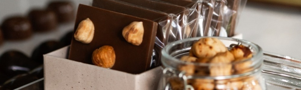
Halfway along the street, on the right-hand side, you will find one of the highlights of the tour: the KakasBonbon artisan chocolate workshop. A visit offers not only delicious handmade chocolates but also an interesting insight into the chocolate-making process.
If chocolate is not to your taste, the Páhok Pub, located about 100 metres further on to the left, is well known for its excellent coffee rather than its beer.
From Dózsa György Street, turn left onto the village's main road, Szent István Street. (Interestingly, unlike many Hungarian villages, the main street here is not named Kossuth Street.) The road continues as Szabadság Street. Traffic may be somewhat heavier along this section, but after a few hundred metres you turn right into Panoráma Street.
Upon reaching the boundary of Alsópáhok, continue via Kölcsey Street to the village's main road. The next 500 metres are again slightly busier, although motorists are accustomed to cyclists. Exercise normal caution until reaching Hévízi Street, which branches off to the left opposite the church.
The histories of Felsőpáhok and Alsópáhok are closely intertwined, as reflected in both their names and the history of their churches. The names are believed to derive from the Hungarian verb páhol, referring to leather tanning, once an important local craft supported by the nearby thermal springs.
The prefixes Felső ("Upper") and Alsó ("Lower") describe their geographical locations. Felsőpáhok occupies the higher ground on the hillside, while Alsópáhok developed lower down in the valley.
A church and cemetery stood on the site of today's church in Felsőpáhok as early as the 14th century, although they were destroyed during the Ottoman period. A new church was built at the beginning of the 18th century and became the mother church of the surrounding area. By the end of the century, however, its condition had deteriorated, and the parish seat was transferred to the newly built church in Alsópáhok.
The present church of Felsőpáhok was built in 1872 and dedicated to the Finding of the Holy Cross, while the church in Alsópáhok, consecrated in 1778, is dedicated to the Exaltation of the Holy Cross.
The Baroque church of Alsópáhok is a protected historic monument. After its completion, it became the seat of the local parish. Most of its furnishings date from the 18th and 19th centuries and include Baroque and Rococo furniture, decorative elements and stained-glass windows from the early 20th century. Since 1905, a relic of the Holy Cross has further enhanced the church's spiritual significance.
Section 4 – 3.1 km
Route
Alsópáhok Junction – Alsópáhok–Hévíz Cycle Path – Cycle Path around Lake Hévíz – Rákóczi Street – Tourinform Office
From the main road in Alsópáhok, a dedicated cycle path leads all the way to Hévíz and continues to the Thermal Lake. In the BalatonBike365 (BB365) network, this section is designated as Route 121 and is additionally marked with the blue A and B route symbols.
The route begins with a downhill section from Alsópáhok, followed by a moderate climb at the boundary of Hévíz to a bicycle rest area. From there, it descends again towards the thermal spa.
Upon reaching the Thermal Lake, the cycle path is interrupted for approximately 100 metres. It then joins the EV14 route coming from Keszthely and the Green Route 13, continuing around the lake. Up to Deák Square, the route follows a shared pedestrian and cycle path. At the square, turn into Rákóczi Street, the pedestrian zone, and after approximately 300 metres you will arrive back at the Tourinform Office, where the tour ends.
Lake Hévíz lies in a valley, a feature that becomes clearly noticeable during the ride. Covering more than four hectares and surrounded by an extensive protected forest, the oval-shaped lake is the world's largest biologically active natural thermal lake.
The lake's water flows into the Hévíz Canal, which then joins the River Zala before eventually reaching Lake Balaton. The canal can be seen opposite the Festetics Bath House.
The development of Hévíz as a spa resort began in the late 18th century under the patronage of Count György Festetics. In 1795, he initiated bathing facilities built on floating platforms on the lake. During the 1860s, the so-called "New Settlement" was established, while from 1905 onwards, brewer Vencel Reischl of Keszthely—who leased the spa from the Festetics family for 35 years—gave fresh momentum to the area's infrastructure development.
These investments laid the foundations for the lake's enduring national importance as both a tourist destination and a centre for medical treatment.
In 1898, Professor Sándor Lovassy of the Academy of Keszthely introduced Indian red water lilies into the lake. They have since become one of Lake Hévíz's most distinctive attractions and an enduring symbol of both the lake and the town.
Lake Hévíz is surrounded by a 60-hectare protected forest, much of which was artificially planted. This forest plays a vital role in maintaining the lake's unique microclimate by protecting it from northerly winds, dust, rapid cooling and noise, while the constant evaporation of the thermal water naturally purifies the surrounding air.

Who is this tour recommended for?
Due to its length and elevation changes, this tour requires an intermediate level of cycling experience. It is particularly recommended for groups of friends who enjoy the challenge of short but demanding climbs and descents. Nature lovers will especially appreciate the route, not only for its beautiful scenery but also for its unique topography. Almost the entire tour takes place in a peaceful natural setting.
Recommended bicycle
Given the road conditions, an electric mountain bike is the ideal choice, although more experienced cyclists can comfortably complete the route on a conventional bicycle. Wider-than-average tyres and reliable brakes are strongly recommended. Most of the route follows medium-quality asphalt roads, but there is one rocky section. Between the Karmacs junction and Hévíz, the road is gravelled, with one short unpaved stretch.
Rest stops
In addition to the local businesses included along the route, there are two designated rest areas. The first is a bicycle rest area at the furthest point of the tour. The second is located on the return route, along the gravel section near the protected historic Jewish cemetery. There are very few opportunities to buy food or drinks along the way, so be sure to bring sufficient water and some fruit.
Sections requiring extra caution
When leaving Hévíz, it is easy to accidentally enter the car park of Hotel Dobogómajor. This is not a problem, however, as you can simply leave through the hotel's main entrance and continue the route.
Crossing Sümeg Road requires particular care. It is recommended to dismount and cross the road on foot, especially when riding in a group.
After the bicycle rest area in Rezi, turn right onto Alsókövesi Street. Here the road descends and is partly covered with larger stones, so ride slowly and with caution. The main road beside the csárda carries relatively heavy traffic for approximately 300 metres until the first junction. As there is no alternative route, extra care is required along this section.
Although this is one of the longer tours, it can still be comfortably completed by recreational cyclists. The route follows well-signposted roads and paths and, apart from one short section, runs almost entirely through peaceful, traffic-free green surroundings. The tour is divided into four sections, based primarily on the different types of roads rather than the stopping points.
Total distance: 18.1 km
Section 1 – 2.1 km
Route
Tourinform Hévíz – Széchenyi Street – Main Car Park – Le Primore Street – Dobogómajor – Hévízi Street – Bikedi Sor (Cserszegtomaj)
From the Tourinform Office, turn left and cycle approximately 200 metres down Széchenyi Street, then turn left into the main car park. As vehicles are often manoeuvring here, take extra care until you reach Le Primore Square. The bus station is located on the corner, where you should turn right. Even if the barriers at the car park are closed, they do not prevent cyclists from passing through.
The road is wide enough for safe cycling. At the end of the street, you join the cycle path towards Cserszegtomaj, which currently extends as far as Hotel Dobogómajor and partly passes through the hotel grounds. At the Y-junction, be sure to take the left-hand branch towards Cserszegtomaj.
After a short distance, you reach a hazardous junction at Sümeg Road. It is recommended to dismount and push your bicycle across the busy road before continuing straight ahead.
Continue uphill along Bikedi Sor until the first junction, where you turn left into Barlang Street and join the signposted Cycle Route 135. Barlang Street continues as Barát Street, which you follow along Route 135.
The largest car park in Hévíz is lined with numerous shops, cafés and restaurants, making it a busy area for both motorists and pedestrians. Behind the car park is the well-known Farmers' Market, held every Tuesday, Thursday and Saturday, where visitors can buy high-quality, chemical-free local produce. Fresh bread, cured meats, cheeses, vegetables, dairy products and pastries are all available, alongside handmade crafts ranging from natural soaps to ceramic products.
Leaving the car park behind, you gradually depart Hévíz and enter the Dobogómajor district of Cserszegtomaj, home to the Club Dobogómajor hotel complex. The area, formerly known as Keszthely-Dobogó, contains an important Avar archaeological site on the southern hillside known as Alsódobogó. Excavations of the 7th–8th-century cemetery, which have been ongoing since the late 19th century, have uncovered remarkable finds, including many beautifully crafted pieces of jewellery.
After crossing the main road, the route follows Bikedi Sor, which marks the boundary between Keszthely and Cserszegtomaj. Today, the two settlements have grown together and are separated only by the town signs. Modern-day Cserszegtomaj was created in the 1840s through the merger of the villages of Cserszeg and Tomaj, both of which belonged to the Festetics estate before and after the unification.
Spread across an extensive hilly landscape, Cserszegtomaj is considered one of the largest villages in Europe by area. Its scattered development extends across the south-western and southern slopes of the Keszthely Hills, encompassing five districts spread over three hills and two valleys. During this tour, you will be cycling through the Tomaj district.
The name Barlang Street ("Cave Street"), branching off from Bikedi Sor, is no coincidence. Near the cemetery lies the entrance to the remarkable Kútbarlang Cave, which should only be visited by experienced cavers. In front of St Anne's Chapel in the cemetery stands the oldest surviving stone cross in the settlement, dating back to 1810.
After several kilometres, you reach another municipal boundary, reflected in the name Határ Street ("Boundary Street"), where Cserszegtomaj meets Rezi.
Section 2 – 6.8 km
Route
Barát Street (Route 135) – Határ Street – Nagycomai Street – Kiscomai Street (Detour) – Kápolna Sor – Mohai Street Bicycle Rest Area
After turning into Barát Street, follow the signposted Route 135 for almost three kilometres to the end of the road. There, turn left into Határ Street (Route 135 continues straight ahead), then take the first right into Nagycomai Street.
This road includes several short but steep climbs. Traffic is limited mainly to local residents, but cyclists should remain cautious on the bends.
At the end of Nagycomai Street, you arrive at a multi-branch Y-junction. From here, you may take a sharp right into Kiscomai Street to visit several wine cellars or an artisan cheese dairy. As this is a dead-end road, you will need to return to Nagycomai Street afterwards, which continues as Kápolna Sor.
At the end of the road lies both the furthest and the highest point of the tour, marked by a cross and one of the region's most beautiful rest areas for cyclists and hikers.
The historic village of Rezi lies on the western edge of the Rezi Basin, surrounded by the largely forested hills of the Keszthely Hills and the vineyard-covered slopes of Meleg Hill, Púpos Hill, Kőmell and Almástető.
The route does not enter the inhabited village centre but instead winds through the vineyards south of the village. This area continues to preserve centuries-old traditions of viticulture and winemaking, as the local soils are much better suited to grape cultivation than cereal farming.
Riesling is the characteristic grape variety of the region, earning the area the nickname "Land of Riesling". The vineyards are dotted with simple single-storey press houses and wine cellars, many of them featuring traditional vaulted underground cellars.
Today, alongside the wine cellars, there are also residential homes and an increasing number of guesthouses. In addition to hobby winemakers and small family vineyards, several family-run businesses operate here. This section of the route includes the tour's principal producers, where visitors can sample local wines and artisan cheeses.
At the junction at the end of Kápolna Sor, you reach the edge of the Rezi vineyards, where the inhabited part of the village begins. The bicycle rest area offers a covered shelter, benches and drinking water, providing an ideal place to relax and refresh. Several information boards have also been installed here. Close to the rest area stands a small statue of Saint Urban, the patron saint of vineyards and winemakers.
Section 3 – 2.5 km
Route
Bicycle Rest Area – Mohosi Street – Tikeritó Street – Óhegy Street – Alsókövesi Street – Kültelek Street – Outlaws' Graves
Although the rest stop is certainly welcome, the most demanding part of the tour is already behind us. From here onwards, the route consists mainly of straight stretches and downhill sections.
Leaving the rest area, continue along Mohosi Street past the cross and—without counting the side road joining from the left—take the first left into the intriguingly named Tikeritó Street. Follow the gently descending road until you reach the familiar Y-junction once again. Here, continue along Óhegy Street for approximately one kilometre until you reach another Y-junction.
Bear slightly right onto Alsókövesi Street. The road descends from the junction, and a statue of the Virgin Mary on the right-hand side provides an easy point of reference.
There are no further turn-offs from Alsókövesi Street. Although parts of the road are rocky and gravelled, the magnificent views more than make up for the rougher surface. The route continues downhill almost all the way to the Gyöngyösi Betyár Csárda. At the bottom, turn left and continue alongside the inn. Here you will find another pleasant place to take a short break at the Outlaws' Graves.
This section also passes through vine-covered hillsides lined with numerous small family-run wineries. The sequence of vineyards is interrupted by a small hilltop chapel, which also serves as an attractive place to rest.
The chapel, dedicated to Saint Donatus, was built in 1866 by local winegrowers. According to tradition, they still celebrate the arrival of spring here on St George's Day.
At the end of the road you will encounter another sacred site: a statue of the Virgin Mary set within a stone niche supported by four columns.
Descending from Almástető Hill, you will notice the thatched-roof building of the Gyöngyösi Betyár Csárda, now more than two centuries old. The inn was once a favourite meeting place for the outlaws of the Bakony Hills and takes its name from the nearby Gyöngyös Stream.
The csárda is still in operation today, serving traditional regional dishes alongside local wines. Objects displayed inside the inn recall the colourful world of Hungary's legendary outlaws.
Beside the csárda, beneath a giant willow tree, stand two memorial graves marking the resting places of the famous outlaws Vak Illés and Kökes Pista. They were surrounded by gendarmes during the winter of 1862 and shot while attempting to escape. They were buried together here beside the road.
Section 4 – 6.7 km
Route
Outlaws' Graves – Kisfaludy Street – Karmacs–Hévíz Link Road – Hévíz
From the Outlaws' Graves, continue along Kisfaludy Street. After the predominantly downhill sections completed earlier, the route now follows pleasant, gently undulating roads through peaceful natural surroundings with very little traffic.
Extra caution is required on the link road between Karmacs and Hévíz, as this section may carry heavier traffic. Fortunately, it is relatively short. Soon afterwards, you return to the quiet roads leading back towards Hévíz.
The landscape along this final section displays the characteristic features of the rolling hills of Western Hungary, where small woodlands, vineyards, meadows and scattered farmland alternate with one another. In the afternoon, the changing light creates particularly beautiful scenery and impressive panoramic views.
As you return to Hévíz, the route once again passes through the surroundings of the Thermal Lake and its protected forests. The humid air, unique vegetation and tranquil atmosphere provide a fitting conclusion to the tour.
Hévíz is one of Hungary's best-known spa towns. Its world-famous thermal lake—with naturally warm water throughout the year, iconic bathhouses and unique aquatic flora—is not only a major tourist attraction but also an area of outstanding natural significance.
The protected forest surrounding the lake plays an essential role in maintaining its unique microclimate. The constantly evaporating thermal water naturally purifies the air, while the forest protects the lake from strong winds and rapid cooling.
The tour finishes back at the Tourinform Office in the centre of Hévíz.

Who is this tour recommended for?
The section between Keszthely and Hévíz includes a moderately challenging climb, but with a little determination it can also be completed by beginners. Around three-quarters of the route follows dedicated cycle paths, while the remaining sections carry only light traffic, making the tour suitable for families with children. The Festetics Visitor Centre is particularly attractive for younger visitors, although the entire route offers plenty to discover. It is also an excellent choice for groups of friends and is recommended for cyclists of all ages.
Recommended bicycle
As around three-quarters of the route is on paved roads, trekking bikes are the most suitable choice, although city bikes are equally appropriate. E-bikes are especially recommended for cyclists looking for a more comfortable ride.
Rest stops
There are several bicycle rest areas on the way to Keszthely and within the town itself, although we recommend taking your first longer break at the Festetics Visitor Centre. The next suggested stop is the Nagymező rest area in the forest, where—after securely locking your bicycle—you can also climb the Festetics Lookout Tower. The abandoned quarry is another worthwhile stop, offering a spectacular and unusual landscape. We also recommend visiting the protected historic mill. On the way to Keszthely, you can enjoy a delicious ice cream at Bringatanya, while after arriving in Keszthely the row of pavilions next to the BalatonBike365 Cycling Centre is an ideal place to eat before taking a stroll to the shores of Lake Balaton and the harbour.
Sections requiring extra caution
In Hévíz, the route follows a shared pedestrian and cycle path alongside the Thermal Lake. As several cycling routes pass through this area, motorists and pedestrians are generally accustomed to cyclists. However, the approximately 200-metre section beside the main road is quite narrow, so if pedestrian traffic is heavy it is advisable to dismount and walk your bicycle.
In Gyenesdiás, after leaving Nagymező, there is a short unpaved section of approximately 100 metres. Cyclists should definitely dismount here, as a very steep gravel track descends for about 50 metres into the quarry. The surface can be slippery even in dry weather and becomes particularly hazardous after rain.
The tour starts and finishes at the Tourinform Office.
The route is divided into five sections.
Total distance: 25.2 km
Section 1 – 5.0 km
Route
Tourinform Hévíz – Rákóczi Street – Deák Square – EV14 and M13 Cycle Route towards Keszthely – Keszthely Town Boundary – Sopron Street
From the Tourinform Office, cycle through Hévíz's pedestrian zone towards Deák Square. There, join the international EV14 cycle route and continue past the Thermal Lake (watch for pedestrians). Then dismount and wheel your bicycle across the main road at the lake's southern outflow canal. Follow the quiet road alongside the canal for approximately 300 metres to the campsite, then turn left onto the cycle path towards Keszthely.
The route crosses the ancient marshland surrounding Lake Hévíz before climbing a moderately steep hill to the Keszthely town boundary. At the junction, dismount and wheel your bicycle across the main road, then continue straight towards Keszthely (the EV14 route turns right here). Follow the cycle path to Sopron Street and, after crossing at the pedestrian crossing beside the Lidl supermarket, continue along the Festetics Cycle Route.
The tour begins in the centre of Hévíz, right next to the Thermal Lake, where elegant villas, family houses, hotels, shops, pedestrian streets, promenades, restaurants, a cinema and event spaces define the townscape. Along the way, you will pass the lake with its distinctive bathhouses floating on the water, beautifully maintained promenades, the site of the former synagogue—which can be explored virtually using augmented reality (AR)—full-length statues by sculptors László Marton and Ferenc Farkas depicting Ferenc Deák and two prominent members of the Festetics family, the town's new event square, the pedestrian precinct, and the building housing both the cinema and the local history exhibition.
With a surface area of more than four hectares and surrounded by a 60-hectare protected forest, the oval-shaped Lake Hévíz is the world's largest biologically active natural thermal lake. Its waters flow into the Hévíz Canal, which eventually joins the River Zala before reaching Lake Balaton. The canal can be seen opposite the historic Festetics Bath House.
From the late 18th century onwards, Count György Festetics played a decisive role in developing Hévíz as a spa destination. Beginning in 1795, he introduced bathing facilities on floating wooden platforms built on the lake. During the 1860s, the so-called "New Settlement" was established, while from 1905 the brewer Vencel Reischl of Keszthely—who leased the spa from the Festetics family for 35 years—gave fresh impetus to the lake's infrastructure development. These investments laid the foundations for the lake's lasting national importance as both a tourist destination and a centre for medical treatment.
In 1898, Professor Sándor Lovassy of the Academy of Keszthely introduced Indian red water lilies into the lake. They remain one of Lake Hévíz's most distinctive attractions and have become a symbol of both the lake and the town.
The lake is surrounded by a protected forest covering 60 hectares, much of it artificially planted. The forest plays an essential role in maintaining the lake's unique microclimate, protecting it from northerly winds, dust, rapid cooling and noise, while the constantly evaporating thermal water naturally purifies the air.
The cycle path through the marshland of ancient swamp cypresses has a unique atmosphere. Two rest areas along the route provide ideal places to pause and enjoy the surrounding natural environment.
Upon reaching Keszthely, the route passes close to the former park of Festetics Palace, more specifically its former English landscape garden. Covering more than 30 hectares, the park served as a military area after the Second World War and is currently awaiting revitalisation.
North of the palace lies the district of Kiskeszthely, formerly known as the "Citizens' Town", which remained an independent settlement until the beginning of the 20th century. Along its main street, Sopron Street, once stood one of the Festetics family's manor farms, known as the Upper Manor, on the site where the Lidl supermarket now stands. The surviving farm buildings on the opposite side of the road have since been converted into various shops. As you reach the cycle path at Csapás Street, you will notice scattered Austrian pine trees marking the original course and width of the old road.
Section 2 – 7.0 km
Route
Sopron Street – Csapás Street – Tesco Car Park – Dornyai Street – Lőtéri Street – Nagymező – Jókai Street – Darnay Street – Bem József Street
From Sopron Street, continue along the Festetics Cycle Route (Csapás Street). A long downhill section makes for an easy ride as far as the Tesco car park. Take extra care within the car park area and observe the priority-to-the-right rule. The route is well signposted, and cycle lane markings make navigation easy, including through the roundabout beyond the car park. Approximately 400 metres after the roundabout, the dedicated cycle path joins a quiet local road with very little traffic.
The Festetics Visitor Centre is well worth a stop. At the end of Darnay Street, continue straight through the junction onto the gently climbing Lőtéri Street, leading to the Nagymező rest area. From here, it is worth taking a short walk to the Festetics Lookout Tower—just remember to lock your bicycle securely at the rest area beforehand.
Beyond Nagymező, the route continues along a gravel track for approximately 300 metres until you reach the northern entrance of the former stone quarry. This is the most hazardous section of the tour. The steep path descending into the quarry can be slippery, particularly after rain, so it is strongly recommended to dismount and push your bicycle for this approximately 100-metre stretch. After crossing the former quarry, you arrive at Jókai Street. Continue along Festetics Street before descending via Darnay Street. The road is very narrow and one-way for oncoming traffic, although cycling is permitted. Shortly before reaching the main road, turn left into Bem József Street.
As you descend Csapás Street, you can admire the striking dolomite formations and forests of the Keszthely Hills stretching out ahead. On a clear day, attentive visitors may also spot the green tower of the Festetics Lookout Tower rising above the trees.
Beyond the shopping centre, at the boundary between Keszthely and Gyenesdiás, lies the Festetics Imre Visitor Centre. This highly recommended stop consists of two main attractions: a wildlife park and the House of Nature visitor centre. The 4.6-hectare wildlife park offers close-up views of native large game species, while the House of Nature presents the wildlife, flora and natural treasures of the Keszthely Hills.
The route then passes through the residential area of Gyenesdiás before entering the forests of the Keszthely Hills, where you soon reach one of the region's most popular excursion destinations: Nagymező. This well-developed outdoor recreation area is an ideal place for a longer break or a picnic. From the western side of Nagymező, hiking trails lead to the already-mentioned Festetics Lookout Tower, which rewards visitors with magnificent panoramic views over Keszthely, the western basin of Lake Balaton and the rolling hills of the Keszthely Hills.
Continuing the tour, you soon arrive at an abandoned stone quarry. Although the former quarry remains a scar on the landscape, it also offers a striking and memorable sight.
After returning to the built-up area, the route reaches Darnay Street, named after the distinguished Hungarian scientist Dr Béla Darnay-Dornyai. Here you can visit a Turkish-era timber cellar discovered by him. According to the date carved into its main beam, it was built in 1644. Beautifully restored, the cellar now houses a small exhibition and, from spring until autumn, also operates as a hospitality venue welcoming visitors.
Section 3 – 0.8 km
Route
Bem József Street – Forrás Street – Kossuth Street – Malom Street
Bem József Street climbs gently, but the beautiful views more than reward the effort. The road is narrow and used almost exclusively by local residents. At the first opportunity, turn right into Forrás Street. This is another very narrow residential street with only minimal local traffic.
Continue downhill on the steep descent until you reach the main road (Kossuth Street). Turn right, but follow the main road for only about 200 metres. You must then cross the road on foot, pushing your bicycle, before continuing into Malom Street.
This section of the tour passes through quiet residential streets on the slopes of the Keszthely Hills, lined with well-kept family homes and guesthouses.
Section 4 – 4.9 km
Route
Malom Street – Lake Balaton Cycle Route – BalatonBike365 Cycling Centre, Keszthely
Malom Street also descends gently. Halfway along the street you will find the protected historic mill and a herb garden. From the mill, continue downhill until you reach the Lake Balaton Cycle Route. Turn right and follow the route towards Keszthely. At the BalatonBike365 Cycling Centre (BB365), turn right, cross the railway tracks and continue towards the town centre. Here you rejoin the signposted EV14 and M13 cycle routes along Erzsébet Királyné Street.
The abundant springs of the Keszthely Hills once powered the waterwheel of the historic mill. Built in the mid-16th century, the mill changed ownership several times over the centuries, a history reflected in the present-day name of the building, which was renovated and transformed into a multifunctional visitor attraction in 2021. Today it houses a bakery museum, the Festetics Herb Garden and a herbarium. A decorative waterwheel can also be seen on the exterior of the building.
At the end of the mill begins the Springs Nature Trail, featuring information boards introducing the area's wildlife and flora. The trail ends at the Lake Balaton Cycle Route. From there, the route soon reaches the lakeshore section with the Diás Beach, the Kárpáti Promenade, and the market and event square.
Leaving the waterfront of Gyenesdiás behind, you soon arrive in Keszthely, passing first the town's newest developed bathing area, Libás Beach. Although relatively small, this well-equipped beach, shaded by large mature trees, offers an excellent place for swimming and relaxation. Right beside the beach lies Phoenix Marina, where yachts and sailing boats are gently moored.
After rounding the north-western corner of Lake Balaton, the route reaches Keszthely's historic waterfront. Since the second half of the 19th century, this area has become the centre of the town's bathing culture, with the construction of the pier and harbour, the bathing island, and the two iconic lakeside hotels, Hotel Hullám and Hotel Balaton. At the beginning of the 20th century, the town beach was established, including the only surviving bathhouse built directly on the waters of Lake Balaton—the Island Bath.
Leaving the attractive lakeside behind, the route continues past Keszthely's largest green space, Helikon Park. Originally known as the Bath Park, it was later renamed after the Helikon Monument, erected here to commemorate the centenary of the famous Helikon literary celebrations organised by Count György Festetics between 1817 and 1819. Supported by eight columns, the domed monument is the park's finest architectural landmark and stands beside its main promenade. The cycle route passes directly alongside the park, offering an excellent view of the monument.
The tour continues along Erzsébet Királyné Street, the only street directly linking Keszthely's historic town centre with the lakeshore. Developed in the early 20th century, this elegant avenue and its surrounding streets are lined with beautiful villas dating from the turn of the century.
Section 5 – 7.5 km
Route
Erzsébet Királyné Street – Main Square – Bem József Street (EV14, M13) – Fejér György Street – Kossuth Pedestrian Street – Georgikon Street – Chestnut Avenue – Wildlife Park – Hévíz – Thermal Lake – Tourinform Office
Follow the cycle path along Erzsébet Királyné Street to the Main Square (EV14, M13). Upon reaching the square, continue along its eastern side before turning right into Bem József Street, which later becomes Fejér György Street. The route then continues through the Kossuth pedestrian precinct before turning into Georgikon Street. From there, continue to Chestnut Avenue and then to the Wildlife Park. Afterwards, return to Hévíz, cycle around the Thermal Lake, and finally arrive back at the Tourinform Office.
This final section of the tour links the historic centre of Keszthely with its green outskirts before returning to Hévíz. The route is generally pleasant and easy to ride, with several shaded stretches providing a comfortable finish to the journey.
Keszthely's Main Square is one of the most important historic town centres on the western shore of Lake Balaton. Its Baroque layout and well-preserved historic buildings create a distinctive atmosphere. The Kossuth pedestrian street forms the social heart of the town, lined with cafés, restaurants and shops.
Georgikon Street commemorates the Georgikon, the agricultural college founded by Count György Festetics in 1797. Widely regarded as Europe's first institution of higher agricultural education, it remains one of the city's most important historical landmarks. The intellectual and cultural legacy of the Festetics family continues to shape Keszthely to this day.
Chestnut Avenue leads into a peaceful green area on the outskirts of the town. From here, the route passes close to the Wildlife Park before continuing towards Hévíz. The landscape gradually becomes more natural, with forests and wetlands dominating the scenery.
On returning to Hévíz, the route once again reaches the surroundings of the Thermal Lake. Lake Hévíz is not only a world-famous spa destination but also a unique natural phenomenon. Its naturally warm waters allow year-round bathing, while the dense vegetation and protected forest create a distinctive microclimate.
The tour ends back at the Tourinform Office in the centre of Hévíz.

Who is this tour recommended for?
This is a true full-day tour designed for experienced cyclists. Not only is the distance considerable, but the frequent elevation changes also make the route more demanding. In addition, it follows quiet public roads for almost its entire length, so confident road cycling skills are essential. Cyclists who enjoy longer distances and a more sporting challenge will find this tour particularly rewarding. As most of the route runs on public roads, it is not recommended for families with children.
Recommended bicycle
Given the length of the route, an e-bike is recommended. However, road cycling enthusiasts can comfortably complete the tour on a conventional bicycle. Although the asphalt is of only moderate quality, the long, uninterrupted stretches make the route particularly suitable for gravel bikes and road bikes (provided they are not fitted with solid tyres).
Rest stops
The first bicycle rest area is located on the road towards Karmacs, near the protected historic Jewish cemetery. Further along, in Vindornyaszőlős, you can take a break either at the Vindornya Marsh or at the bicycle rest area in the village.
In Kisgörbő, we recommend stopping at the small village shop selling regional products or at the rest area directly opposite.
In Zalaszentgrót, there are several cafés and shops in addition to the tour's main attractions. On the return journey, it is well worth stopping at the Community Centre in Zalaszentlászló, designed by the renowned Hungarian architect Imre Makovecz. At the boundary of Zalaköveskút, a scenic viewpoint provides another excellent opportunity to rest while enjoying panoramic views across the Zala Valley.
Sections requiring extra caution
Apart from the fact that most of the tour follows public roads, there are no particularly hazardous sections. As long as the usual rules of safe road cycling are observed, no special danger points require additional attention.
The tour starts and finishes at the Tourinform Office in Hévíz.
The route is divided into four sections.
The main attraction of this tour is the cycling experience itself. The landscape offers an authentic rural atmosphere with relatively few tourist attractions, making it ideal for those who enjoy peaceful countryside rides.
The route is clearly divided into four distinct sections. The first follows the signposted National Cycle Route 13 (green waymark). A shorter section between Kisgörbő and Zalaszentgrót uses almost traffic-free minor roads. The third section circles Zalaszentgrót, while the fourth follows the international EV14 route back to Hévíz.
Total distance (including the circuit of Zalaszentgrót): 56.9 km
Section 1 – 20.9 km
Route
Tourinform Office – Attila Street – Zrínyi Street – Karmacs – Vindornyaszőlős – Kisgörbő (Route 13)
From the Tourinform Office, turn left into Széchenyi Street and, after approximately 50 metres, turn right into Attila Street. At the end of the street, you will reach the Roman Ruin Garden. After passing the site, turn right into Zrínyi Street towards Karmacs.
Leaving Hévíz, the first short section follows a farm track, which after a few hundred metres becomes a well-maintained gravel road leading to the public road. As mentioned earlier, the entire route is signposted; simply follow the green Route 13 waymarks.
The route then passes through the villages of Karmacs, Vindornyaszőlős and Kisgörbő. Recommended stops include the protected historic Jewish cemetery and the Vindornya Marsh. In Kisgörbő, at the junction where the route turns left towards the north, you can visit a local shop selling regional products and sample local specialities.
One of the distinctive features of the Egregy district of Hévíz is its Roman heritage. Behind the green-painted Church of the Sacred Heart lie the remains of a Roman villa dating from the early Imperial period. Built around AD 100 and covering almost 1,000 square metres, the villa featured a columned portico as well as hot, warm and cold bathing pools. Following several reconstructions, it remained in use until the beginning of the 5th century. Archaeological evidence suggests that the healing waters of the "Miracle Lake" may also have attracted the Romans to settle here. Today, the beautifully situated Roman Ruin Garden is an inviting place for a leisurely walk.
A short distance further on, the Calvary Hill and its small medieval church come into view on the edge of the village. The Way of the Cross, with its fourteen Stations, winds up the hillside to the Árpád-era church. The path ends beside the protected cemetery chapel, allowing visitors to explore both the chapel and the medieval church.
The Church of Saint Mary Magdalene—better known as the Church of Egregy—is considered one of the finest medieval village churches in the Lake Balaton region thanks to its picturesque setting, harmonious proportions, and remarkably simple yet elegant design. One of its greatest treasures is the original wooden shingle spire, an exceptionally rare survival today.
Beyond Hévíz, the gravel road passes through cultivated farmland where, in the middle of a grain field, stands a small historic Jewish cemetery. Forgotten and left to deteriorate after the Second World War, it was cleared and restored during the early 2010s. Surrounded by a low stone wall, the cemetery once served the Jewish community of nearby Karmacs.
As you cycle through Karmacs, you will notice Saint Anne's Church standing a short distance from the main road.
After leaving the village towards Vindornyaszőlős, beautiful panoramic views open up on the right across the western foothills of the Keszthely Hills. On clear days, attentive cyclists may even spot the white dome of the Buddhist Stupa at Zalaszántó on nearby Kovácsi Hill.
From the beginning of the 18th century, Vindornyaszőlős formed part of the Festetics estates centred in Keszthely. After 1778, with the support of the estate owners, the Church of Saints Peter and Paul was built, and it still stands in the heart of the village today. The pulpit of the Roman Catholic church still displays the coats of arms of Count Pál Festetics and his wife, Julianna Bossányi.
A few kilometres farther on lies the small village of Kisgörbő. Until well into the 20th century, its predominantly poor population lived almost entirely from agriculture. At the end of the 15th century, the original settlement was divided into Nagygörbő and Kisgörbő. In the mid-17th century, following the extinction of the Görbey family in the male line, the estate passed through marriage to the Bezerédj family, who remained the village's principal landowners until the mid-20th century.
Their former manor house stands near the junction leading to Óhíd and is now privately owned. At the same crossroads stands the village's protected historic church.
Section 2 – 5.1 km
Route
Kisgörbő – Zalaszentgrót
In the centre of Kisgörbő, after turning left, leave Route 13 approximately 300 metres later. Please note: this section of the route is not signposted.
From here, a moderately surfaced asphalt road leads directly towards Zalaszentgrót. Traffic is extremely light, and there is virtually no possibility of taking a wrong turn, as the road continues straight into the town. With only minor elevation changes, this section offers a relaxed ride through the peaceful countryside. There are no recommended rest stops along this part of the route.
The tour follows the edge of the Zala Hills, where cyclists are rewarded with gently rolling, forested landscapes, a distinctly rural atmosphere and the tranquillity of the surrounding countryside. The region takes its name from the River Zala, the area's most important watercourse, which appears several times along the route. Much of the landscape is covered by forests and agricultural land, creating a characteristic mosaic of natural and cultivated scenery.
Section 3 – 8.9 km
Route
Circuit of Zalaszentgrót
Cyclists interested primarily in riding may choose to skip this loop, as after reaching Zalaszentgrót you will later return along the same route. However, the town is well worth a visit, offering an authentic rural atmosphere that has remained largely untouched by mass tourism, affordable prices and several interesting attractions.
Ride into the town, cross Balatoni Street and turn right into Szabadság Street. Continue along Szabadság Street, cross Balatoni Street once again and proceed straight into Bocskai Street. After approximately 300 metres, you will reach the signposted cycle path, which forms part of the international EV14 route.
Cycle past the fishing lake, a pleasant place to stop for a break, and continue along the cycle path to Ifjúság Street. Turn right, then after approximately 50 metres turn left onto a gravel track, following it until you reach the paved Gyár Street. Turn left again and continue back towards the town centre.
Gyár Street later becomes Kossuth Street, leading directly into the centre of Zalaszentgrót. Interestingly, Zalaszentgrót is one of the few Hungarian towns whose main street is named not after Lajos Kossuth but after Lajos Batthyány, the first Prime Minister of Hungary during the Revolution of 1848.
At the end of Kossuth Street, turn right into Batthyány Street, where the town centre is located. Continue across the River Zala and, at the end of the street, turn left onto the main road. Although this section carries heavier traffic, it lasts for less than one kilometre before you turn right for a short detour to visit local producers.
This detour follows a rocky, uneven road with a few short climbs. Afterwards, continue for another 700 metres along the main road before turning left back towards Zalaszentgrót into Szabadság Street. This brings you back to the starting point of the town loop, where you turn right towards Balatoni Street.
One of the first sights in Zalaszentgrót is the Sports Lake, consisting of two ponds surrounded by a nature trail that introduces the area's natural environment.
Beyond the lakes lies the town's industrial district. Following the Second World War, Zalaszentgrót experienced significant industrial development through the nationalisation of existing businesses and the establishment of new factories. For example, the butter factory founded in 1928 became the cheese factory of the Zala County Dairy Company after 1945.
A bakery and the Tüskeszentpéter Mill also established operations here, while important brickworks, construction companies and woodworking cooperatives were active in the town. The Rekord clothing factory continues to operate today.
Among the former industrial buildings stands the Dóka Éva Winery, one of the featured destinations of this tour. The winery's headquarters have been created within the former spirits factory.
The focal point of the town centre is the free-standing Parish Church of Saint Emeric. According to the inscription above the sacristy door, it was built between 1753 and 1758 by the Batthyány family, whose coat of arms is still visible high on the church tower.
The church contains several remarkable treasures, including the Gothic wooden statue known as the Madonna of Szentgrót, dating from the 1490s.
The frequent appearance of the Batthyány name throughout Zalaszentgrót is no coincidence. The family played a central role in the town's history for centuries. Their former castle—one of the town's best-known landmarks—still stands at the end of Batthyány Street.
On the site of today's school building, the Szentgróti family constructed an important fortress as early as the 12th century on an island surrounded by branches of the River Zala. During the Ottoman period, the castle came under repeated attack and gradually lost its military significance.
In 1654, Zalaszentgrót became the property of Ádám I Batthyány. At the end of the 18th century, members of the family used stones from the former fortress to build the Late Baroque U-shaped castle that survives today.
From the end of the 19th century, the castle belonged to the Károlyi family. Following the Second World War, it was nationalised and has served as an educational institution since 1950.
The castle stands within a protected four-hectare park featuring two-hundred-year-old plane trees.
Flowing directly in front of the castle is the River Zala—the region's most important river, the namesake of both the county and many surrounding settlements, and the principal source of water feeding Lake Balaton. The river rises near Szalafő in the Őrség region and enters Lake Balaton near Keszthely.
Immediately in front of the castle stands a partially preserved stone bridge. Built between 1844 and 1846 to replace the Batthyány family's earlier wooden toll bridge, it originally crossed the River Zala. Following river regulation works, however, the river was diverted, leaving the bridge isolated from the watercourse.
Today, the bridge is a protected historic monument and is regarded as one of the region's most significant architectural landmarks.
Csáford lies approximately four kilometres from the centre of Zalaszentgrót and has formed part of the town, together with Tekenye, Zalaudvarnok and Zalakoppány, since 1984. In that year, Zalaszentgrót once again received town status, becoming the 100th officially designated town in Hungary.
Thanks to its favourable topography, Csáford is an important wine-growing area. As part of the Zala Wine Region, it is particularly well suited to producing aromatic, lively white wines with crisp acidity. The surrounding vineyards also offer magnificent views across the Zala Valley.
Alongside small family wineries and hobby winegrowers, the area is home to several other family-run businesses.
Section 4 – 22.0 km
Route
Zalaszentgrót – Zalaszentlászló – Zalaköveskút – Karmacs – Hévíz (EV14)
From Balatoni Street, continue along the international EV14 cycle route towards Hévíz. The return journey follows quiet public roads for most of the way, with long, gently rolling sections and moderate elevation changes, making for a pleasant ride.
Soon after leaving Zalaszentgrót, you arrive in Zalaszentlászló. Here it is well worth stopping to visit the Community Centre designed by Imre Makovecz. The building is a fine example of the renowned Hungarian architect's organic architectural style, blending harmoniously with its natural surroundings.
The route then continues through the peaceful landscape of the Zala Valley. Forests, meadows, small agricultural fields and gently rolling hills define the scenery. Traffic remains very light, making this one of the most enjoyable sections of the tour.
At the boundary of Zalaköveskút, a scenic viewpoint offers magnificent panoramic views across the Zala Valley. This is an ideal place to pause, admire the landscape and enjoy the tranquillity of the countryside.
The area surrounding Zalaköveskút is among the most peaceful parts of the rolling hills of Western Hungary. Small villages, traditional farmhouses and expansive green landscapes create an authentic rural atmosphere.
Continuing along the route, you soon reach Karmacs once again. From there, the road leads back towards Hévíz. The final kilometres follow familiar roads as the forests and wetlands surrounding Lake Hévíz gradually come back into view.
As you return to Hévíz, you will once again notice the region's distinctive microclimate. The Thermal Lake and its surrounding protected forests create clean, humid air and a unique natural environment.
Lake Hévíz is the world's largest biologically active natural thermal lake. Its constantly circulating warm water allows year-round bathing, while its unique aquatic plants—including the famous Indian red water lily—have become enduring symbols of the town.
The protected forest surrounding the lake shelters the area from wind, dust and rapid cooling. Together with the constantly evaporating thermal water, it creates the exceptional microclimate that has made Hévíz one of Hungary's most renowned spa destinations.
The tour ends back at the Tourinform Office in the centre of Hévíz.