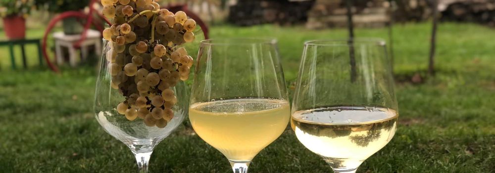

Where wine is more than just Olaszrizling
A Hidden Gem of the Balaton Uplands
Just ten minutes from Keszthely, Rezi’s vineyard hills mark the meeting point of the Balaton Uplands and Zala County. Locals fondly call it "the land of Rizling" — a name that reflects both tradition and character. Olaszrizling has long been the defining grape of the area, but here it takes on a unique personality, thanks to the region’s exceptional microclimate:
South-facing slopes ideal for viticulture, higher rainfall from the nearby Alps, and the balancing effects of Lake Balaton and the Zala Hills. These natural factors create cooler nights, longer ripening periods, and wines known for their elegant acidity and rich aromas. But what truly sets Rezi apart is scale. This is not industrial winemaking. Here, small, family-run wineries produce limited batches of handcrafted wines. The winemakers personally tend to their vines, ferment, and bottle their wines with care — each with their own time-honored techniques.
Alongside classics like Olaszrizling, Pinot Gris, and Kékfrankos, more and more winemakers are experimenting with rare Hungarian varieties such as Nektár, Zengő, and Rozália.
Three wineries from “the land of Rizling”
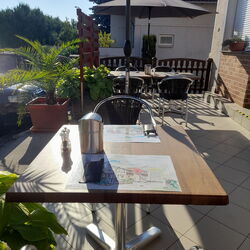
Whether you visit individually or as part of a wine tour, these three wineries offer authentic, personal tasting experiences. Advance booking is required.
Bakos Winery – From concert halls to vineyard rows
At Bakos Winery, every glass comes with a story. Rezső Bakos, a former concert pianist, traveled the world before returning to Rezi to blend his love for wine, music, and hospitality. Encouraged by his grandfather, he made his first wine at age nine. Today, he treats winemaking as a full sensory experience: hosting tastings where he plays music, shares stories, cooks, and pours his wines.
His vineyards span multiple Rezi sites, both inherited and newly planted, all cultivated with organic methods — no herbicides, no systemic pesticides, and all vineyard work done by hand. Wines like Olaszrizling, Irsai Olivér, Cabernet Sauvignon, and Kékfrankos are aged in a mix of oak barrels and stainless steel, combining modern technology with traditional methods.
In 2025, Bakos Winery’s 2024 vintage Rezi Rizling Barnabás was once again awarded the title "Wine of the land of Riesling."
Contact:
Imagine a vast body of water — over 1,000 meters deep and more than 400 times the size of Lake Balaton — once rippling across this land. The story of the Pannonian Lake is not just a fascinating chapter of geological history, but a legacy that continues to shape the region: it left behind mineral resources, fertile soils, and even inspired legends. Discover how an ancient lake transformed Transdanubia — and why its impact is still felt today. An Inland Sea for Millions of Years At its greatest extent, the Pannonian Lake covered an enormous area, far surpassing the size of today’s Balaton. For millions of years (approximately 12 to 8.5 million years ago), it dominated the region. As surrounding mountain ranges gradually rose, the lake became cut off from the world’s oceans. Its water slowly turned fresh, and its basin began to fill with sediments. Because of its isolation, the lake developed a unique ecosystem with many endemic species. The Lake Didn’t Appear Overnight The Pannonian Lake didn’t simply “appear” in the Carpathian Basin. Its formation was the result of millions of years of tectonic activity and shifting climate. It emerged as an independent, enclosed body of water — no longer connected to the open seas. Deep Waters, Varied Shores In some areas, the lake reached depths of over 1,000 meters. Elsewhere, shallower zones supported lagoons, river deltas, and small, isolated lakes. During high water periods, rocky shorelines formed along the mountain fringes — traces of which can still be found today in the Keszthely Hills and the Mecsek Mountains. The Lake’s Retreat — and Sediment Legacy Despite its size, the lake was eventually filled in by immense volumes of sediment, carried mainly by rivers flowing from the Alps and the Carpathians. Over the course of 6.5 million years, it gradually disappeared from the landscape. What did it leave behind? Its sediments — composed mostly of sand, clay, and fine silt — became the so-called “Pannonian formations,” which today hold key mineral resources (such as petroleum) and aquifers. These formations define much of the surface geology of Transdanubia, including the Zala Hills. Fertile soils later formed on the laminated silty and clay-rich deposits of the Somló Formation. Even the legendary “Tihany goat’s hoof” fossils — actually worn shell fragments of the Congeria ungulacaprae mollusk — can still be found embedded in these ancient layers. The Final Lakes and a Gradual Goodbye Because most of the sediment entered from the northwest, north, and northeast, the lake slowly retreated toward the south and southeast — as if it were “withdrawing” from what is now Hungary. Small remnant lakes persisted for much longer in areas of present-day Slavonia (Croatia) and northern Serbia, but due to their different scale, character, and fauna, they are not considered true successors of the ancient Pannonian Lake.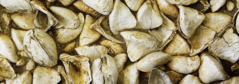
Czimondor Winery – In harmony with nature
For István Czimondor, winemaking is in his blood. His family has tended vineyards on Rezi Hill for generations, passing down not only land but also a deep respect for nature and tradition. His lineup features staples like Olaszrizling, along with Muscat, Pinot Gris, Rozália, and Kékfrankos.
Some wines are tank-aged, others rest in oak. István produces only as much as he can personally oversee, ensuring each bottle reflects the quality of small-batch craftsmanship. While the selection varies by vintage, his core varieties are reliably available.
In every bottle, you’ll taste the essence of Rezi.
Contact:
Takács Zsolt's Winery – Stepping into the 18th century
The Takács family has been making wine on these lands since the 1700s, even supplying the noble Festetics family. Today, Zsolt Takács represents the eighth generation, carrying forward this legacy with passion and pride. On his one-hectare estate, cultivation is done by hand with the help of family and friends. Beyond his role as a winemaker, Zsolt is a gifted storyteller, sharing the rich history of Rezi’s wine culture. The winery’s flagship is Nektár, a unique Hungarian variety with Hungarikum status, available in both dry and semi-sweet versions.
The lineup also includes Zengő, Tramini, Chardonnay, and Kékfrankos — each crafted with modern tools but traditional, natural methods, highlighting Rezi’s unique terroir.
Contact:
Imagine a tropical sea where the dolomitic peaks of the Keszthely Hills now rise. The landscapes we consider timeless are, in fact, fleeting guests on Earth’s ever-changing stage. How does a shallow tropical sea become Hungarian highlands? Why does dolomite crack? And how does this still influence local farming today? Travel back millions of years into a story written in stone. Mountains, plains, islands, seas, rivers, and lakes may appear permanent within a human lifetime — but from Earth’s perspective, they are only temporary scenes. The rocks that form our planet’s surface are constantly in motion. Like the shattered shell of a boiled egg, tectonic plates drift endlessly atop the semi-fluid mantle beneath them. Some crash together or sink beneath one another to create towering mountain ranges, while others subside, forming deep trenches or basins that may fill with water. That’s how the dolomite and limestone now forming the Keszthely Hills were once deposited — in the shallow waters of an ancient tropical sea, thousands of kilometers from their present location and long since gone. The scene would have resembled the crystal-clear shallows of today’s Bahamian paradise. While the northern block of the Keszthely Hills is made of relatively young (a few million years old) volcanic rock, the southern section — including Rezi and Cserszegtomaj — is dominated by much older dolomite, formed in those ancient tropical seas. Alongside widespread formations of so-called Main Dolomite, small patches of Rezi Dolomite can also be found — dating back over 200 million years. The Keszthely Plateau is dissected by a north–south valley system and crisscrossed by micro-tectonic fault lines. Due to the shallow topsoil and varied terrain, more than 70% of the area is forested. Its karst surface experiences year-round water scarcity and has unique ecological features. The plateau is divided by intermontane basins and bordered by deep tectonic fractures (such as the Hévíz and Ederics faults), making the area seismically sensitive. Soils formed on the debris of weathered dolomite provide the natural foundation for land use in the region. Several of our local producers cultivate land along the western edge of the Keszthely Plateau, where farming is defined by the proximity of a highland landscape — a plateau formed of horsts rising 350–440 meters, framed by tectonic fault lines.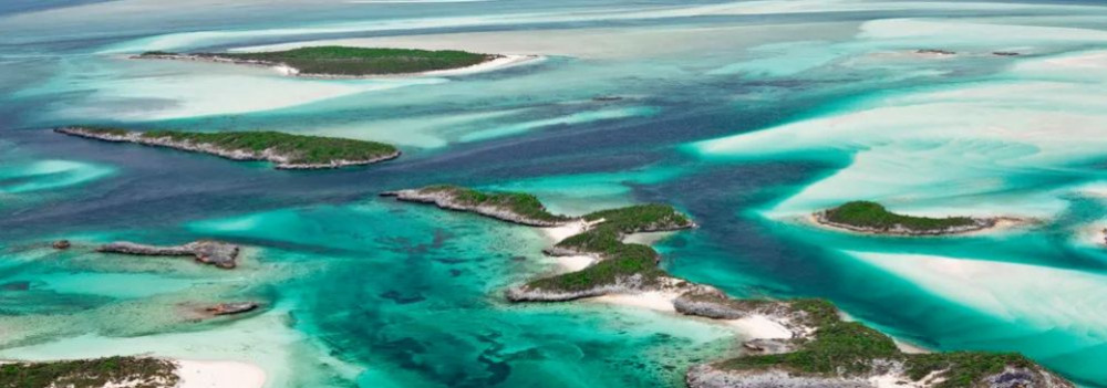
The Surface: Only Seemingly Permanent
Volcanoes in the North, a Tropical Sea to the South
Geology and Today’s Land Use