Search
Kizárt szavak
Tiltott szavak
- cialis
- viagra
- php
- sql
- html
- https
- http
- chr
- script
- sex
- porn
- sexmassage
Alternatív kifejezések
- =
21. EKF - Hévíz
Last modification: 2025. March. 19. 12:25
Találati relevancia adatok
Tárolt adatok:
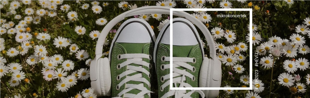
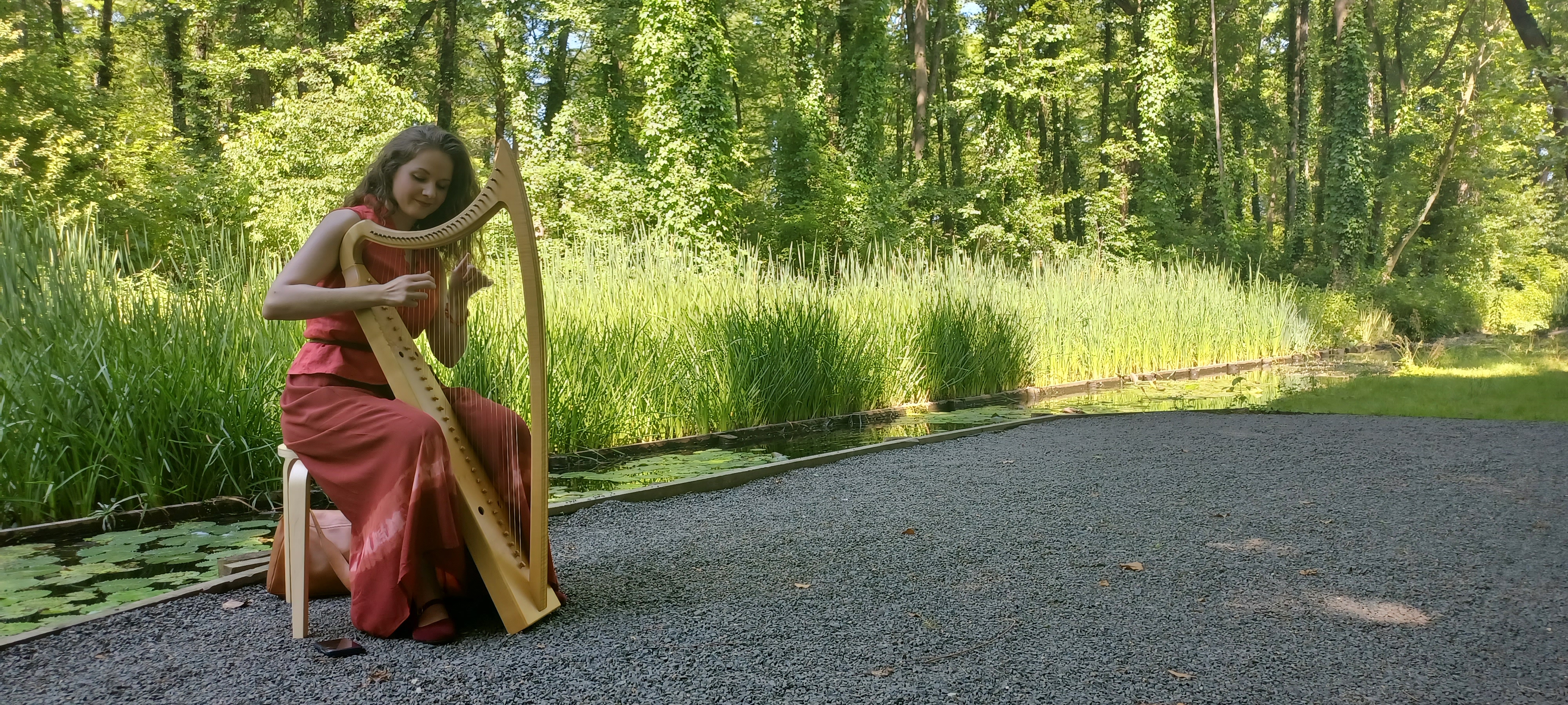
Find the music!
The "music" of the GROUND, the WIND, the WATER and the BIRDS - microconcers in secret spots of the Protective Forest.
Wander through the charming paths of the Forest and find the music of the forest. Enjoy the soft music and the cool of the trees. You can listen to short, 15-minute micro-concerts in the secret venues hidden in the trees, once in every hour.
23 June 15.30 in the West Protective forest, on the Treetop Walkway
14 July 16.00 in the Northern Protective forest
4 August 16.00 in the Northern Protective forest
18 August 16.00 in the Northern Protective forest
8 September 16.00 in the West Protective forest, on the Treetop Walkway
15 September 16.00 in the Northern Protective forest
We reserve the right to change the program! In case of rain, the program will be held at a new time or at a different location depending on the occasion!
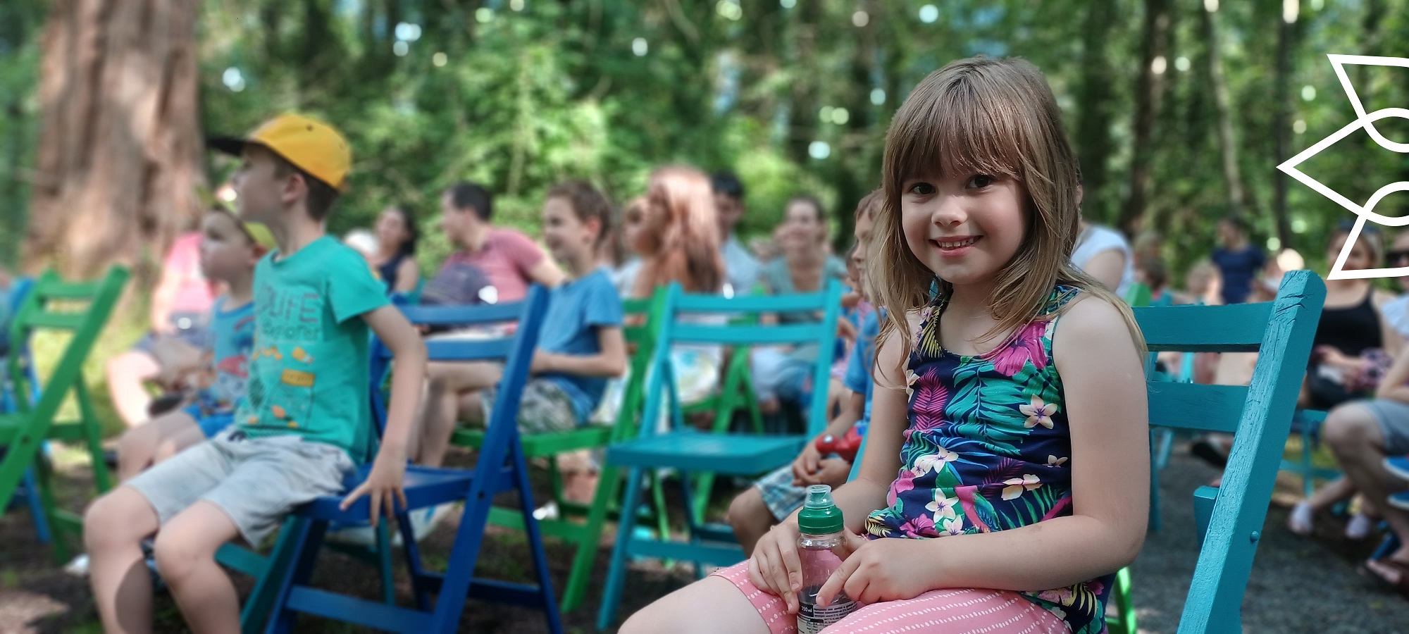
Egregyi Museum Garden - August 4-6. Friday-Saturday-Sunday
First Egregy Eco-festival
Step on the grass allowed! Try it, experience it, learn it, listen it, enjoy it, see it…performances, arts and craft show, creative works and many others!
programs before the festival
3 August, Thursday
20:00 Trio Brax concert
21:00 Bossa & More Concert
4 AUGUST, FRIDAY
16:00 pART forest exhibition opening and micro-concerts in the Northern Protective Forest
Between 16:00 and 18:00 Gastronomic presentation - Tanácsa Attila's cooking school (vegan, vegan dishes)
16:00 - 20:00 Try it, experience it, learn it, listen it, enjoy it, see it... in the tents set up in the museum garden in Egregy: singing bowl session, mandala painting, lifestyle advice, right hemisphere drawing, vegan food, gastro show, craft creative sessions and much more!
16:00 Brum Bandi Band
17:50 Film: Climeate-film - film of the Balaton-Uplands National Park
18:30 Klára Hajdu and Milán Szakonyi concert
20:00 Ivett & JB Jazz concert

5 August, Saturday
10:00 Morning Yoga
10:00-18:00 Try it out, experience it, learn it, listen to it, enjoy it, see it... in the tents set up in the museum garden in Egregy: sound bowl session, mandala painting, lifestyle advice, drawing with the right hemisphere, vegan food, gastro show, craft creative sessions and much more!
10:00 - 18:00 Playhouse
11:00 Gastronomy presentation with tasting - Attila Tanácsa cooking school (vegan, vegan dishes)
14:30 - Joy dance for and with seniors
15:00 Gastronomy presentation with tasting - Attila Tanácsa cooking school (vegan, vegan dishes)
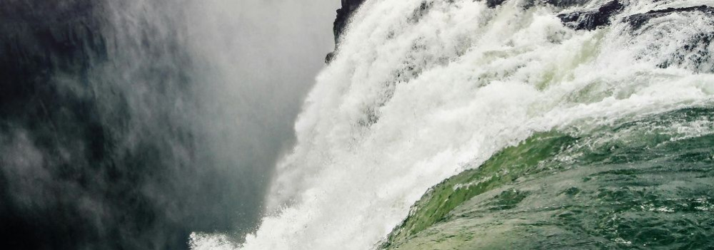
15:00 Nature film: Wild Waters
16:00 Igricek concert
16:00 Caricature painting with Tibor Karnics
From 4:00 p.m. TRAVELING PLANETARIUM - new shows every hour in a traveling planetarium
Amazing universe film (from 6 years old) in English
17:00 Light musical afternoon with the Vagabond Trio and the Cséplő-Poór Duo
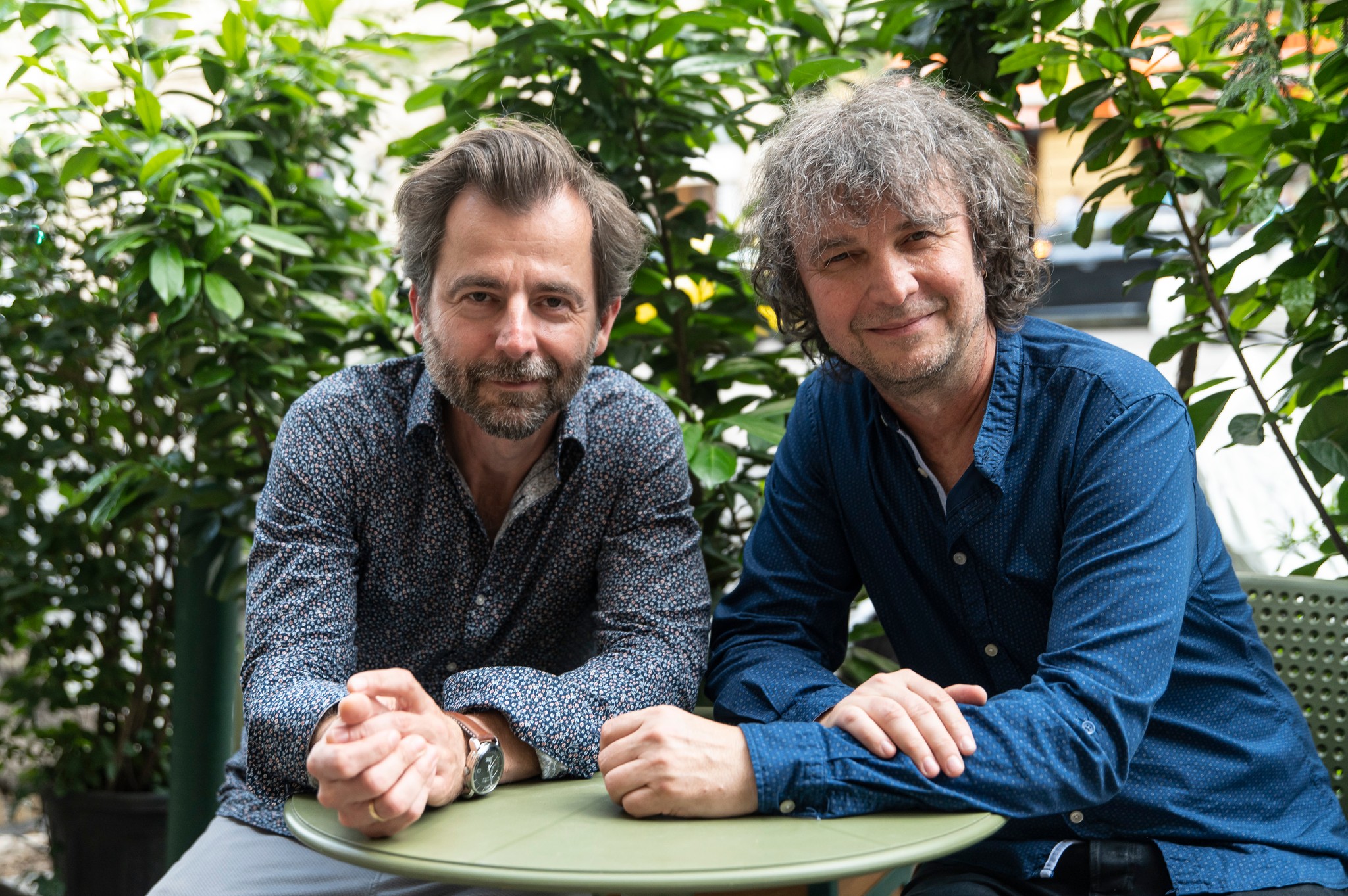
19:30 Krisztián Grecsó autographs
20:00 Libikóka: Grecsó & Hrutka musical literary evening
6 August, Sunday
10:00 a.m. Musical nursery for the little ones
10:00-16:00 Try it out, experience it, learn it, listen to it, enjoy it, see it... in the tents set up in the museum garden in Egregy: sound bowl session, mandala painting, lifestyle advice, right hemisphere drawing, vegan food, gastro show, craft creative sessions and much more!
10:00-12:00 Playhouse
11:00 Kanga Training
15:00 Tüskevár film HU
16:00 A nagy Ho-Ho-Horgász film (The big angler) HU
17:00 Nature film entitled Wild Hungary HU
Refreshing beverages and delicious snacks every day!
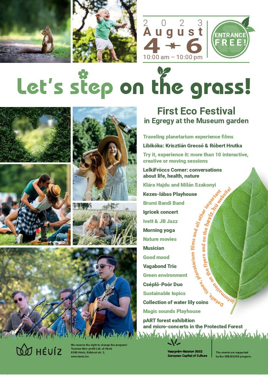
The program is implemented within the framework of the Veszprém Balaton 2023 European Capital of Culture program with the support of VEB2023.
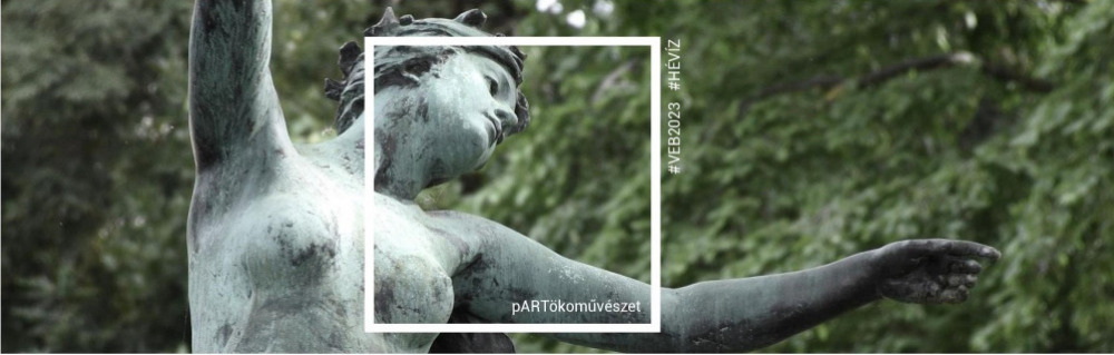
Opening on August 4, 2023 at 4:00 p.m. in Protective forest.
The essence of the pART project is to consider the forest itself as an art space, and let nature itself be the central component of the work of art. Art is not alien to its environment, on the contrary: it is an integral part of the landscape. The creations are not made to last forever, but are volatile and changeable, just like nature. They are part of a permanent cycle, while the forest itself becomes a gallery and also the subject of art.
We will introduce the artists and the exhibition after the opening!
Anyone who knows the area and has seen the exhibition - which is not only about the forest but also about the forest itself - will understand the choice of title. The pART forest exhibit is located on the forest path next to the northern stream of Lake Hévíz. The exhibition of more than 60 images of the wildlife in the nature reserve allows you to walk through the forest and discover the hidden beauties that are usually difficult to see with the naked eye or remain hidden during an ordinary walk. The pictures, stretched on and between trees, show wonderful birds, special plants, small animals and insects. Many of the works are paintings by nature illustrator Márton Zsoldos. The exhibition also includes a few photos taken by nature conservation guards Előd Búzás and Gábor Sinka in the immediate vicinity of Lake Hévíz.
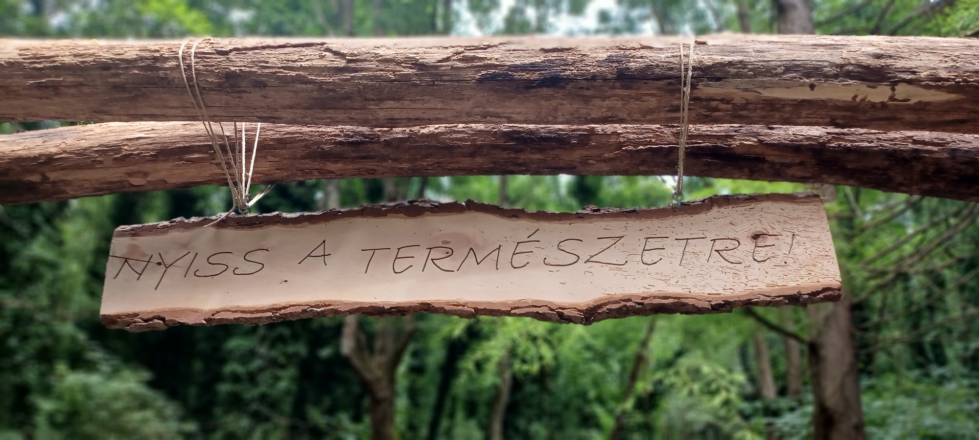
The forest exhibition opens with a wooden gate bearing the motto of the exhibition:
"Open to nature!"
Tamás Pálffy from the organizer Hévízi Turisztikai Np Kft. emphasized that the whole Forest Ministry programme series was organized taking into account the nature conservation, sustainability and green event aspects. Each event tries to leave as small an ecological footprint as possible, and in all its elements it strives to bring people, nature and cultural experiences closer together in a way that only interferes with nature in a small but in no way harmful way.
For this exhibition, recycled wooden picture frames donated by local residents were used, and sugar cane was used for fixing. The forest exhibition is expected to be on display until 30 September, but this may change depending on the use of natural materials and weather conditions. Durability was not an objective in this case.
However, the gate will remain! Because whether or not there is a pART Forest Tour in the Hévíz Forest, the message is always the same: Open to nature!
Galerie
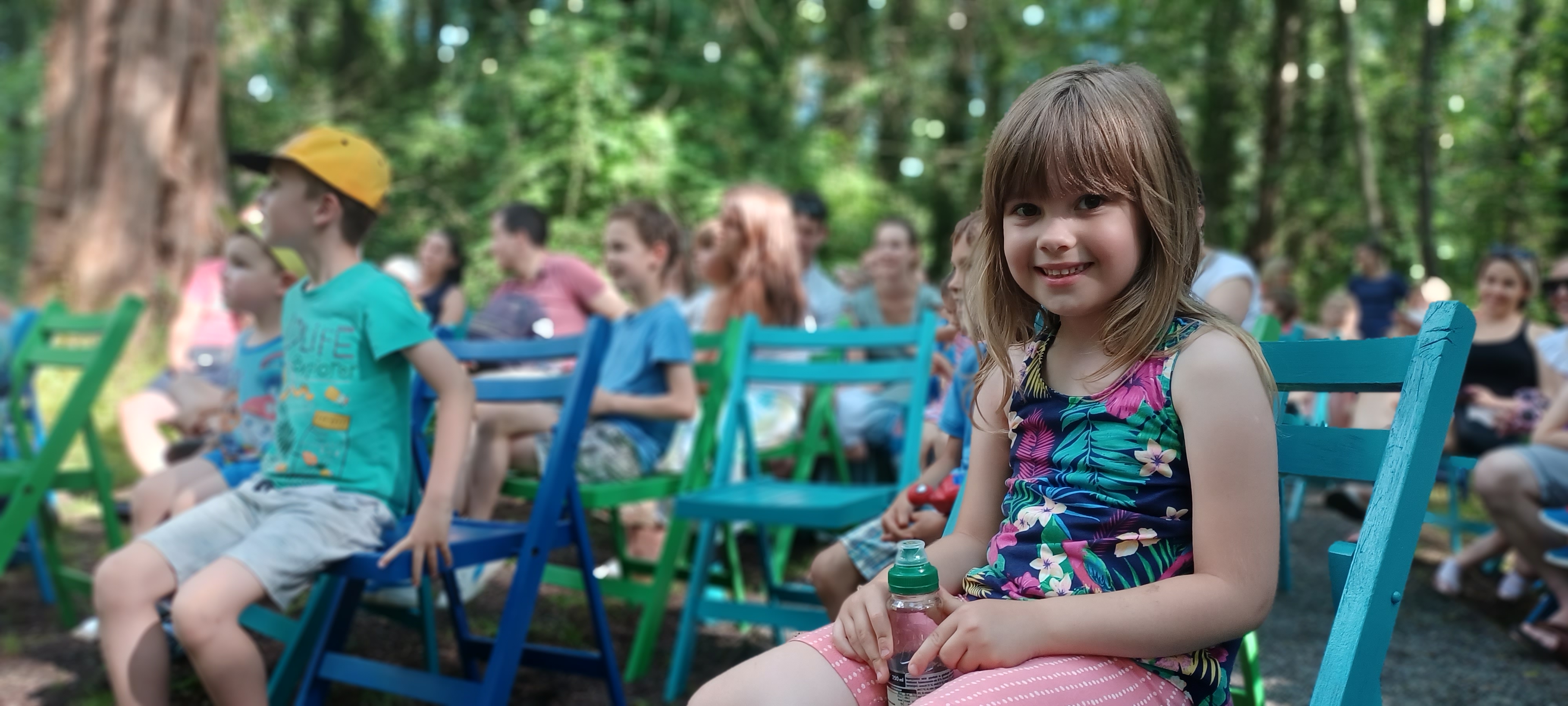
The stage plays are held in the Protective Forest, at the crossing near to the Water Lily Trail.
We can provide 60 places to sit, attendance is free of charge!
All plays are held in Hungarian!
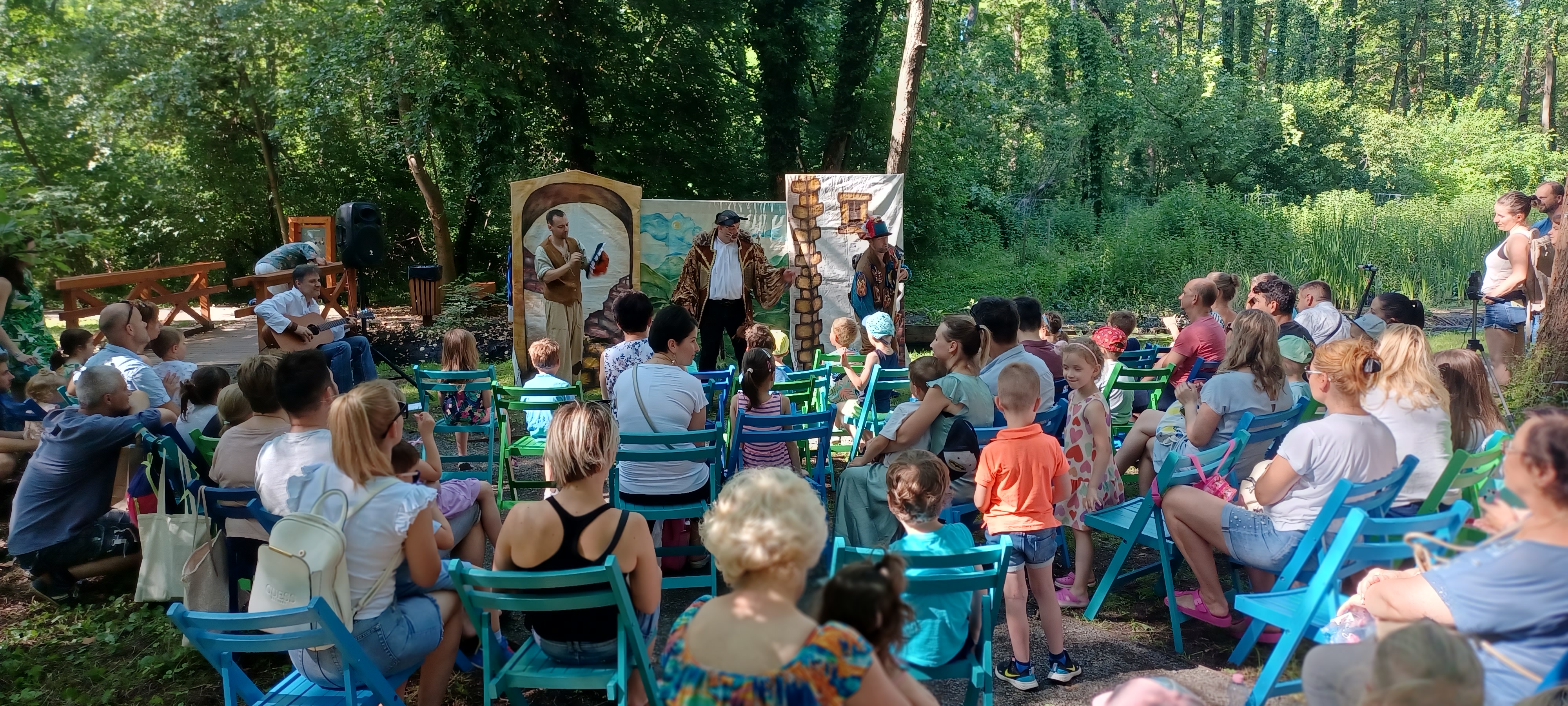
15 July Saturday 17:00 Kacor Király (King Kacor) performance for children - performed by the Hahota Children's Theater
19 August Saturday 16:00 A császár új ruhája (The ceasars new clothes) performance for children - performed by the Hahota Children's Theater
26 September Tuesday 10:00 Mátyás király és az uzsorás (King Matthias and the usury performance for children - performed by the Hahota Children's Theater
Guided geobotanical tours for adults - geotour in the Protective Forest / 120 min.
Zoltán Tamás Samu geocoach will lead the tours. On the nearly 2-hour geotour, we can get to know many unique species, from the swamp cypress and the protected forest, from the marsh cypress to the waterlilies. What gives the Hévíz forest its speciality and uniqueness? You will get know the landscape specifications! The maximum number of participants is about 15 people.
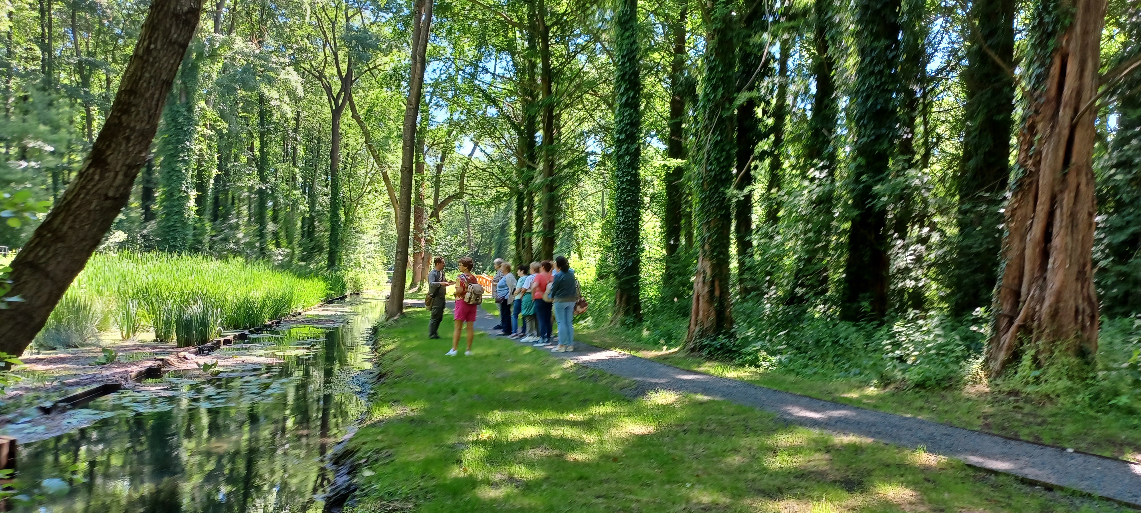
The guided tours are held in Hungarian (except 2 times, which will be held in German!)
30 April 14.00
27 May 16.00
24 June 16.00
14 July 10.00
16 July 10.00 - in German
19 July 11.00
4 August17.00
6 August 10.00- in German
8 September 14.00
7 October 15:00
21 October 15:00
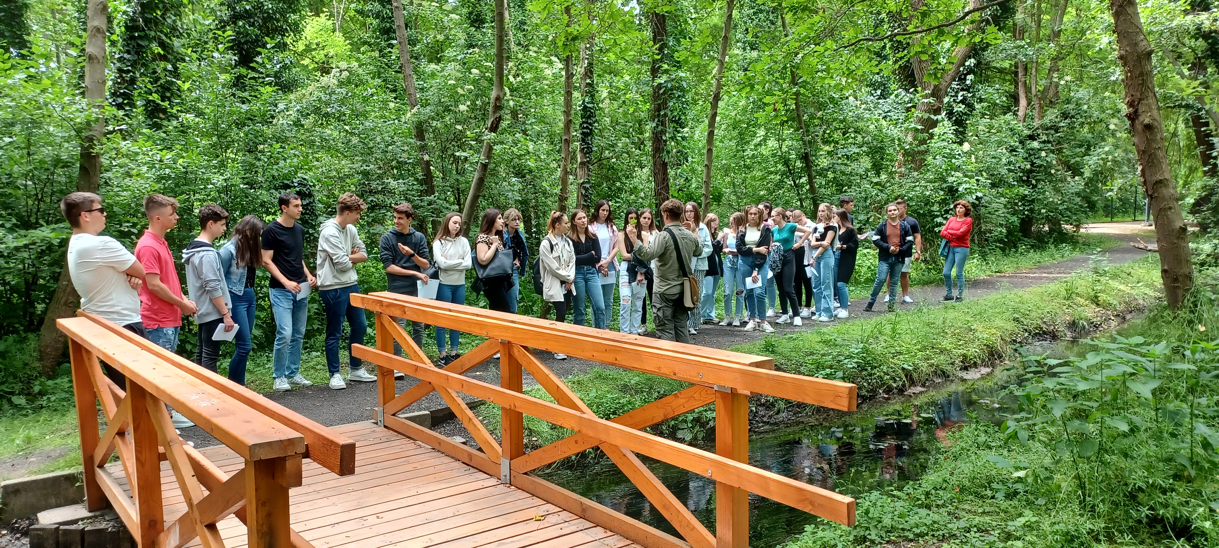
Duration of the tours 120 minutes.
Regitstration
By phone at the tour guide, Tamás Zoltán Samu: +36 30 414 9009 By phone at the Tourinform office every day between 9 a.m. and 5 p.m.: 06 83 540 131
EVERY TOUR IS FOR FREE!- ONLY IN HUNGARIAN (or German) LANGUAGE
The main aim of the program is to see the forest as a protected natural value while we also show it as an existing place for culture and art. We would like to connect the man-nature-art trio to each other to create a new unity with the help of cultural events.
What do WE do to reach this?
- we do not intervene in the circle of nature with our events, we do not create alien objects in the forest
- we do not set stages, lighting or an auditorium: everything stays natural
- we only use portable devices
- the number of attendees are limited to 50 people/event
- we do not spend more than 3 hours in the forest at one occasion
- we do not litter, and we try to reduce the ecological foot print of the event to the minumum
- we honour the rules of the forest - we do not make noise, we do not harm the flora and fauna, we do not pollute the air and we do not disturb the life of the night forest
- we didn't buy new devices for the programs
- we minimalise the usage of plastic
- we give eco-friendly and sustainable gifts for the participants of the guided eco-tours
What can YOU do for our forest?
- don't litter in the forest
- protect the flora and fauna of the forest
- do not leave the beaten path. You can't know if there is a small hedgehog family hiding among the fallen leaves or a new tree is about to grow out of the ground
- be aware that our events are micro events - here experience is more than comfort
- our programs are free of charge, but you can buy a souvenir in the Tourinform Office if you'd like to support what we do
- come to our events on foot or by bicycle or by public transport
- bring water with you and we provide you fresh water to refill your flasks
- take a picture, shoot a video or a selfie during or events or in the Protective Forest and share the experience on social media, use #IloveHévíz
22. Top hiking tips
Last modification: 2022. March. 01. 21:22
Találati relevancia adatok
Tárolt adatok:
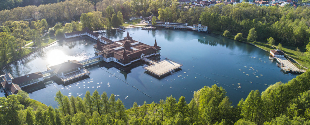
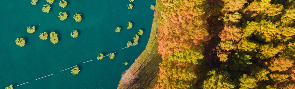
The 60-hectare Lake Hévíz Nature Reserve, the eastern and western protective forests offer a pleasant forest walk. The western park forest (8.8 ha) has a hilly landscape typical of County Zala. The altitude ranges from 115 m to 155 m above sea level. A few centuries ago it was connected with the forest of Egregy. The northern and eastern protective forests cover a total area of 23.1 ha. The flat, semi-wet area here is an integral part of the Nagyberek - Kis-Balaton - Tapolca marsh. In some areas, the peat layer is 6-8 m thick. It takes 30-40 minutes to walk around Lake Hévíz. The impressive 200-year-old plane trees and turn-of-the-century buildings of the Schulhof Promenade, the newly developed Festetics Promenade and the eastern protective forest with its bald cypresses make for a pleasant walk. The paved road offers a nice walk even in rainy weather and in the evenings. Distance: 1.5 km, Accessible, Family-friendly, Catering facilities on the way
The name ‘Berki’ refers to the Hungarian word ‘berek’, which means low-lying, marshy, densely vegetated area. In the old days, the world of the marshland was known only to the local inhabitants; strangers could easily get lost in the marshy, reedy area. Today, thanks to the drainage work of the Festetics family, Lake Hévíz and the stream are easily accessible to everyone. The flora and fauna of the marshland is an extremely rare and valuable natural treasure not only in Hungary but also in Europe. In the warm water, the Indian red water-lily (Nympaea rubra var. loniflora) blooms almost all year round in Lake Hévíz. This plant was introduced by Sándor Lovassy, a teacher at the Keszthely Academy of Economics, between 1898 and 1906. Insectivorous plants, such as the greater bladderwort (Utricularia Vulgaris), which sucks in microscopic animals with the help of tiny bladders, also live here. To help you find your way around, a brochure created by the Hévíz Association for the Protection, Development and Culture of Hévíz and the Keszthely Environmental Protection Association can be downloaded by clicking on the link. vezetofuzet.pdf Distance: 5 km (there and back), No restaurant along the way, dog-friendly, family-friendly
Arriving in Hévíz from the east, many people notice the multi-storey wooden lookout tower, which is interesting not only for its building but also for its history. Jenő Horváth, a horticulturist and botanist, who was 90 years old at the time, built the lookout for his beloved wife Margit in the early 2000s. He wanted his wife to be able to see Lake Balaton, if not from a closer distance, at least from the top of the lookout tower. For his wife's sake, he had a special lift installed in the lookout tower. The lookout is located on private land and used to be open to the public, but since 2015 it is no longer accessible. Still, many people like to walk to the 31 m high lookout, which can be found 2.5 km away from Hévíz. To get to Cserszegtomaj, you have to follow the yellow sign and continue the hike. 700 m away from the Margaret Lookout, you will find the Cserszegtomaj well cave, which is of thermal water origin and can be visited with the permission of the Balaton-Uplands National Park Directorate. Distance: 6 km (back and forth), no restaurant, dog-friendly, accessible
The National Blue Trail passes through the most beautiful parts of Hévíz. It passes by Lake Hévíz, the Church of the Holy Spirit, the Church of the Heart of Jesus, the Egyregy Museum, the row of wine cellars in Egregy and the Árpád-era church. After leaving the town of Hévíz, the trail also passes the Jewish cemetery in Karmacs, which was renovated in 2012. Opposite the cemetery, at the bottom of the Rezi vineyard, you can see the Gyöngyösi Betyárcsárda (Highwaymen’s Inn of Gyöngyös), which can be reached after 1.5 km on the blue sign. The ancient walls tell many stories of the highwaymen, including the one where Jóska Sobri danced with his lover Rozi Répa. According to another story, Illés Vak and Pista Kökes were ambushed and shot by the Pandurs in the vineyard near the inn, and their graves are probably located under the two wooden crosses next to the inn. Distance: 9 km - back and forth, Restaurants can be found on the row of wine cellars in Egregy and of course the Highwaymen’s Inn, family-friendly, dog-friendly
Within a half an hour's drive from Hévíz, you can easily reach the Kis-Balaton, a unique wetland habitat in the Balaton-Uplands National Park. The 1.6 km Great Crested Grebe Nature Trail on Kányavári Island features fifteen panels showing the typical birds of Lake Kis-Balaton. In many cases, the great egret (Egretta alba) and the greylag goose (Anser anser), the squacco heron (Ardeola ralloides), the little egret (Egretta garzetta), the spoonbill (Platalea leucorodia) or the Eurasian bittern (Botaurus stellaris) can be observed with the naked eye or binoculars. You can fish on the island with a licence, but there is also a sports field and a lookout tower for active recreation. Distance of the hiking trail: 1.6 km, family-friendly, dog-friendly, barbecue facility and snack-bar
Only a half-hour drive from Hévíz, starting from the basalt quarry in Vindornyaszőlős, which is still in operation today, you can discover the unique "construction" of nature - the basalt street. A bird on a white background next to the S tourist sign marks the trail. The unique natural formation on the Kovácsi Hill is one of the seven wonders of Zala County, a protected area of the Balaton-Uplands National Park. As a result of erosion and land-slide, the strange stone formations, consisting of cracked basalt columns that have been split off the rim, present a chaotic world. As the wind blew the sand from beneath the basalt rocks, the huge blocks of volcanic rock tilted along the vertical cracks. Caves and interesting morphological formations of various cavities are hidden between the 5-15 m high columns. The trail is named after the late Ferenc Buruczki, a great naturalist who died young. The ten information panels describe the geological, botanical and zoological values of the area and also show how to track four-legged animals. Distance: 4 km (back and forth), No catering facilities, family-friendly, dog-friendly
According to the research of the famous Keszthely scientist and museologist Dr Béla Darnay-Dornyai, the first spring of Hévíz broke out on Meleg Hill near the Rezi Castle about 2 million years ago. Meleg Hill (‘Hot Hill’) got its name from the fact that in winter when snow covered the landscape, the snow always melted near the volcanic thermal spring. The second place of uprush was the Cserszegtomaj well cave, and then, about a million years ago, sulphurous thermal water appeared on the Biked Hill near Hévíz, and later on the Dobogó Hill. Today's Lake Hévíz was formed at the same time as Lake Balaton by crustal movements 20-22 thousand years ago. The hiking trail of the Balaton-Uplands National Park leads along the most spectacular karstic formations created by the thermal waters. The starting point of the trail is Kőhát Street in the centre of Cserszegtomaj. From here, following the S+ sign to the Csóka-kő, hikers can see a series of holes and small caves, which have been carved out by the thermal waters. The Csókakő (Jackdaw stone) got its name because its hard-to-access cavities were used by jackdaws. Worth a visit: Kígyóvári-szikla, Függő-kő. Passing the forester's house at Csorna-kút, the K+ sign on the left takes you to Rezi. If you don't want to go that far, turn back from the forester's house and walk 3 km along the dirt road of the Csornakúti Valley, which leads back to Cserszegtomaj. Distance: 10 km, No catering facilities, family-friendly, dog-friendly
The Csodabogyós cave in Balatonederics can be reached after half an hour's drive from Hévíz. The cave is named after the prickly knee-holly, a red-berry evergreen shrub with a Mediterranean distribution, which is widespread on the sunny side of the Keszthely Hills. The cave can only be visited with a guide from the Balaton-Uplands National Park but it is necessary to book your tour in advance. During the guided section of about an hour, you can expect some crawling and climbing. The National Park provides a helmet and a high-intensity headlamp, as well as a caving oversuit. The cave, rich in dripstones, is one of the largest caves in the Bakony region. After visiting the cave, it is possible to continue the hike without a guide towards the Jukucs László cave and the Sipos mouth on the green sign, then you can turn back to the starting point (Balatonederics) on the red and green sign. Guided tour, Distance covered: 5 km, Duration: 3 hours +1,5 hours cave visit, Difference in level: 300 m, Catering facilities: none, Child-friendly: 10+ If you want to do more caving, you can choose between two more extreme tours under the management of A.G. Explorer Turisztikai Kft., which is a contracted partner of the Balaton-Uplands National Park.
The Nagymező in Gyenesdiás, located only a 15-minute drive from Hévíz, is a popular picnic spot in the area. Although you can also drive up to the Nagymező, it is worth taking the yellow-marked road from the centre of Gyenesdiás to the Nagymező, from where you can follow the K ∆ sign for a few minutes to the Festetics lookout, and from the forest gymnastics field on the Nagymező the S+ and S∆ signs will take you to the Berzsenyi lookout, where you can see the whole western end of Lake Balaton in a 360-degree panorama. The yellow sign leads through the Tüskés láp (Spiky bog) to the legendary Vadlánlik. According to the local legend, wild girls wandered barefoot in the forest, their only clothing was a shawl tied around their waists, their bosoms were covered by their long hair, and their song, like the sirens', lured fishermen to the Szerelem hill (Love hill) in Balatongyörök. The Vadlánlik cave in Gyenesdiás, like the other cavities in the Keszthely Hills, are openings formed by wind erosion. The locals used the Vadlánlik cave as a secret distillery at the end of the 19th century. Route: Tourinform office, Gyenesdiás - Jókai Street - Quarry (S)- Nagymező - Festetics lookout (K∆) - Forest gymnastics trail - Pető Hill, Berzsenyi Lookout - Tüskés láp (Spiky bog) - Vadlánlik cave - Dolomite nature trail - Light Cross - Statue of Mary, Kesellő - Bem Street - Darnay Street - Jókai Street - Tourinform office, Gyenesdiás Distance: 11 km, Walking time: 3.5 hours, Difference in level: 410 m, Family-friendly, Dog friendly
Even the Romans were fascinated by the area around the Szépkilátó (Lookout point). A villa was built under the lookout point and the spring, now known as the Roman well, provided running water. During the lookout hike, after overcoming considerable differences in height, you can visit the Mátyás Bél and Batsányi lookout towers to admire, from different perspectives, the buttes surrounding this part of Lake Balaton. After the built-up Szépkilátó car park, you can enjoy a wonderful panorama from different angles on a hike with considerable differences in level. Szép-kilátó car park-(P)-Garga-nyereg-(S∆)-Bél Mátyás lookout tower -(S∆)-Pele nature trail-(S)-(P+)-(P)-(P)-Bise-kő tető-(P∆)-Batsányi lookout tower -(P∆)-Szépkilátó Distance: 7 km, Duration: 4-5 hours, Difference in level: 250 m, Catering facilities: at the Szépkilátó, Child-friendly, dog-friendly
The ruins of the Rezi Castle, built at the end of the 13th century, stand on the dolomite cliffs of Meleg Hill. The castle was probably built between 1292 and 1307 by Apor and Lukács of the Pécz clan, who owned the village, and from the 14th century, it was the property of the Gersei-Pethő family. However, by 1571, the financial position of the Pethő family deteriorated considerably. The castle, in bad condition and poorly guarded, was demolished to prevent it from falling into Turkish hands. A charter from 1592 mentions the ruined castle of Rezi. The archaeological excavation of the castle was started in 2000 by the Directorate of County Zala Museums. The Rezi Castle can be reached on foot on the national Blue Trail or by following the blue sign marking the castle from Rezi. In 2014, the Rezi Castle Nature Trail was inaugurated. It starts from the wine press in the village on the national Blue Trail and describes the local fauna and avifauna, the tree species and the geology of the forest on 11 information panels in different languages. You can follow the panels up to the Rezi Castle. Distance: 6 km (back and forth). No catering facilities, child-friendly, dog-friendly
Tátika Castle, a medieval castle ruin, is located on the 413-metre high basalt hill of the Keszthely Hills. There used to be two castles. The Tátika Hill was named after its first owners, the Tátika clan. In 1248, during the Tatar invasion, King Béla IV of the House of Árpád confiscated the Lower Tatika Castle from the Tátika clan and gave it to Bishop Zlaudus. The bishop, learning from the experience of the Tatar invasion, did not consider Lower Tatika Castle secure enough, so he had a new, larger stone castle built on the top of the castle hill. Later the castle became the property of the Gersei Pethő family. After the Battle of Mohács in 1526 and due to the Turkish expansion, the noble families, Pauline monasteries and Franciscans of Keszthely deposited their valuables and treasures in Tátika Castle, which are said to have been worth over 100,000 golden forints. In 1538, the Bishop of Veszprém besieged the castle and simply stole the valuables found there. The castle then fell into disrepair, and in 1589, it was stormed, seized, looted and burnt down by a marauding Turkish troop. Archaeological excavations and restoration work were carried out in the 2000s, so tourists can now tour the preserved parts of the medieval castle ruins. After Zalaszántó, heading towards Sümeg, it is easy to join the National Blue Trail, which takes you straight up to the ruins of the Tátika castle. The trail climbs steeply, but those who climb the 413 m high former volcano can enjoy a wonderful panorama. Distance: 5 km (back and forth) No catering facilities, family-friendly, dog-friendly
23. Visitor Policy Hévíz
Last modification: 2025. November. 12. 13:57
Találati relevancia adatok
Tárolt adatok:
24. Valley of Herbs
Last modification: 2025. November. 26. 09:58
Herbs become teas and infused oils, fruits turn into dried snacks and pure juices — all crafted from natural ingredients using modern methods. Step into their “witch’s kitchen” and discover how nature’s gifts are transformed.
Találati relevancia adatok
Tárolt adatok:
The Life-Giving Winds of the Ice Age: How Loess Shaped the Land
Did you know that Transdanubia’s rich, golden soils are actually a gift from the winds of the Ice Age? Loess isn’t just a dry geological term — it’s an ancient natural recipe that gave rise to some of the most fertile soils in the Carpathian Basin. Where vineyards grow today and birds nest in loess cliffs, strong winds once carried yellow dust across the landscape — for thousands of years. Learn how this unique sediment shaped the land and why loess is still essential for sustainable farming today.
What Is Loess and How Did It Form?
The term loess comes from the German word lose, meaning "loose." Loess is a fine-grained, yellowish sediment that was deposited during the Pleistocene epoch (2.58–0.01 million years ago), particularly during glacial periods. It formed in periglacial environments south of the great Scandinavian ice sheet — cold, dry landscapes with little or no vegetation.
The dust was carried by strong Ice Age winds from floodplains and barren steppes, and slowly accumulated over tens of thousands of years. Eventually, calcium carbonate cemented these layers into loess, which developed characteristic vertical fissures.
It’s important to note that the Pleistocene wasn't a single “Ice Age,” but a period that included alternating cold and warm phases — some even warmer than today.
Loess and the Landscape
Loess gave the Carpathian Basin — especially Transdanubia — its distinct terrain.
Steep loess cliffs (sometimes up to 10 meters high), caves that provide nesting sites for bee-eaters and sand martins, centuries-old sunken roads carved into hillsides, and exposed root systems are all part of the landscape’s geological legacy.
Together, they define the unique character of this region — shaped by time, wind, and stone.
Fertility and Water Retention
Loess-rich areas have produced some of the most fertile soils in the region. Many local producers farm on land that sits atop loess. This creates an excellent foundation for agriculture — not just because of the high humus content, but also because loess has outstanding water-holding capacity. Its vertical pores allow moisture to penetrate deeply and remain in the soil, even during dry periods.
A Modern Echo — Dust from the Sahara
Interestingly, the fine Saharan dust that now reaches Central Europe more frequently can be seen as a modern counterpart to loess-forming material. It’s a reminder that the powerful natural forces that shaped the land long ago are still at work today — just on a different scale.
25. Kakukkfű Lodge
Last modification: 2025. November. 26. 10:28
At Kakukkfű Lodge you can taste jams, vinegars, syrups and get back to nature through the adventure programs.
Találati relevancia adatok
Tárolt adatok:
About 10,000 years ago, rapid climate warming triggered a cascade of natural responses: torrential floods, landslides, and intense rock weathering. The landscape we walk on today was not shaped over mere centuries, but by the dramatic forces of climate and water, working together. Did you know that the Zala Valley floor is made up of sediments deposited by a kind of "river of time"? Discover how the Earth’s surface became one of the most sensitive indicators of climate change.
Climate Change: Not Just a Modern Phenomenon
We often associate climate change with contemporary issues, but Earth’s climate has shifted many times throughout its history — sometimes quite rapidly. Within large-scale climatic cycles, alternating periods of warming and cooling have long been part of the planet’s natural rhythm.
When Climate Changes, Everything Reacts
A change in climate sets off a chain reaction of environmental processes. It’s not just animals and plants that respond — so does the landscape itself.
Around 10,000 years ago, as the climate warmed significantly, rainfall became more intense.
More rain meant more erosion: stormwater began washing away sediment from hills and valleys into riverbeds. The rivers, now carrying more water and more sediment, flooded more often and spread these materials across the landscape.
Shaping the Terrain
This had a major impact on topography: the land surface became more fragmented and dynamic. Warming temperatures also sped up chemical and physical weathering, breaking down bedrock and helping fertile soil layers to develop.
In short, natural geological processes that had long been underway suddenly accelerated — and reshaped the surface of the land.
Young Sediments at the Base of the Slopes
Today, in many areas of the region, the lower slopes and valley edges are coated with sediment — debris washed down from higher ground, largely within the last 10,000–20,000 years. In the Zala Valley, for instance, these deposits have spread so far that they now reach the center of the valley floor.
The original bedrock source of these sediments varies: in Zala, it’s typically Pannonian sand (Somló Formation), while in the Keszthely Hills, marine-origin carbonates dominate — mostly dolomite, with some limestone. These sediments now appear as fine gravel, pebbles, or coarse sand, quietly recording the environmental changes of the recent past.