Search
Kizárt szavak
Tiltott szavak
- cialis
- viagra
- php
- sql
- html
- https
- http
- chr
- script
- sex
- porn
- sexmassage
Alternatív kifejezések
- =
21. MézÉdes Műhely
Last modification: 2025. November. 26. 10:36
Crumbly, fragrant, and spiced — MézÉdes Műhely’s honey gingerbread cookies bring back childhood memories, grandma’s kitchen, and the festive spirit with every bite.
Találati relevancia adatok
Tárolt adatok:
Imagine a vast body of water — over 1,000 meters deep and more than 400 times the size of Lake Balaton — once rippling across this land. The story of the Pannonian Lake is not just a fascinating chapter of geological history, but a legacy that continues to shape the region: it left behind mineral resources, fertile soils, and even inspired legends. Discover how an ancient lake transformed Transdanubia — and why its impact is still felt today.
An Inland Sea for Millions of Years
At its greatest extent, the Pannonian Lake covered an enormous area, far surpassing the size of today’s Balaton. For millions of years (approximately 12 to 8.5 million years ago), it dominated the region. As surrounding mountain ranges gradually rose, the lake became cut off from the world’s oceans. Its water slowly turned fresh, and its basin began to fill with sediments. Because of its isolation, the lake developed a unique ecosystem with many endemic species.
The Lake Didn’t Appear Overnight
The Pannonian Lake didn’t simply “appear” in the Carpathian Basin. Its formation was the result of millions of years of tectonic activity and shifting climate. It emerged as an independent, enclosed body of water — no longer connected to the open seas.
Deep Waters, Varied Shores
In some areas, the lake reached depths of over 1,000 meters. Elsewhere, shallower zones supported lagoons, river deltas, and small, isolated lakes. During high water periods, rocky shorelines formed along the mountain fringes — traces of which can still be found today in the Keszthely Hills and the Mecsek Mountains.
The Lake’s Retreat — and Sediment Legacy
Despite its size, the lake was eventually filled in by immense volumes of sediment, carried mainly by rivers flowing from the Alps and the Carpathians. Over the course of 6.5 million years, it gradually disappeared from the landscape.
What did it leave behind?
Its sediments — composed mostly of sand, clay, and fine silt — became the so-called “Pannonian formations,” which today hold key mineral resources (such as petroleum) and aquifers. These formations define much of the surface geology of Transdanubia, including the Zala Hills.
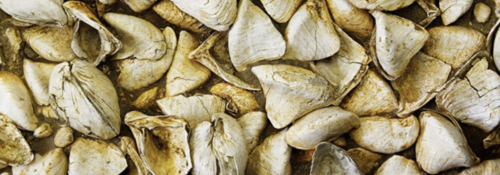
Fertile soils later formed on the laminated silty and clay-rich deposits of the Somló Formation. Even the legendary “Tihany goat’s hoof” fossils — actually worn shell fragments of the Congeria ungulacaprae mollusk — can still be found embedded in these ancient layers.
The Final Lakes and a Gradual Goodbye
Because most of the sediment entered from the northwest, north, and northeast, the lake slowly retreated toward the south and southeast — as if it were “withdrawing” from what is now Hungary.
Small remnant lakes persisted for much longer in areas of present-day Slavonia (Croatia) and northern Serbia, but due to their different scale, character, and fauna, they are not considered true successors of the ancient Pannonian Lake.
22. CseroSajt
Last modification: 2025. November. 26. 11:15
Smoked parenyica, spiced gomolya, sweet whey cream — if you love authentic flavors, you simply must try CseroSajt!

Találati relevancia adatok
Tárolt adatok:
Imagine a tropical sea where the dolomitic peaks of the Keszthely Hills now rise. The landscapes we consider timeless are, in fact, fleeting guests on Earth’s ever-changing stage. How does a shallow tropical sea become Hungarian highlands? Why does dolomite crack? And how does this still influence local farming today? Travel back millions of years into a story written in stone.
The Surface: Only Seemingly Permanent
Mountains, plains, islands, seas, rivers, and lakes may appear permanent within a human lifetime — but from Earth’s perspective, they are only temporary scenes. The rocks that form our planet’s surface are constantly in motion. Like the shattered shell of a boiled egg, tectonic plates drift endlessly atop the semi-fluid mantle beneath them.
Some crash together or sink beneath one another to create towering mountain ranges, while others subside, forming deep trenches or basins that may fill with water. That’s how the dolomite and limestone now forming the Keszthely Hills were once deposited — in the shallow waters of an ancient tropical sea, thousands of kilometers from their present location and long since gone.
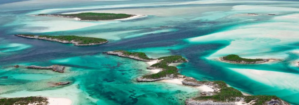
The scene would have resembled the crystal-clear shallows of today’s Bahamian paradise.
Volcanoes in the North, a Tropical Sea to the South
While the northern block of the Keszthely Hills is made of relatively young (a few million years old) volcanic rock, the southern section — including Rezi and Cserszegtomaj — is dominated by much older dolomite, formed in those ancient tropical seas. Alongside widespread formations of so-called Main Dolomite, small patches of Rezi Dolomite can also be found — dating back over 200 million years.
The Keszthely Plateau is dissected by a north–south valley system and crisscrossed by micro-tectonic fault lines. Due to the shallow topsoil and varied terrain, more than 70% of the area is forested. Its karst surface experiences year-round water scarcity and has unique ecological features.
The plateau is divided by intermontane basins and bordered by deep tectonic fractures (such as the Hévíz and Ederics faults), making the area seismically sensitive.
Geology and Today’s Land Use
Soils formed on the debris of weathered dolomite provide the natural foundation for land use in the region. Several of our local producers cultivate land along the western edge of the Keszthely Plateau, where farming is defined by the proximity of a highland landscape — a plateau formed of horsts rising 350–440 meters, framed by tectonic fault lines.