Be Ready aims to:
- provide local and regional authorities with research, assessment and operational instruments to better understand UHI, its drivers, and effects;
- co-create, test and validate jointly developed solutions to mitigate the UHI effects in cities;
- support partner cities to develop and adopt action plans for increased resilience to UHI effects with specific actions to promote green, blue, or white measures.The novel approach to be taken by the project – “green acupuncture” - will allow the partners, both cities and knowledge partners, to take targeted, small but powerful, context-based measures to deal with UHI in critical urban areas. City pilots will test solutions in three areas: “green acupuncture” (vegetation-based interventions); “white acupuncture” (based on innovative surfaces and materials); and “blue acupuncture” (novel uses of water resources).
Search
Kizárt szavak
Tiltott szavak
- cialis
- viagra
- php
- sql
- html
- https
- http
- chr
- script
- sex
- porn
- sexmassage
Alternatív kifejezések
- =
1. GM Design
Last modification: 2025. November. 26. 09:57
In the heart of the “capital of Lake Balaton,” a small artisan workshop in Keszthely crafts handmade chocolates from premium Belgian ingredients. One of their most unique creations features sea buckthorn.
Találati relevancia adatok
megtalálta: lead (3) description (4) | összesen: 7 pont
Tárolt adatok:
cím: GM Design
lead: + 3 In the heart of the “capital of Lake Balaton,” a small artisan workshop in Keszthely crafts handmade chocolates from premium Belgian ingredients. One of their most unique creations features sea buckthorn.
tartalom: Artisan chocolate crafted as an artform Did you know that sea buckthorn isn’t just an immune-boosting superfruit, but also pairs beautifully with dark chocolate Gorza Melinda, founder of GM Design Chocolate Atelier, discovered this perfect harmony when she created her sea buckthorn-infused dark chocolate bars and bonbons. But GM Design is more than just a chocolate shop. Melinda’s creativity shines through in pastry competitions, where she regularly wins awards for her artistic chocolate sculptures. Now you can taste her award-winning chocolates too! A childhood dream come true Melinda knew by age nine that she wanted to become a pastry chef. In 2006, she earned her pastry certification and has been honing her skills ever since, especially in chocolate-making. For her, working with chocolate is more than a job — it’s a passion and a form of artistic expression. In 2025, she opened her own workshop and store in Keszthely, GM Design, where she creates handmade chocolates using Belgian couverture. Melinda loves that through chocolate, she can bring a little happiness into people’s everyday lives. To sharpen her skills and fuel her creativity, she regularly competes in pastry contests, particularly in the artistic category — crafting edible chocolate sculptures and lifelike compositions that require weeks of precision and imagination. For true chocolate lovers At GM Design, you’ll find everything a chocolate lover could wish for: filled and unfilled bars, bonbons, chocolate sculptures, chocolate flowers — in a variety of flavors. Melinda creates every product by hand, using premium Belgian chocolate. She never uses cocoa mass substitutes, palm oil, or artificial additives. Her milk chocolate contains 36.5% cocoa, while her dark chocolate boasts 70.5% cocoa content. She handles every step of production herself — from tempering the chocolate to achieve a glossy, crisp finish, to molding bars, bonbons, figurines, and roses. For filled chocolates, she develops her own ganache recipes with seasonal flavors like sour cherry, raspberry, coconut, pistachio, rose, salted caramel — and the most distinctive of all, sea buckthorn. Melinda often decorates her creations with freeze-dried fruits, edible flowers, and nuts. After cooling, the chocolates are packaged — available in gift boxes and special seasonal themes. A real treat is her chocolate-covered dried or fresh fruits, available seasonally. An authentic chocolate experience GM Design is located in downtown Keszthely, just steps from the main square. The cozy shop doubles as an open-view workshop, where visitors can peek into the chocolate-making process. The shop is open Tuesday to Saturday, and Melinda also brings her sweets to the Hévíz Farmers’ Market every Thursday and Saturday. Product highlights Sea buckthorn filled dark chocolate bar & bonbon Among GM Design’s most exciting creations are the sea buckthorn-filled dark chocolate bar and bonbon. Here, the tartness of sea buckthorn perfectly balances the richness of silky dark chocolate. Made with 70.5% premium Belgian chocolate, these treats feature a refreshing sea buckthorn ganache — offering both a unique taste and a natural vitamin boost. Fun fact: ganache is a silky filling made from chocolate and butter, commonly used in chocolates and pastries. Melinda enhances hers with sea buckthorn purée and ground seeds, giving an added layer of flavor and texture. The sea buckthorn is sourced from a local producer, Kiss Homoktövis farm in Bocfölde, ensuring freshness and traceability. Where to find GM Design Chocolates: Hévíz Farmers’ Market 8360 Keszthely, Bem József Street 25 Google Maps More information & Contact: Facebook Website Phone: +36 30 216 2294 [galeria]
title: GM Design
description: + 4 In the heart of the “capital of Lake Balaton,” a small artisan workshop in Keszthely crafts handmade chocolates from premium Belgian ingredients. One of their most unique creations features sea buckthorn.
címkék:
fókusz kulcsszó:
szinoníma címkék:
2. DO NOT MISS IT!
Last modification: 2022. March. 01. 12:51
Találati relevancia adatok
megtalálta: description (4) | összesen: 4 pont
Tárolt adatok:
cím: DO NOT MISS IT!
lead:
tartalom:
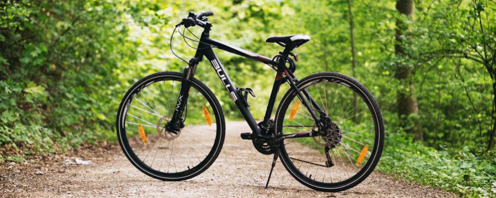
Bicycle, e-bike rental in Hévíz
On two wheels
Choose an outdoor spot for sports activities whenever it is possible. While you are on holiday, a lake-shore area, the edge of a forest or a park could be the most ideal spot for active recreation.
Hévíz and its surroundings provide you with good cycling facilities; there are a number of built cycle tracks and marked cycle routes. While cycling, you can get to know the towns and superb landscapes of the Balaton Highlands, the volcanic hills and the valleys hiding between the shore hills as well as the wildlife of the Kis-Balaton. You can hire a bike in various places, including tourist offices, hotels and even guest houses.
Bicycle and E-bike rent at the Tourinform Office
From January 2021, we await our guests with a whole new set of bicycles, e-bikes!
Prices from 15.05.2025
| 3 hours |
24 hours |
3 or more days |
|
| Classic bicycle |
4 900 Ft | 6 900 Ft | 6 500 Ft/day |
| e-bike - NEUZER |
6 000 Ft | 9 000 Ft | 8 000 Ft/day |
| e-Trekking BIANCHI | 9 000 Ft | 14 000 Ft | 12 500 Ft/day |
| e-MTB fully BIANCHI | 14 000 Ft | 22 000 Ft | 20 000 Ft/day |
/We reserve the right to change./
Free accessories:
- child seat
- bicycle lock
- crash helmet
Accessories for rent:
- phone holder: HUF 1,000 / pc
- side bag: HUF 1,000 / pc
- water bottle holder: HUF 1,000 / pc
- basket: HUF 1,000 / pc
Bike Rental – General Conditions
Pick-up and Return:
Bikes can be collected at the Tourinform Hévíz office and must be returned to the same place no later than 30 minutes before closing time, or stored overnight in a locked place. Rental extension is possible with an extra fee (grace period max. 30 minutes).
Payment:
The rental fee must be paid in advance. Accepted payment methods: cash, bank card, SZÉP card. Payment is made in HUF.
Equipment and Accessories:
Bikes are handed over in proper technical condition. Helmets, child seats, phone holders, baskets, panniers, and bottle holders are available on request. E-bikes are provided fully charged.
Use:
The renter must comply with traffic regulations and use the bike properly. It is forbidden to leave the bike unattended or unlocked. Overnight, it should be stored in a locked or guarded place whenever possible.
Liability:
After collection, all risks are borne by the renter. The renter is financially responsible for any damage, loss, or theft of the bike, as well as for any damages or violations caused with the bike. Any damage must be reported and settled immediately upon return.
Data Protection:
Personal data required for the rental will be processed by Hévízi Turisztikai Nonprofit Kft. in accordance with its privacy policy.
This summary is for informational purposes only. The detailed terms and conditions are set out in the rental agreement signed on site.
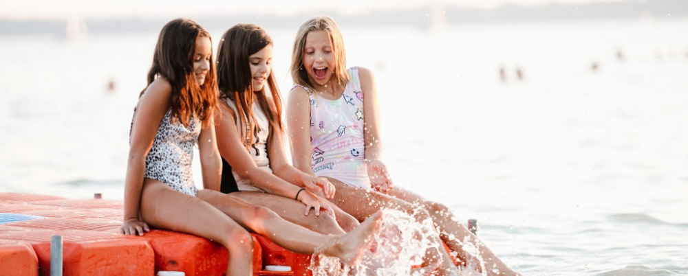
Beaches, baths, and adventures in water
Active programmes on the beaches, in the marinas
On several beaches of Lake Balaton you can rent canoes, kayaks, SUP and of course paddle boats. If you want to experience something more challenging, you can also try the water adventure park on the Municipal Beach of Keszthely or the water skiing track on the beach of Vonyarcvashegy. Going on a pleasure cruise is less active but also can be great fun. There are not only scheduled boat services from the Keszthely pier but also themed excursion boats. And if you want to drive a boat yourself, you can hire a small motorboat in the bay.
Kis-Balaton Paddling tours
The Balaton-Uplands National Park organises canoe trips to Diás Island on the Gyöngyös stream during the summer. The group can visit the István Fekete Memorial and Uncle Matula’s Hut, which evokes the atmosphere of the famous Hungarian novel Tüskevár. Advance booking is required for the tours. Guided tours around the Kányavár Island on Kis-Balaton are also available.
Paddling on the River Zala
Paddling on the River Zala for 12 km from Zalaapáti to Zalavár, an easy all-day programme for everyone
Canoeing in winter on the steaming Hévíz Stream
Those who are attracted to extreme conditions can try paddling on the steaming Hévíz Stream from November to March. As protected plants bloom in the stream in the summer and several water birds breed in the reeds along the banks, paddling on the stream is only allowed in the winter with a tour guide. However, it's a fantastic experience, especially if it is snowing. You can have more details about tours at the Hévíz Tourinform Office during the winter season.
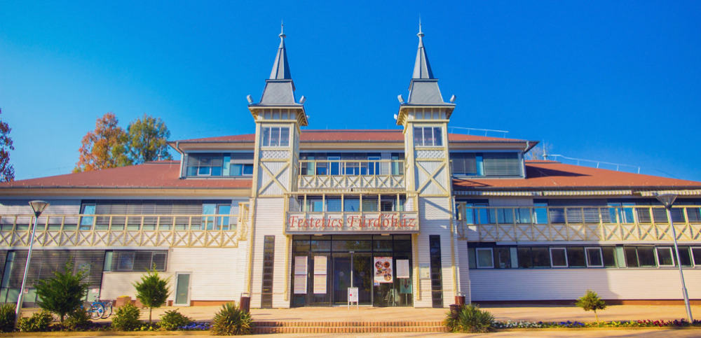
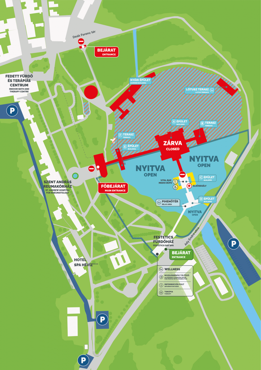
Hévíz Lake Baths opening hours and rates
From 3 November 2025, Lake Hévíz can be accessed only via the entrance on Ady Street through the Festetics Day Spa.
Bathing is allowed only outdoors.
Accessible areas
• Festetics Day Spa and Therapy section, Kinesio‑Lab
• Wellness area (the admission ticket includes the wellness usage fee)
• Vital Bar and Medio Buffet
• Covered rest areas in the section between Festetics Bathhouse and Vital Bar / Medio Buffet (“C” and “D” buildings)
• Outdoor shoreline section between the main entrance and the Festetics Day Spa (seasonally)
A limit is introduced on the accessible territories of the Lake Bath, which determines the simultaneous capacity of the facilities. For up‑to‑date information, please contact the information desk:
E‑mail: spaheviz@spaheviz.hu
Mobile: +36 30 959 1002
Closed areas
• Main entrance from Dr. Schulhof Vilmos Promenade
• Deák Square entrance
• Central Bathhouse (“A” building and “B” terrace)
• Northern water surface (between the “A” building and the Summer building)
Detailed information about the closure of the central Bathhouse (“A” building and “B” terrace) is available on www.spaheviz.hu.
• Deák Square entrance
• Central Bathhouse (“A” building and “B” terrace)
• Northern water surface (between the “A” building and the Summer building)
Detailed information about the closure of the central Bathhouse (“A” building and “B” terrace) is available on www.spaheviz.hu.
Due to technical preparation work, phased closures on the water surface and shoreline are expected.
For guests with disabilities
• Changing room: mixed changing room in the Festetics Day Spa building
• Patient lift: at the outdoor seating pool (Vital Bar terrace, “C” Building )
Our staff provide assistance with the use of the patient lift.
• Patient lift: at the outdoor seating pool (Vital Bar terrace, “C” Building )
Our staff provide assistance with the use of the patient lift.
Yearly opening hours |
|||
| Opening | End of bathing and wellness time | Closing | |
| 2025.10.06. - 2025.10.25. | 9:00 | 17:00 | 17:30 |
| 2025.10.26. - 2026.02.08. | 8:30 | 16:00 | 16:30 |
| 2026.02.09. - 2026.03.29. | 9:00 | 17:00 | 17:30 |
Closing time on 24.12.2025 is at 14:00; on 31.12.2025 at 16:00. Opening time is at 11:00 on 01.01.2026.
Hévíz Lake Bath and Festetics Bathhouse price list
Valid from 03.11.2025 to 31.03.2026
2-hour admission + WELLNESS ACCESS |
|
| Valid only on the day of purchase – entitles to a one-time entry. Includes the use of the wellness area. An additional charge will be levied if the allotted time limit is exceeded. Additional time extension cannot be purchased after the time limit has expired. Admission for children under the age of 6 is free of charge. | |
| 2-hour admission | 3 000 HUF |
| 2-hour admission seniors - Available for individuals over the age of 60. Can be purchased upon prior presentation of a valid photo ID. | 2 500 HUF |
| 2-hour admission students - Available for individuals over the age of 14. Can be purchased upon prior presentation of a valid student card. | 2 500 HUF |
| 2-hour admission children - Available for children aged 6 to 14. | 1 500 HUF |
| 2-hour admission groups - Discounted 2-hour admission - available for groups of 20 people or more, if payed in one sum. | 2500 HUF/Person |
Memberships + WELLNESS ACCESS |
|
| 10-hour membership - Valid for 20 days (can be used on the day of purchase + 19 calendar days) - the pass grants entry twice per day. Includes the use of the wellness area. The deposit is refundable within 5 calendar days after the expiration date. | 13 000 Ft + 2 000 Ft deposit |
| 20-hour membership - Valid for 30 days (can be used on the day of purchase + 29 calendar days) - the pass grants entry twice per day. Includes the use of the wellness area. The deposit is refundable within 5 calendar days after the expiration date. | 23 000 Ft + 2 000 Ft deposit |
Other rates |
|
| + 1 hour extension - Usable for extending the 2-hour admission. Valid once per admission. | 1 500 HUF |
| Additional charge - For exceeding the allotted time limit, payable for every 30 minutes. | 1 000 HUF |
| Cloakroom - Operates seasonally - the fee applies per coat/package. | 300 HUF |
| Safety deposit box - Usage is free of charge. |
2000 HUF deposit |
| Swimring rental - Daily fee. | 700 HUF + 2 000 HUF deposit |
| Sauna towel | 500 HUF |
Online purchased tickets and gift vouchers can be redeemed at the information desk located in the Festetics Day Spa.
Gift vouchers purchased from 1 October 2025, can be redeemed between 1 April 2026 and 31 October 2026.
General information
- The depth of the lake is 2 to 38 m.
• We reserve the right to change prices and opening hours.
• The price of purchased tickets can not be refunded.
• Accepted means of payment: cash (HUF), bank card or SZÉP card.
• By purchasing admission to the lake area, visitors implicitly agree to adhere to the house rules.
• Admission for children under the age of 6 is free.
• Swimring rental is possible only with the purchase of a rental ticket and the payment of a deposit. The Bath refunds the deposit only, if the rented equipment is returned until the end of bathing time, on the day of rental. Payment is possible only in cash (in Hungarian Forint).
• The admission tickets include the use of the wellness area. Wellness and sauna services are available to individuals over 12 years of age only. For reasons of hygiene, one sauna towel is provided for each wellness admission.
• For more information, please contact the information counter at the Festetics Day Spa
title: Everything you need to see if you walk around Hévíz!
description: + 4 Attractions, seasonal programs, the best places with small children or even in rainy weather. Guided sightseeing tours, or just the most popular excursion places near the western shore of Lake Balaton.
címkék:
fókusz kulcsszó:
szinoníma címkék:
3. Recipe tips from Hévíz
Last modification: 2019. June. 12. 14:13
Találati relevancia adatok
megtalálta: szöveg (1) | összesen: 1 pont
Tárolt adatok:
cím: Recipe tips from Hévíz
lead:
tartalom: + 1 We want to give our kind guest some tips for special tasted dishes. The most of the menus were inspired by the wine of Hévíz 2013.The dishes are various and associated with a healthy lifestyle because they are rich in vegetables. Try them! Roasted chicken breast fillet flambéed with white wine, vegetables and flavoury wild mushrooms Rabbit ragout made with tasty wild mushrooms and a pinch of chili served with vegetable rösti Venison wrapped with porcini mushroom and duck leg with ‘Esküvé’ sauce Blue catfish steak with algae tagliatelle and parmesan crisps Veal ragout with cream and vegetables and dödölle of Zala Catfish fillet of Lake Balaton, wild mushroom ragout with spinach and garlic, rösti with cabbage ‘Saltimbocco’ Duck pate with duck liver and wine gelee Goose-giblets with rice Small Festetics Christmas Skewers Cabbage with beans and knuckle of pork, Potato sterz Bejgli – Poppy seed or walnut roll Roasted chicken breast fillet flambéed with white wine, vegetables and flavoury wild mushrooms Pápai Lajos Master chef's recommendation,Danubius Health Spa Resort Aqua Ingredients (4 servings): 0,6 kilo chicken breast fillet 0,15 kilo celery 0,15 kilo leek 0,15 kilo courgette 0,15 kilo colourful peppers 0,3 kilo mixed mushrooms: porcini mushroom, Scotch bonnet mushroom, champignon, chanterelle 2 bunches of parsley 0,1 litre olive oil white wine, wine of Hévíz, Bussay ESKÜVÉ 2011 0,1 litre cream salt, white pepper, nutmeg, garlic – according to taste 0,05 litre brandy – for flambéing PreparationFry the vegetables cut into thin strips in a pan or a wok, add the mushrooms then continue to simmer. Make sure that the vegetables are not too soft. Season it with salt, pepper and add a little ground nutmeg. Pour some white wine and simmer it until it is ready.In the meantime cut the chicken breast into thin slices, season them with grill spices and roast them. Pour a little brandy on them and light it.Mix with the boiled vegetables, pour a little cream into it, sprinkle with fresh parsley and serve it.Make sure that you freshly prepare the food! Rabbit ragout made with tasty wild mushrooms and a pinch of chilli served with vegetable rösti Kámán János Master chef's recommendation,Danubius Health Spa Resort Hévíz Ingredients (4 servings): Rabbit ragout 80 decagram rabbit leg (prepared, cut into strips) 30 decagram wild mushrooms 20 decagram California peppers (cut into strips) 20 decagram tomatoes (without skin, cut into cubes) chili pepper – according to taste garlic – according to taste 1 decilitre wine of Hévíz, Bussay ESKÜVÉ 2011 salt, coarsely ground mixed peppercorns – according to taste 5 decilitre oil (for cooking) Rösti 30 decagram raw potatoes 16 decagram cut vegetables 10 decagram onions (finely chopped) 5 decagram flour 1 egg 1 bunch of parsley salt – according to taste 2 decilitre oil (for cooking) DirectionsPrepare the rabbit leg to the rabbit ragout: bone it, then cut it into centimetre-thick strips, marinate it in oil and coarsely ground mixed peppercorns, if it is possible, the day before.In a pan, in heated oil fry the rabbit leg strips, then add the chopped peppers, garlic and wild mushrooms, continue to fry it for a few minutes and at the end add the peeled tomato cubes. Season with salt, pepper, chili and white wine to taste, then boil it.To make the rösti, grate the peeled potatoes, then mix with flour, egg, vegetables, parsley and fried onions. Season it according to taste, form small plates, then in a heated pan or on a griller fry both sides.Then serve the so prepared röstis with the ragout. Venison wrapped with porcini mushroom and duck leg with ‘Esküvé’ sauce Szentgyörgyi Tamás chef's recommendation,Hotel Mirage Restaurant and Diner Ingredients (4 servings): 1 kg saddle of venison 0,3 kg duck leg 0,2 kg onion 0,05 kg garlic 0,05 kg juniper-berry 0,1 kg thyme 0,1 kg rosemary 0,15 kg root parsley 0,15 kg carrots 0,15 kg celery 1 bottle of 2011 Busai Esküvé “Wine of Town Hévíz” salt, pepper / according to taste / 0,05 kg pine nuts 0,03 kg butter duck fat Duck ragout: Grate the carrots, the root parsley, celery, onions and garlic, then fry them in olive oil. ESküvé sauce: Fry the pine nuts, juniper-berry and pour in the wine, season with salt and pepper to taste, then put butter into it to make it silky.Preparation: Marinate the saddle of venison (marinade: oil, juniper-berry, rosemary, thyme)Filet the wild duck leg, cut into small cubes, then put onto the fried vegetables and simmer until tender.Take the saddle of venison out of the marinade and make an open slice of it, then lightly spread the duck ragout on it, roll it and bind it. In a pan fry the outer side of the meat to make a crust on it. Simmer it in its own fat, covered until it is ready. (approx. 30-40 min.) Serving: Cut the saddle of venison into thin slices and serve it on the sauce. Sprinkle it with fresh thyme. Blue catfish steak with algae tagliatelle and parmesan crisps Sendula Péter Sous chef's recommendation,Hotel Európa fit Ingredients (4 servings): 800 gr catfish filet 400gr tagliatelle 120gr algae 2 cloves of garlic 1 decilitre olive oil 150 gr parmesan cheese salt 1 decilitre white wine Cut the catfish filets into 2-centimetre slices, season with salt both sides, then put into a vacuum bag and simmer them in 45-50 degrees’ steam for 90 minutes. Then without opening the bag put it into icy water or a thermal shock machine to cool it down. Put it in the fridge until use.Cook the tagliatelle in salty water. While it is being cooked, prepare the algae.Heat the oil in a pan, add the algae cut into thin slices and the chopped garlic. Fry it for a short time, then pour in the white wine. Stir the cooked noodles into it.Take the fish out of the vacuum bag and fry both sides for a minute in a pan preheated to 180 degrees.Grate the parmesan cheese for the parmesan crisps, put baking paper in a baking pan. Make small piles from the cheese and bake them for a few minutes in the oven preheated to 200 degrees. Veal ragout with cream and vegetables and dödölle of Zala Mayer Tibor and Veress Ferenc Chef's recommendation, from Hunguest Hotels Ingredients (4 servings) 1/2 kg veal round 1/2 kg porcini mushrooms 2 cloves of garlic 1,5 dl dry white wine 2 dl vegetable broth 2 dl cream salt freshly ground black pepper 1 bunch of parsley 2 tablespoons butter 2 tablespoons olive oil Preparation1. Heat the mixture of butter and olive oil and fry the veal cut into small but equal sized pieces, seasoned with salt and pepper in advance, and the finely chopped parsley and garlic.2.If every side of the meat cubes turned brown, pour the white wine and half of the vegetable broth. Cook over medium heat and half-covered until almost tender. Check it sometimes and pour some broth in it if it is not enough.3. In the meantime clean the mushrooms, cut them and add them when the meat is almost ready. Pour in the remaining vegetable broth and cook it until it is ready. 4. In the end pour in the cream and boil it. Season it with salt and pepper if it is necessary. If the sauce is too thin, thicken it with potato-starch.5. Serve it with freshly chopped parsley. Dödölle of Zala2 kg potatoes, salt according to taste, 2 onions 2 dl oil, 50 decagram flour This meal evokes my childhood, the free, barefoot summer times. My grandmother made it for me, whenever I wanted to. It is cheap, fast and very filling food. At the end of the month it stands everyone in good stead. Peel the potatoes cut them into small pieces, pour salty water over them to cover and cook them. Mash the cooked potatoes over the heat then sprinkle with flour and start to knead with a wooden spoon. It is a bit tiring procedure. It is OK if the batter is hard enough and the flour is completely worked off – it can be more or less, it depends on the quality of the potatoes- and our forehead is sweating. Turn off the cooker.Cut the onions into small cubes and fry them in oil until pink. Take a bigger pot and start to cut the ‘dödölle’ batter into big dumpling-shapes, then sprinkle with the onion and fat. If it is ready, serve it. It is very delicious freshly with sour cream, but if you have to warm it, fry it in a pan until it is crispy and serve it with some salad. Enjoy your meal! Goose-giblets with rice Goose-giblets150 gram goose liver3 carrots2 turnipsa piece of celery1 onion200 gram green peasa bunch of parsley400 gram ricea tablespoonful of goose fata tablespoonful of oilsalt and pepper Put the goose-giblets into a saucepan with a carrot, a turnip and a piece of celery and add enough water to cover them, then cook until soft. If it is ready, take the meat out of the juice, unbone the wings and the neck, cut the lean meat into small pieces, and chop the heart and the gizzard as well.Heat the goose fat, add the chopped onion and fry it until glassy. Cut the remaining two carrots and turnip into smaller cubes and add them to the onion. Add a little juice and cook the vegetables until soft. If it is almost ready, add the goose meat, the gizzard, the heart, the chopped goose liver and the green peas and cook them together until soft, then season it with salt and pepper.Heat some oil in another saucepan, add the washed and cleaned rice and pour on it double quantity of water (a part of it can be the juice of the goose, but be careful, it should not be too greasy) and boil until soft. At the end, add the goose ragout with vegetables and the chopped parsley and cook them together for a few minutes. Catfish fillet of Lake Balaton, wild mushroom ragout with spinach and garlic, rösti with cabbage Tamás Gergály's recommendation,Hotel Palace Hévíz Catfish filet: Catfish filet 0,8 kg Butter 0,15 kg Salt 0.02 kg Ground pepper 0,001 kg Wild mushroom ragout with spinach and garlic: Spinach leaves 0,05 kg (1 handful) Oil 0,10 kg Ground pepper 0,002 kg Salt 0,02 kg Mix of wild mushrooms 0,8 kg Garlic 2 cloves White wine 0,2 l 1 medium onion 1 bunch of parsley Rösti with cabbage: Sauerkraut 0,20 kg Potatoes 0,1 kg Salt 0,01 kg Milk 0,3 l Flour 0,15 kg Oil 0,1 l Directions:Season the catfish filets with salt and pepper and refrigerate until roasting.For the mushroom ragout chop the onions finely and simmer until it becomes glassy, add the chopped mushrooms, the chopped parsley and season with salt and pepper, then continue to simmer them together. If it is half-simmered, add the cleaned spinach leaves, season with crushed garlic, then pour the white wine and simmer until it is ready.For the rösti cut the sauerkraut into 2-centimeter pieces, add the grated potatoes, salt and the flour, then pour the milk and make a medium-thick batter. In preheated oil fry the palm-sized röstis. In the meantime dip the prepared catfish slices into melted butter, put them on a preheated grill and roast both sides. ‘Saltimbocco’ The recipe of Kovács Györgyné,the chef of Hotel SPA Hévíz Platán Restaurant 10 servings 1.80 kg pike-perch filet of Lake Balaton 10 thin slices of dried ham 0.02 kg salt 0.001 kg ground pepper 10 sage leaves 0.1 liter oil 0.10 kg butter 0.20 kg flavour mushrooms from the woods of Hévíz 2 pieces of lemon Saffron risotto 0.60 kg risotto rice 0.3 l Bussay Esküvé / or dry white wine/ vegetable broth as needed /approx. 1.3 l/ 0.08 liter olive oil with truffle 1 medium white onion salt ground pepper 0.05 kg butter saffron according to taste 0.20kg grated Parmesan cheese Directions:Slice the fish filet, season it lightly with salt and pepper. Heat the butter and the olive oil up in a pan. Put the fish slices in and 4 or 5 sage leaves. Fry them until ready, put them on plates and keep them warm.Quickly fry the thin ham slices until crispy, make crisps of them and put them on the fish slices. Season and fry the mushrooms in the rest of the oil.At serving use the remaining sage leaves. Saffron risottoFinely cut the onion, fry the rise in half of the butter and the olive oil until glassy, pour the white wine and put the saffron in and cook it stirring constantly until no juice left. Pour the vegetable broth little by little and simmer it without covering over medium heat. Season it with salt, pepper and finally add the cheese and the butter. Duck pate with duck liver and wine gelee Lajos Bán Chef's recommendation,Hotel Kolping Ltd. Ingredients: fatted duck liver: 0.25kg duck breast filet(with skin) 0.15kg toast with wild garlic: 10 slices cream: 2 dl salt, black pepper according to taste allspice: 5 pieces Bussay esküvé: 2 dl gelatine: 1 tbsp mixed green salads 5 bunches broth 5 dl Directions:Cut the liver into cubes, cut off the crust of the bread slices to get same sized slices. Season the breast filet with salt and crushed allspice and roast it in a 170 degree oven. Then cut it into cubes (leave a few thin slices for decoration).Cook the liver, the breast and the bread with the cream and a little broth in a saucepan as a ragout and add a half tablespoon of gelatine. Put them into PacoJet dishes and put them in the freezer for 24 hours.The following day prepare it in the PacoJet dishes, put the bread slices close to each other in a baking pan. Spread the bread with the liver and meat paste and put into the 0-5 degree fridge for 3 hours.In the meantime heat the wine and cook the remaining gelatine into it. Pour it on the refrigerated pâté and leave it for another half an hour. At serving cut into nice cube shapes, place on green salad and decorate with the put aside breast slices. Small Festetics Christmas Skewers Put round of mangalitza, mangalitza bacon, sausage, onion and kapia peppers one after another on a skewer, season it, then grill it. Serve it placed on lecsó (thick vegetable stew) with fresh wild mushrooms. Cabbage with beans and knuckle of pork, Potato sterz With recommendation of the Korona Pension***Restaruant Ingredients, for 10 peopleSauerkraut 1 kiloOnion 0,2 kiloLard 0,0,5 kiloGarlic 0,05 kiloPaprika 0,0,1 kiloFlour 0,08 kiloTomato paste 80 gramSmoked knuckle of pork 2 piecesDry beans 0,4 kilo Cook the knuckle of pork and the beans, cut the saurerkraut.Fry half onion rings in some lard or oil, add the crushed garlic, salt and paprika to it. Pour in the juice, in which the knuckles were cooked, then add the sauerkraut as well. Cook it for an hour, then add the beans. Make roux, add the tomato paste then mix it with the sauerkraut and cook until ready.Slice the knuckles and serve them together. Potato sterz:Cook the sliced potato in salty water. Mash it and mix it with flour (as much as it needs). Simmer it until the potato is completely mixed with the flour. Simmer the onions in lard or oil. Put spoonfuls of dough in hot fat and fry them until brown. Season it with sour cream and cracklings. Bejgli – Poppy seed or walnut roll Rácz Bakery's recommendation Dough:1 kilo flour400 gram lard150 gram sugar20 gram yeast15 gram salt4 dl milk1 egg Ingredients of the walnut filling:0.5 kilo walnut250-300 gram sugara pinch of cinnamongrated orange peel1 dl hot milk Ingredients of the poppy seed filling:0.5 kilo poppy seed0.5 kilo sugarvanilla sugargrated lemon peelrum (according to taste)1 dl hot milk Knead the dough and put it into the refrigerator for at least 6 hours.Prepare the desired filling.After 6 hours take the dough out of the fridge and let it rest for an hour at room temperature, then roll it out to the required size. Spread the desired filling on the entire surface in such a way that the thickness of the dough and the thickness of the filling would be the same. Roll it, so you will get a bejgli roll. Smear the surface of the roll with egg yolk, then put it in a cool place for 1.5 hours. After 1.5 hours smear it with egg yolk again. After another 1.5 hours' rest in a cool place smear it with egg white as well.Raise the so prepared dough further for a short time, then bake it in the oven at 200°C for 30 to 35 minutes until it is ready
title:
description:
címkék:
fókusz kulcsszó:
szinoníma címkék:
4. Museums
Last modification: 2021. April. 23. 13:01
Találati relevancia adatok
megtalálta: szöveg (1) | összesen: 1 pont
Tárolt adatok:
cím: Museums
lead:
tartalom: + 1 Tomb of the Roman soldier The tomb of the Roman soldier, or the late Roman brick-tomb is located in the Egregy part of Heviz. The tomb was made out of bricks with quicklime.It has been discovered in 1925 when doing earthworks and it was fully intact. The objects found in the tomb were from the era of the Roman imperator Constantinus II. Bronze belt decoration, cloth clamps, knife made of iron, coins of the imperator and of course the skeleton of a Roman soldier were found. The findings were placed in the Balaton Museum located in Keszthely, and the skeleton was left on its place. In 1931 the ruins of a Roman cottage of the early Augustan age were discovered a few hundred meters to the East of the tomb, in the neighbourhood of the Villa Rustica excavated between 2001 and 2004. The house was built at the end of the 1st century. The findigs suggest that the building must have been richly decorated and it was still in use in the 4th century. When digging in the backyard of one of the houses of Egregyi Street a brick burning kiln was found. The items discovered in the neighbouring area testify that man of means have been staying here long time ago. For example on the way to the church to the Arpadian age there was a clay pot found, and there were 276 pieces of Roman coins from the 4th century in it. Look around in our 3D tour! Roman ruin garden Even the ancient Romans discovered and used the lake of Hévíz. This is shown by the roman ruin garden located at the end of Attila Street, which was completely renovated in 2011. The remains of the roman villa from the early Imperial times were discovered in 1931 and then the building of Villa Rustica was excavated between 2001 and 2003 in its vicinity. The house was built at the end of the 1st century. According to the findings it must have been a richly decorated building and it was used even in the 4th century. At the turn of the 1st and 2nd centuries a large stone building was erected in its place which was 45 meters long and almost 23 meters wide, therefore more than 1000 square meters. The building had a porticus (columned porch) on the eastern side and some pools with warm, lukewarm and cold water. But it is not certain whether the building was the residential building (villa urbana) of the villa-farm, since there was no evidence of central heating. The building is believed to have been ruined towards the end of the 2nd century, but in the 3rd century it was rebuilt with other interior design. Even a Mithras shrine was built in. The foundation stone of the altar was discovered during the excavation. The shrine and the building were destroyed in the 4th century, but soon it was rebuilt. At the beginning of the 5th century it was ruined completely. The function of the building is uncertain also in this period. Probably it was used for some kind of economic activity. Look around in our 3D tour! Flavius wish ribbons at the ruins of Villa Rustica Hundreds of wishes written on ribbons make the Roman ruin garden, located at the Museum of Egregy at the end of Attila Street, decorated. Placing colourful ribbons revive a Roman legend. The most well-known Hévíz legend about the formation of the lake and its miraculous effect is linked to the Roman Emperor Flavius Theodosius. According to the legend, Flavius suffered from infantile paralysis. Every day, his Christian nurse prayed to Virgin Mary asking for the boy’s recovery. Virgin Mary answered her prayers and brought forth water. A whole lake was formed from the thermal spring. The nurse bathed the ill child in the water of the lake regularly. Miraculously, Flavius got over his illness by the help of the water and became a strong, healthy ruler, the emperor of the Roman Empire. Out of gratitude, he declared Christianity the official religion throughout the realm in 391. The legendary curative lake is none other than Lake Hévíz, in the water of which thousands of patients have been healed and have regained the pleasure of healthy movement since then. Local collections In Hévíz you can find recreation facilities not only for your body but for your mental condition as well. In the course of a nice afternoon walk it is worth visiting the Hévíz Museum Collection, which can find above the Fontana Cinema in the walking street. The permanent exhibition allows visitors to get insight into the 210-year past of Hévíz in the room of the local history. Visitors can also see the memorial room named after dr. Károly Moll, which was set up in commemoration of the famous doctors from Hévíz. In the Museum there are also some temporary exhibitions to be visited apart from the permanent one. The Museum’s permanent exhibitions are “History of Hévíz”, “Memories from Hévíz Spa”, ”Medical History Memorial Room for Senior dr. Károly Moll” and “Exhibitions of artist József Simon”. The outside front of the building is decorated with the work named “Spring” by Munkácsy Prize awarded ceramic artist János Németh. The Museum is open for visitors between 10 a.m. and 6 p.m. from Tuesday to Saturday. There are no admission fees. If you come to Héviz for a fairly long time and you also consider cultural programs important during a medicinal cure, the Zsigmond Móricz Town Library might be interesting for you; you can borrow books both in Hungarian and foreign languages there. Beside the Museum you can also find temporary exhibitions on several other spots of the town, for instance, in the Gallery of the Fine Arts of the Aquamarine Hotel there are exhibitions regularly, where tourists can meet artists in person at the opening of the exhibitions or in the Show Room of the Magyar Csárda Restaurant being in service for more than 15 years, and major hotels also organize exhibitions of fine arts on temporary basis. The exhibitions may be visited free of charge. And once the Fontana Motion Picture Theatre has been mentioned, we recommend the cinema as an entertaining evening program for young visitors. Having a cinema is quite unusual in the area, as there is no cinema even in Keszthely. The cinema has a seating capacity of 104 persons. Recently new digital technology equipment has been installed; as a result, both the video and the sound technique meet the most modern requirements. However, we should warn visitors not to expect the standard of multiplex cinemas but they should imagine a nice cinema typical of small towns. Have fun and enjoy mental recreation. Look around in our 3D tour!
title:
description:
címkék: ;Egregy;Hévíz;Cinema;Museum of Egregy;Museum;Inner City Museum;
fókusz kulcsszó:
szinoníma címkék:
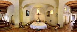
5. Churches
Last modification: 2019. July. 22. 13:21
Találati relevancia adatok
megtalálta: szöveg (1) | összesen: 1 pont
Tárolt adatok:
cím: Churches
lead:
tartalom: + 1 800-Year-Old Church The Egregy part of the town called Hévíz used to be a medieval village, which has been destroyed during the Turkish occupation and has been rebuilt by German settlers in the 17th century. The traditions of vine-growing are preserved by the local oenologists and inns. One of the pearls of the town, the ancient monument church built in the 13th century is located in the Egregy part of the town. The church is surrounded by a graveyard. From the top of the hills there is a wonderful view to see. The exact date of the construction of the church is unknown; presumably it was built in the middle of the 13th century. Written records mention it for the first time in 1341. The building was heavily damaged during the 16-17th century, in the baroque times it has been renovated in 1731. Luckily only the parts that absolutely needed action were involved in the renovation, therefore, the medieval form of the church remained. The results of this renovation included the internal and the external decorative paintings, heightening of the nef, and the missing arches have been replaced, too. The first patron of the church was St. Catherine of Alexandria. After the renovation the church has been consecrated again, and the new saint patron was St. Magdalena. Then the church has been subject to renovations repeatedly: in 1860, in 1912, between 1964 and 1965, in 1990, 1991 and in 2015. There is an opened baroque door on the southern side. The arching of the tower has been renewed in the 18th century, and the quadrangular nef adjoins it. The only decorative element adding space to the interior of the church is the row of chambers in the northern wall. It is important to pay attention to the paintings on the wall of the church. These are not of medieval origin, but are the clear evidence of the architectural enrichment of the church. It reflects the due respect of the folk art treasure forms. Inside the building there are the fragments of a baptising pool from the Roman age, and a consecrated cross from the medieval age. The church of Egregy is one of the three churches from the Arpadian age left entire in the area of Lake Balaton. The structure and the space of the orientated church are clear-cut, it has a straight sanctuary and a single nef. The tower has three floors of rich formation, with double and triple windows. The tower is covered by an octagonal helmet-shaped roof reinforced by eight quarter-timbers. The foundations preserved the forms used for building from wood. The painted decorations and the scratched forms remained on the external surfaces. Look around in our 3D tour! Holy Spirit Catholic Church The Holy Spirit Catholic Church is the largest church of Hévíz. Its seating capacity is about 1000. The foundation stone of the church was laid by Jozsef Szendi then bishop in May 1996.Its GPS co-ordinates are the following: N 46° 47' 21.85", E 17° 11' 06.04"The church was built based on the plans of Janos Bocskai architect. Due to the support of the town and the population it has been completed in three years. The seven sky-high towers serve as a guide for the visitors of the town. The seven towers are the symbols of the seven gifts of the Holy Spirit. On September 9th, 1999 it has been consecrated together with the Town Hall by Jozsef Szendi retired bishop. The interior of the church is alloying modern architecture and tradition enhanced mainly by the nice wooden panels. Its excellent acoustics makes it a suitable scene for giving organ concerts, too. The colourful windows with their Gothic-like forms are the hand-made products of Endre Simon artist from Heviz. The torso cross on the wall of the sanctuary is a 200 years old art treasure that has been granted to the church and has been restored by Gyula Karolyi restorer and painter. The bronze statue of Christ on the left side of the altar was created by Laszlo Marton. He is also the composer of the bronze statue called the Dowager of the Hungarians standing on the right side and wearing the Hungarian Crown. The lustre glaze pictures on the walls were made by Laszlo Morvay. The wooden structure was built by Tibor Kováts and the wooden works of the interior were produced by Andras Hegedus. There are four bells in the towers. In the garden of the church and in its neighbourhood there are several statues and reliefs. Due to static reasons there was no bell placed in the highest tower. In the tower on the left there are two bells ringing, one of those have been founded by Dr. Bela Horvath and his family to pay homage to Saint Peter, the another was moved here from the old church. One of the bells in the right tower have been founded to do homage to Saint Paul and the costs were covered by the widow of Imre Varga, its another bell is again from the old church. Look around in our 3D tour! Calvinist church The Calvinist church was constructed between 1995 and 1998 based on the 1941 plans of Balint Szeghalmy architect from Nagyvarad. The marble decorations of the building are evocating of the Hungarian Calvinist churches of Transylvania. When creating the interior the Calvinist traditions were followed and it has remarkable woodworks. The church is used both by the Calvinist and the Lutheran denominations for servicing and meetings. Indeed only the minority of the population of the town is Calvinist or evangelical, but every year there are thousands of visitors belonging to these churches arrive here from Hungary and from abroad. The Calvinist from Heviz used to have no church, their meetings were held in houses and in the Community Centre of the Spa-Hospital. The evangelists used the small room of the movie theatre, then the lobby of Hotel Alba and the Community Centre of the hospital. In 1994 the city council made a donation of this piece of land to the denominations. It was again the local government supporting the construction, then a funding was started in order to cover the remaining costs of the works started in 1995. The foundation stone of the Calvinist church was laid on June 21st, 1997. The finished church building was consecrated by Dr. Bela Harmati evangelist bishop and Dr. Mihaly Markus Calvinist bishop. Karoly Borsos and his family made the donation of the bell located under the opened arch of the tower to the church. Look around in our 3D tour! Heart of Jesus church The Heart of Jesus church is located in the Egregy part of the town. It consists of two parts constructed in different ages. Close to the church there are building ruins left from the Roman age, the excavation was brought to a close in 2004.Its GPS co-ordinates are the following: N 46° 48' 07.28" , E 17° 11' 20,94” The church was built based on the plans of Janos Bocskai architect. The belfry was built at the beginning of the 20th century, while the nef was completed in 1994-1995. The belfry built in 1905 had two floors, but in 1937 a third floor was added. The tower built in Roman style has twin windows and includes a small and a large bell. The small bell has been founded to do homage to Maria Magdalena in 1905. In 1937 the large bell was founded upon the order of Egregy village to do homage to those who died in the King’s service. To pay homage to those 16 people lost in World War I there is a table made of stone in the middle of the cope and the names are listed on this. In commemoration of them again there were 16 trees planted, together with grave-markers having each name, date of birth and birth of death carved into those. There are only 6 trees alive as of today. To pay homage also to those who died in World War II there was a memorial tablet placed into the wall of the belfry, including the names of the young people from Egregy who died. Later the tablet has been moved to the graveyard. In 1994 the construction of the church nef started in accordance with the plans of Janos Bocskai. Then it has been consecrated by Dr. Gaspar Ladocsi major-general, chaplain general to the forces on April 22nd, 1995. The church is also called Fradi church, due the significant support provided by Sport Club of Ferencvaros (Fradi) for the construction. The white and green colours of the interior and the small memorial corner reflect the ties with the club. Look around in our 3D tour!
title:
description:
címkék: ;church;Hévíz;
fókusz kulcsszó:
szinoníma címkék:
6. Sights around Hévíz
Last modification: 2020. April. 22. 11:47
Találati relevancia adatok
megtalálta: szöveg (1) | összesen: 1 pont
Tárolt adatok:
cím: Sights around Hévíz
lead:
tartalom: + 1 Anyone who has ever been to the West Balaton region knows that this is one of the most colourful regions of the country. In this beautiful corner of Lake Balaton, a week is definitely not enough to discover everything! This is the region worth returning from time to time to discover hidden treasures and have unforgettable adventures! Spending your holiday in the western corner of Lake Balaton is something you definitely don’t want to miss! Every season is showing a different face of the area and the landscape is not the only thing offering an incomparable experience; from season to season many programs are waiting for tourist to try them out and to collect memories they can obtain nowhere else! But what can the West Balaton region offer? The most beautiful view to Lake Balaton and the so called Witness Mountains (Badacsony, Csobánc, Szent György-hegy) can be seen in this region. Here lies one of the most beautiful baroque castles of Hungary, the Festetics Castle of Keszthely which offers many exhibitions all year long. The most unique lake in the world can be found here, in Hévíz. On the top of the volcanic hills, we can enjoy both the unexceptional panorama and the medieval castle ruins often accompanied by tournaments. Explore the many secrets of the Balaton Uplands National Park, from the Kis-Balaton to the Cave Lake of Tapolca! During the winter, canoe tours, ice-skating, the steaming Lake Hévíz, wellness services, great food and hot drinks wait for the guests visiting the area. Unlike during the summer, the best family-friendly beaches and restaurants on the shores of Lake Balaton are offering unforgettable moments while the cities get full with life offering festivals for almost every weekend. During the spring and the fall, the lovers of active leisure activities take hold of hiking and bicycle trails. And the keen gastronomy enthusiasts won’t get disappointed by the gastro experiences of Hévíz, the famous wines of Badacsony and the better and better ice creams and special deserts all around Lake Balaton. The most notable sights of the region: Beautiful nature: The sights and hiking trails of the Balaton Upland National Park Lookout towers and hiking trails in the Keszthely hills Kis-Balaton (Small Balaton) Kányavári Island – Kis-Balaton Csodabogyós Cave – Balatonederics Kotsy Water Mill – Zalaszántó Buffalo Reserve – Kápolnapuszta Basalt Columns at Szent György-hegy (Saint George’s Hill) The permanent exhibition of Museum of Balaton – Keszthely House of Nature Visitor Centre – Gyenesdiás Szépkilátó viewpoint – Balatongyörök Africa Museum – Balatonederics Lake Cave – Tapolca Lavender House Visitor Centre – Tihany Castles, ruins: Festetics Palace – Keszthely Castle of Szigliget Castle of Sümeg Ruins of Tátika Ruins of Rezi Ruins of Csobánc – Csobánc Hill Museums: Festetics Palace – Keszthely – permanent and temporary exhibitions Museum of Balaton – Keszthely Inner City Museums: Doll Museum, Snail Shell Parliament, Cadillac, Retro Toys, Erotic Panoptic – Keszthely House of Nature Visitor Centre – Gyenesdiás Africa Museum – Balatonederics Further sights or programs to consider: Port of Keszthely – pleasure boat trips and scheduled liners on Lake Balaton City Beach – Keszthely Diás Beach – Gyenesdiás Paintball – Gyenesdiás Imre Festetics Animal Park – Gyenesdiás Darnay Cellar - Gyenesdiás Michael’s Chapel – Vonyarcvashegy Lido Beach – Vonyarcvashegy Water Lily Adventure Park (Tavirózsa Kalandpark) – Keszthely, Kertváros Zala Springs Golf Club – Zalacsány Zobori Adventure Park – Zalaszabar Peace Stupa – Zalaszántó List broken down into cities: KESZTHELY | 6 kms from Hévíz Festetics Palace – Keszthely Museum of Balaton – Keszthely Inner City Museums: Doll Museum, Snail Shell Parliament, Cadillac, Retro Toys, Erotic Panoptic – Keszthely Port of Keszthely – pleasure boat trips and scheduled liners on Lake Balaton City Beach – Keszthely GYENESDIÁS | 8 kms from Hévíz House of Nature Visitor Centre – Gyenesdiás Diás Beach – Gyenesdiás Paintball – Gyenesdiás Imre Festetics Animal Park - Gyenesdiás Darnay Cellar – Gyenesdiás REZI | 9 kms from Hévíz Dino Park ZALACSÁNY | 10 kms from Hévíz Zala Springs Golf Resort VONYARCVASHEGY | 11 kms from Hévíz Michael’s Chapel – Vonyarcvashegy Lido Beach – Vonyarcvashegy BALATONGYÖRÖK | 14 kms from Hévíz Africa Museum – Balatonederics Szépkilátó viewpoint – Balatongyörök ZALASZABAR |22 kms from Hévíz Zobori Adventure Park SZIGLIGET |24 kms from Hévíz Castle ruin of Szigliget SÜMEG | 25 kms from Hévíz Castle of Sümeg Tournament TAPOLCA | 30 kms from Hévíz Cave Lake BADACSONY – BADACSONYTOMAJ |30 kms from Hévíz Hiking and wine-tasting Farther away: ZALAEGERSZEG | 40 kms from Hévíz AquaCity Azalea Valley Göcsej Village Museum Lake Gébárti and surroundings TIHANY | 67 kms from Hévíz Tihany Monastery Hermit’s Cave Lavender House Visitor Centre BALATONFÜRED | 70 kms from Hévíz Tagore Promenade Museums and Galleries Lóczy Cave The House of Jewish Excellence Wines of the Csopak Wine-District VESZPRÉM | 80 kms from Hévíz Castle and Old City Zoo
title:
description:
címkék: ;Hévíz;Sights;Program guide;Hévíz;Explore it!;
fókusz kulcsszó: sights
szinoníma címkék:
7. Wellness ABC
Last modification: 2024. August. 16. 13:38
Learn about the most important wellness treatments
Találati relevancia adatok
megtalálta: szöveg (1) | összesen: 1 pont
Tárolt adatok:
cím: Wellness ABC
lead: Learn about the most important wellness treatments
tartalom: + 1 To evolve a conscious lifestyle is necessary to carry about the body, nut just the soul. The wellness treatments can help you a lot.We collected the most important wellness treatments, cure types for you. Acupressure Acupuncture Anti-aging Aquarobic Aroma light-therapy Ayurveda Balneotherapy Caldarium Fango Jacuzzi Jogging Chinese massage Cleopatra-bath Kneipp steps Laconium Lomi Lomi Nui Lymphatic massage Qi-Gong Paraffin treatment Shiatsu Step Aerobic Stretching Sole massage Thai massage Thalassotherapy Yumeiho Acupressure In the course of the acupressure, the particular points of the body are massaged with finger pads or nails. As a result, the direction and the intensity of the flow of the chi, that is a vital force, in the meridians will be restored to the normal and healthy channel. Acupuncture Human has around 360 main acupuncture points, and through these points, certain disorders of the body may be stopped by using acupuncture needles. The acupuncture is quite effective against pains and it also stimulates blood flow, stabilizes circulation, increases the body energy level and improves the general state of health. Anti-agingIt comprises treatments which help you remain fit and young, including stress relief, exercise therapy, beautician techniques, change of eating habits, vitalizing substances, brain training, change of lifestyle, and many others. AquarobicIt is gymnastics performed in water and accompanied with instructions and mostly with music, which is protective to joints but it is also featured of training and massage as it requires force against the water pressure. Aroma light-therapyIt is not the scent what is primarily used in aroma-therapy treatments but the volatile oil extracted out of plants. Volatile oils have certain components that get locally active within the body and perform only a secondary effect through smelling.With lighting during the light therapy colored light penetrates deep into the skin so that to stimulate the positive reactions of the cells to everyday complaints and mental disorders. AyurvedaThe Ayurveda is an ancient Indian system of medicine and philosophy at the same time, which aims at the individual instead of the treatment of disease or symptoms by consideration and comparison of the individual habitus, climate, the seasons of the year and parts of the day, lifestyle, diet and many other aspects. BalneotherapyThis is a kind of treatment with medicinal water or so-called thermal mineral water not classified as medicinal water yet. It comprises drinking cure with such waters, inhalation, mud treatment, carbonated baths, and medicinal baths. CaldariumThis is one of the facilities used in Roman baths, which means hot water bathroom. The caldarium, usually tiled or covered with marble, in which people usually stay for 30 to 40 minutes, poses less burden on human organism than a sauna due to the lower temperatures (40-50 °C) and the humidity of the air (70-100%). FangoMud pack from ground volcanic rock is applied to a certain part or the whole of the body. Fango is capable of holding heat for a long period, rich in minerals and free of organic substances. It has been used for the treatment of rheumatism for centuries, and it is also used for beautician purposes. JacuzziThe water-jets directed to the particular points of the body and the massage promotes full relaxation. Due to the intensified blood circulation your body will get more oxygen so you’ll feel fit. The pores of skin get larger and due to the intensified blood circulation, your skin will be purified from toxins. As a result, the skin will be firmer and more elastic. JoggingJogging combines all the benefits of walking; it conditions the heart, improves muscle tone and strength, relieves stress, and can help with a variety of health problems, such as osteoporosis, heart disease and arthritis. Chinese massageThe Chinese massage may be considered as a kind of acupuncture combined with stretching. The massage may consist of various parts. It may refer to the spine massage and the Chinese head massage aiming at the head and neck. During the massage, the acupuncture points are treated as well. The Chinese massage also includes the stretching of muscles or joints. Cleopatra-bath Cleopatra, the Egyptian Queen did her best to fight ageism; she tried to make her skin soft and healthy by having a bath with donkey milk in it. The beauty care products named after her suggest having a bath with a mixture of milk and vegetable oil. These products are based on the conditioning and nourishing effects that milk and vegetable oils have on the skin. Kneipp stepsYou tread cold water stepping on pebbles placed on the bottom of a tub while walking around. The legs are lifted out of the tub at every step so that the cold water and the warm air will provide the contrasting bath character. The pebbles gently massage the reflex zones of the soles initiating a certain regulatory process. LaconiumIt is a cool version of the Finnish sauna. The temperature may not exceed 55 C° and the degree of humidity is insignificant. It enhances congestion and supports the immune system. Lomi Lomi NuiThis traditional Polynesian massage is one of the most pampering therapies of the Hawaiian kahunas. The massage starts by rubbing the body with “ti” leaves, and the body is heated with hot stones. Then while the lomi-lomi masseur is dancing with traditional dance-steps, imitating the steps of a frigate bird, around the nearly naked body of the patient, lying on the massage bench, he is giving the treatment, which means soft smoothing and kneading motions of the pad of his/her forearm and palm. Finally, he/she completes the massage with a ritual ablution of the body. Lymphatic massageThis is a special kind of massage that makes lymph fluid drain away. The lymph flow may be stimulated along the lymph vessel by smoothing with gentle pressure, thus the tissues may be purified from the roughage. As a result, the skin becomes cleaner, better supplied with blood and firmer. This massage activates the immune system, promotes the recovery of the cells and tissues and reduces the susceptibility to inflammation. It is highly recommended as an additional treatment to detox cures. Qi-GongIt is a generic term to mean a wide range of heath-preserving practices. This ancient method combines the mental concentration, breathing technique and physical exercise so as to enhance and maintain your vital energy. The technique requires regular practice but it is easy to acquire for any age group depending on the fitness level of the individual. Paraffin treatmentAfter smearing your skin with thermo cream you should apply the heated paraffin, which will harden on your body. This will temporarily hinder the skin respiration promoting the absorption of the cream full of effective substances. The paraffin pack contains alga, which is a fat-dissolving agent with high iodine content. It makes skin spectacularly firm, smooth and velvety. ShiatsuShiatsu is based on the ancient Japanese medicine and philosophy, but it has also been affected by the modern western medicine. It is suitable for preventing diseases, locomotor and mental disorders or just for a pleasant sensual and spiritual journey in the universe of your inner self. According to the Taoist philosophy the energy – prana, qi or chi – flows continuously both in the universe and in human body. The therapist treats the patients on the acupuncture spots along the meridian lines because these spots provide access to the various organs. Step-AerobicStepping on and off a platform may enhance the development of the balance between the energy level of the sigh tensors and flexors. Such balance plays an important role in the prevention of certain sports injuries. In well-organized step training the choreography and the step combinations match the rhythm of the music used for the training. StretchingIt means a set of stretching and relaxing exercises. Painless muscle system of good tone is required for coordinated injury-free motion. While being used, muscles perform repeating motions of a small extent, that’s why they tend to grow stiff soon. These exercises help you loosen your stiff muscles of poor tone. Sole massageIt has been used in Asia for five thousand years and nowadays we can see its revival. It protects and improves your physical and mental health without any side-effects within a short period if time. It helps you prevent diseases and stimulates the self-healing mechanism of the organism. Massaging the sole opens a way to affect the central nervous system, circulation and internal organs as it is extremely rich in nerve endings. In the reflex zones related to the particular organs, crystalline lumps of various sizes may be felt which could often be sensitive or even painful. The aim is to rub off these deposits and detoxify the body, improve blood circulation and stimulate the self-healing capacity. Thai massageAn Indian medical man was the first to use this technique in Thailand 2500 years ago. In the course of time it changed but it has preserved its bases up to this day. The massage is carried out with hand, elbow, sole or knee along the so called meridian lines connecting the acupuncture spots. You can enjoy this massage wearing a comfortable cotton T-shirt and cotton trousers. It has a relaxing effect, reduces tension and pain and affects muscles, interstitial tissues, joints, the autonomic nervous system, organs, blood circulation as well as the lines and spots harmonizing energy. Thalasso therapySince the mid-19th century the thelasso therapy - -derives from the Greek word "Thalassa" = sea – has combines the holistic and the wellness experiences for the body and soul. A French doctor called La Bounnadiére was the first to use the designation in 1867, and since then it has been associated with soothing and regenerating effects of the therapy applying sea water, seaweed and sea climate. YumeihoYumeiho is a kind of massage originated from Japan. It was created by Sajoni Masayuki, who used the elements of martial arts of Chinese Buddhist monasteries. The masseur kneads the body thoroughly, stretches the joints and loosens the blocks to make motion and energy flow free. The treatment combines the techniques of acupressure and the manual therapy with eastern physical exercises.
title:
description: Learn about the most important wellness treatments
címkék:
fókusz kulcsszó:
szinoníma címkék:
8. Hiking and touring
Last modification: 2024. August. 16. 13:40
Találati relevancia adatok
megtalálta: szöveg (1) | összesen: 1 pont
Tárolt adatok:
cím: Hiking and touring
lead:
tartalom: + 1 Walking tours do not require any preparation or sports equipment. Tourists keen on nature may explore the area abounding in woods even individually. As the spring comes closer, it inevitably occurs to the lovers of nature to set out, enjoy the sunny weather and take a deep breath of fresh flower-scent air. At such times it doesn’t matter which direction you choose for a start; the only important thing is being outdoors. The West-Balaton Region, within that the Kis-Balaton and the Balaton Uplands with their unique natural values as well as Hévíz and its surroundings rich in forests provide great opportunities for the tourists who are willing to find a few days for wandering the countryside. These days walking with special poles, called Nordic walking, is getting more and more popular. We recommend this activity primarily for our elderly visitors, since you burden not only your legs but you can set the upper part of your body in motion as well. Nordic walking can be pursued anywhere. Of course, the best choice is walking outdoors, enjoying the fresh air in a pleasant environment close to nature. Such conditions enhance the beneficial effects of the Nordic walking; it relieves stress and improves stamina and gait. You can join the guided Nordic walking tours organized by the Tourinform Office on which you can acquire the basic techniques from an instructor, and in the meantime, you can hear a lot of interesting information on Hévíz and its surroundings. Nordic walking is an excellent family and community sport, that’s why it is highly recommended for tourists who are here with a company or reluctant to do any sports on their own. Do not give up if you have no Nordic walking poles; you can hire ones from the instructor. You can make enquiries on the details of the program in the Tourinform Office. The most popular Nordic walking route – a 6-km-long tour on the route Hévíz Véderdő (shelter forest) – Nemesbük – Egregy winery row – may be covered within one and a half hours. Download the walking tourmap from the area, where all trails are signed! Tourmap Guide for the tour map Would you like to walk around the Small-Balaton? We recommend you to use this map, which guides you through the whole West-Balaton region. Small text on the other side of the map helps you to get familiar with the area. Tips for walking tours: Hévíz – Egregy – Alsópáhok – Hévíz (8 km) Hévíz – Cserszegtomaj; Margit kilátó (lookout tower) – Hévíz (3 km) Hévíz – Cserszegtomaj Várszínház – Hévíz (4 km) Hévíz – Keszthely Balatonpart – Hévíz (8 km) Hévíz – Cserszegtomaj – Keszthely Kertváros – Hévíz útvonal (12 km) Hévíz – Karmacs – Hévíz (15 km) Relax and enjoy walking!
title: Hiking and touring
description: Walking tours do not require any preparation or sports equipment. Tourists keen on nature may explore the area abounding in woods even individually.
címkék:
fókusz kulcsszó:
szinoníma címkék:
9. Natural attractions
Last modification: 2019. July. 22. 11:55
Találati relevancia adatok
megtalálta: szöveg (1) | összesen: 1 pont
Tárolt adatok:
cím: Natural attractions
lead:
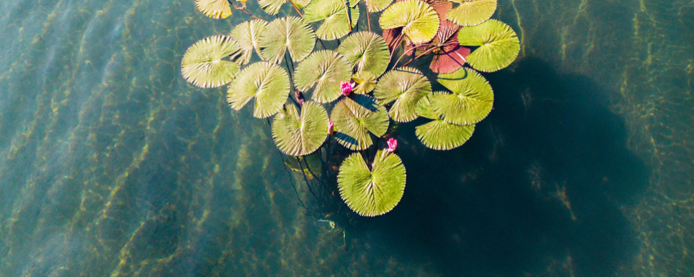
tartalom: + 1 The flora and fauna of the lake is unique due to the temperature and chemical composition of the water. Some species of the Hungarian flora and fauna can only be found here. Water lilies in the lake We may say it with good reason that the most unique plants of Lake Hévíz are the water lilies. The English physician and traveller Richard Bright also commemorated these special flowers in his book from 1815. White water lilies are autochthonous in the lake – although they have almost vanished, but a lot of them can be found in the sluice. In the end of the 1800s several attempts were made to plant various types of water lilies, of which the acclimatization of the Indian red water lily was successfully accomplished. The Indian red water lily was acclimatized in 1898 by Lovassy Sándor, a lecturer of the Academy of Economics in Keszthely.Since then the flower has become a real symbol of the town. Did you know that the home of the red water lily is actually the tropical Bengal, Eastern India? a stem develops even 10 to 20 leaves during a summer? the flowers open late at night and only close the next morning? blooming lasts from June to late November? the flowers are not only aesthetically important, but also play a significant role in decreasing the cooling of the water? the stolons trailing all over the bottom protect the medicinal mud? Little animals In addition to the flora, the fauna of the lake is also very diverse. Small unicellular organisms and vertebrates live here too. They do not disturb bathers, because only those will become aware of their existence who persistently search for them. The lake and its environment make home for plankton-crabs, water-snails, fish, dragonflies, leaf- and rose beetles, and even many species of butterflies. Did you know that 66 kinds of snail live in and around the lake? common carp and tench are autochtonous species of fish? However, you can also meet the mosquitofish, the Prussian carp or the pumpkinseed sunfish. in addition to the edible frog, also the marsh frog and the European fire-bellied toad live here? the European pond turtle, the smooth newt and some grass snakes come sometimes into view in the sedge marsh? the surroundings of the sluice are swarmed by wild ducks in the autumn and spring? The mute swans, black-headed gulls and Eurasian coot can find shelter here in the winter. tourists sometimes can see water shrew, common shrew or European mole? Protection forest, park Everybody takes delight in the colourful sight of water-lilies covering the surface of the lake. The red Indian water-lily was brought to Hungary in 1898 by Sándor Lovassy, the teacher of the Academy of Economy in Keszthely. These days the indigenous white water-lily of the Lake occurs mostly in the drainage canal due to the purification. The strictly protected plants are in bloom from the beginning of summer to the end of November. Water-lilies are significant for two reasons; in one hand, their leaves slow down the evaporation of the lake and on the other hand their runners all around at the bottom of the Lake protect the medicinal mud. The Berki Study Trail still unknown by most people, however, there are several sights worth visiting in the course of a walking tour. The Trail covers the Lake of Hévíz and the surrounding moor as well as its flora and fauna which is unique not only in Hungary but in Europe as well. Under the microscope... Typical plants of the heat spring are blue-green algae, whose certain species are able to live in high temperature because of the special composition of their proteins. Thiobacteria are also typical inhabitants of the lake, they are able to store the sulphur excreted from the water in their cells. Different strains of bacteria living in the lake make the water of the lake antiseptic. Also one of the special species of micromonospora lives in the lake, which is called ‘micromonospora heviziensis’ after its residence – since it has not been known before. It is a powerful protein- and cellulose decomposer, therefore it is an important organism of the underwater soil of the lake. The actinomycetes species also discovered in Hévíz is said to be special as well: it can only be found here in Central Europe. It accumulates iodine crystals in its cells and in their environment.
title:
description:
címkék: ;Hévíz;Nature;Natural park;Thermal lake;Tour;
fókusz kulcsszó:
szinoníma címkék:
10. Synagogue
Last modification: 2024. July. 22. 09:32
Találati relevancia adatok
megtalálta: szöveg (1) | összesen: 1 pont
Tárolt adatok:
cím: Synagogue
lead:
tartalom: + 1 THE HISTORY OF THE JEWISH COMMUNITY IN HÉVÍZ BEFORE WORLD WAR I Hévízfürdő, which became world-famous for its medicinal lake, was referred to as Keszthelyi-Hévíz before the First World War. On the western side of the lake, the bathing complex was established in the 1860s, which belonged to the Festetics estate. In the 1920s, the spa community was established in its neighborhood, which, together with the spa complex, belonged administratively to the Hévízszentandras district registry established in 1907. The Jews of Hévízfürdő were closely linked to the Jews of neighboring Keszthely. View of Hévízfürdő Towards the end of the 18th century, the first Jewish residents settled in Hévízszentandrás (then still Szentandrás). The village's first Jew - a certain Joachim - appeared in the 1795 tax census, and the 1798 register mentioned a person named "Isák Jósef". The Jews of Szentandrás belonged to the mother faith community of Keszthely from a religious and administrative (registry) point of view. In the second half of the 19th century, the number of Jews was limited to only a few families and only 2-3 percent of the population. In 1890, 5 out of 240 inhabitants (2.1%), in 1910 8 out of 303 inhabitants (2.6%) were of Israelite religion. Thanks to the booming spa life after the First World War, most Jews lived in Hévízszentandrás in 1930 (23 people, 3.4 percent of the population), while in Egregy, which is further from the spa, there were no Jews since the 1920s. Among those vacationing and seeking healing at Hévízfürdő, however, the proportion of Jews became more and more significant, accounting for a quarter of the visitors (20-30 thousand people) in the summer season. The Israeli guests played an important role in the urbanization of the bathing place, in spreading the bourgeois way of life and cultural customs, while Hévízfürdő also promoted the social acceptance and practical validation of their civil equality. Several of the hotels, shops and restaurants that spread in the spa area were owned by Jewish investors. The Jewish guests' religious needs were met by the Israelite house of prayer, inaugurated in 1910, which was built on the left bank of the drainage channel of the spa, near Ignác Lusztig's restaurant named "Jeruzsálem". During the high season - from the end of May to the end of August - dr. Sándor Büchler, The chief rabbi of Keszthely, often taught from the Bible and the Talmud. The collection of the musical services and cultural performances was used for the medical treatment of poor believers. Mandel's restaurant provided kosher meals for spa guests of the Israeli religion. The Israelite House of Prayer stood next to the left bank of the drainage channel The Jerúzsálem restaurant (later Alsó restaurant) The Reischl family, who leased the spa from the Festetics for 35 years (1905–1940), played a major role in the spa's prosperity - jr. Vencel Reischl, then Imre and Richárd's sons - as well as the Jewish spa doctors who created the foundations of Hévíz spa medicine, dr. Vilmos Schulhof and dr. Ödön Schulhof, and the Christian dr. Károly Moll. Dr. Vilmos Schulhof, spa doctor, rheumatologist and balneologist, worked in Hévíz from 1906. Here, in 1911, he established the second Zander medical institution in Europe, where therapeutic gymnastics using machines was used as a supplement to the spa treatment. Before the First World War, spa doctor Schulhof carried out extensive scientific work to promote the spa in both domestic and foreign interest. His articles were published in numerous domestic and German trade magazines, he was one of the editors of the spa guides published annually by the National Balneology Association, in which he wrote the chapter on the Hévíz Spa. Dr. Vilmos Schulhof laid the foundations of Hévízfürdő with his research, scientific and educational work, and made the spa known abroad. The Zander Institute and its medico mechanical machine line THE HISTORY OF HÉVÍZ JEWISHNESS BETWEEN THE TWO WORLD WARS By the end of the 1920s, the house of worship proved to be small, and it was far from the spa community that was developing at the "American pace". The Israelite church was inaugurated in an ornate ceremony on July 2, 1933, the ceremony was presided over by dr. Sándor Büchler, the chief rabbi of Keszthely, and it was attended by representatives of the secular authorities, many Neolog and Orthodox rabbis, as well as the spa guests. The Festetics principality contributed with real estate, the Reischl Fürdőbérlő Társaság and the Hévízszentandrás spa community, as well as numerous private individuals contributed to the construction through monetary donations. Established as a branch of the Keszthely parish and later becoming independent Dr. Sándor Büchler Chief Rabbi was elected as President of the Hévíz parish, and Dr. Adolf Kertész, a lawyer from Budapest, the organizer of the church construction and an enthusiastic supporter of the spa was elected as the secular president. Among the members of the presidium was Dr. Ödön Schulhof spa doctor, local resident Miksa Singer, and several regular visitors to the spa. The exterior and interior of the synagogue in Hévíz followed Orthodox traditions with the aim of enabling even the more religious of the spa guests to practice their faith. The synagogue was built in 1933 near the lake According to reports from the time, the synagogue was crowded during the Friday evening and Saturday services with Israeli guests seeking spiritual nourishment in addition to healing, whose donations helped maintain the religious life. Among the vacationers, a significant proportion of people were of the Israelite religion. In one of the buildings of the spa walkway, the Kurszalon (Medicine Room), concerts were often organized for the benefit of the Israelite church fund, in which spa guests participated regardless of denominational difference. The church was inaugurated by dr. Sándor Büchler Chief Rabbi Dr. Ödön Schulhof (Vilmos' half-brother) worked in Berlin after graduating from the medical university in Budapest, from where he returned home in 1923, and practiced at his brother Vilmos's Zander Institute in Hévíz during the spa season. His work was already considered pioneering in the decades between the two world wars. In the 1920s, he was the first to use novocaine infiltration to relieve rheumatic and joint pain. As the first X-ray doctor in Hévíz, he also produced outstanding joint and bone X-rays on a national scale. The so-called Bársony-Schulhof "view" X-ray procedure has been used all over the world. Dr. Ödön Schulhof (on the left) and Dr. Vilmos Schulhof (on the right) spa doctors During the census of the Jewish residents of the Hévízszentandrás district registry on April 28, 1944, fifteen Jewish residents were recorded in 4 households in Hévízszentandrás and the spa area. The same number were listed in the list of names made in the Keszthely ghetto on May 26, but only thirteen were listed on the list of those transported to Zalaegerszeg due to labor service calls. Among the Jews of Hévíz, the members of the Freller, Frisch, Simon and Singer families, as well as dr. Vilmos Schulhof and László Ungár were destroyed in Auschwitz, several others (men in labor service) died elsewhere. STARTING AGAIN AFTER THE WAR, DEMOLITION OF THE CHURCH In the intact synagogue, Jewish spa guests visiting Hévíz continued to practice their religion after the war. However, after the death of Dr. Adolf Kertész (1959), the religious life ceased at the end of the 1960s, and the orphaned, decaying building was demolished in April 1977, in connection with the reconstruction of the buildings of the lake bath between 1977-1982. The lake cabinet cover was donated by Imre Simon in 1955 The synagogue was demolished in 1977 On July 2, 2000, the Holocaust memorial ("Hévíz Wailing Wall") was inaugurated on the site of the synagogue in the presence of the Israeli Ambassador Judith Shorer Várnai, which was built with the sacrifices of the city. Holocaust memorial erected on the site of the synagogue Sources used: SZARKA Lajos, Páratlan testvérpár. A Schulhof - testvérek szerepe Hévíz „világfürdővé” válásában. Hévíz: Hévíz Város Önkormányzata és Szent András Állami Reumatológiai és Rehabilitációs Kórház, 1999. első kiadás és 2002. második kiadás DR. SZARKA Lajos, A hévízi zsidóság története. Hévíz: Hévíz Város Önkormányzata, 2000. INFORMATION FOR INTERIOR SPACE OBJECT ELEMENTS The synagogue - or in Hebrew bet hákneszet (house of assembly) - is the central place of Jewish religious and ritual life, where Jewish people gather. The orthodox synagogue in Hévíz was inaugurated on July 2, 1933. The main entrance and two side entrances opened from the western side of the synagogue. The women entered through the side entrance on the left, from which a staircase led up to the upstairs gallery. Women were separated from men. The main entrance and the door on the right were used by men, the latter led to the room in the vestibule where the basin of water for ritual hand washing stood, and the faithful could enter the main entrance vestibule after this had been done. At the inauguration of the synagogue, several commemorative plaques made of precious stones (granite, marble) were placed in the vestibule, two listed the names of those who made large donations to the construction, one indicated the time and main data of the construction (it was built between 1930-33 on the plot donated by the hg. Festetics Tasziló , at the initiative of Dr. Adolf Kertész and his wife, based on the plans of the chief technical advisor Artúr Boros, under the leadership of master builder András Varga and under the supervision of Béla Berényi). On the fourth board were the names of those who supported the Israeli patients who came to Hévíz with bed donations. The fifth - smaller - white marble tablet was erected in honor of Adolf Kertész the synagogue founder, who died in 1959. The wooden-framed plaque of the Israelite Prayer Society of Hévízfürdő was hung in the lobby. This showed the order of services, which started on Friday at 7 pm and on Saturday at 9 am during the bathing season. Among those listed, two large memorial plaques (donors and bed donors) and dr. Adolf Kertész's plaque was placed on the Holocaust memorial inaugurated on July 2, 2000. In the center of the interior stood the bima, or Torah reading platform, from which the designated section of the Torah was read aloud facing east (towards Jerusalem) on Sabbaths and holidays in Orthodox synagogues. The bima was typically decorated with a menorah (seven-branched candelabrum). In the central space - in front of and behind the bima - benches were placed, where the believers took their seats and followed the prayer. On the east side – facing Jerusalem, the former Sanctuary – was the Torah cabinet (or frig cabinet), where the Torah scroll (or scrolls) containing the 5 books of Moses were stored. The Torah cabinet was covered with a decorative Torah cabinet cover made of velvet and silk, with embroidered Hebrew inscriptions and Jewish symbols (Star of David, menorah, olive branch), which was pulled away when the Torah was taken out. Imre Simon and his wife donated a new Torah cabinet cover to the Hévíz church in 1955, the inscription on which referred to the martyrs who were destroyed in the Holocaust ("in memory of our fathers"). Near the Torah booth, the rabbi (from the right) and the cantor, or prayer leader (from the left), had a decorative seat. The seat of the leaders of the religious community was placed near the eastern side. On the high-backed bench preserved from the Hévíz church, The names of President dr.Adolf Kertész, Artúr Boros and József Brüll were marked with enameled plaques. The church was lit by 3 large windows from the north and south, and the narrower windows on the west (entrance) side were the galleries designated for women. The synagogue's small decorative glass window - depicting a blue Star of David enclosed in a white circle - has survived. The interior lighting of the synagogue was provided by the chandelier hanging from the ceiling and the lamps placed on the walls, with bronze and wrought iron wall brackets. A wall arm from the latter also remained. In front of the frigate, there was a perpetual candlestick (nér tómid) hanging from the ceiling, which reminds of the eternally burning fire on the altar of the Church of the Holy Sepulchre in Jerusalem. A separate association (Nér Tómid, or Örökmécs Egyesület) usually took care of keeping the candle flame alive. HÉVÍZ SYNAGOGUE 3D RECONSTRUCTION [zsinagoga3d] Text written by: Dr. Szarka Lajos (PhD) historian. Sources Used: SZARKA Lajos, Páratlan testvérpár. A Schulhof - testvérek szerepe Hévíz „világfürdővé” válásában. Hévíz: Hévíz Város Önkormányzata és Szent András Állami Reumatológiai és Rehabilitációs Kórház, 1999. első kiadás és 2002. második kiadás DR. SZARKA Lajos, A hévízi zsidóság története. Hévíz: Hévíz Város Önkormányzata, 2000. Kép: Fortepan/Album051
title:
description:
címkék:
fókusz kulcsszó:
szinoníma címkék:
11. BeReady Project
Last modification: 2025. June. 30. 15:29
Találati relevancia adatok
megtalálta: szöveg (1) | összesen: 1 pont
Tárolt adatok:
cím: BeReady Project
lead:
tartalom: + 1 In the first call of the Interreg Danube Region Programme, 290 concept notes were submitted. Out of these, 89 advanced to the second phase, and 60 reached the funding agreement stage. Twenty of these projects fall under the priority area “A greener, low-carbon Danube Region.” One of the innovative projects selected is Be Ready (urban heat island resilience, preparedness, and mitigation strategy). The project aims to provide tools for local and regional authorities to identify urban heat islands and understand their causes and impacts on human health, productivity, energy consumption, and biodiversity. The project involves 19 partners from 12 countries, working together to develop solutions to mitigate the effects of heat islands in urban environments. Partner cities, including Hévíz, are preparing action plans to address urban heat islands through data analysis, urban planning solutions, regulations, increased awareness, and infrastructural measures. A key aspect of the project’s approach is the concept of “urban acupuncture” – specific small-scale interventions with large impact. The urban pilot activities seek solutions in three areas: “Green acupuncture”, using vegetation; “White acupuncture”, applying innovative surfaces and materials; “Blue acupuncture”, exploring new ways to utilize water resources. You can get involved and support the fight against climate change in Hévíz, helping make the world more sustainable for everyone. Find more information about the project on our social media pages (Facebook and LinkedIn), and on the project website: https://www.interreg-danube.eu/projects/beready Project news
BEREADY PROJECT
The project Be Ready (UrBan hEat islands REsilience, prepAreDness and mitigation strategy) addresses the climate change capacities in the Danube Region taking into account ecosystem-based approaches. The common challenge to be tackled is urban heat islands (UHI). The recent unprecedented heat waves demonstrate the acute need to strengthen the preparedness and adaptive capacity of the society to cope with impacts of climate change and foster resilience at city level.

The project main outputs include jointly developed and implemented methodologies and toolkits for UHI risk assessment, data analysis and modelling at city level; co-designed solutions for tackling UHI, tested and peer reviewed in urban environment by 12 pilot cities; a common strategy for improving the climate change preparedness and resilience aimed at local and regional authorities in the Danube region; action plans and transformative strategic outlooks for the participating partners; policy recommendations; a virtual training program with SPOCs; awareness campaigns in 12 countries over the 30-month period.Key for Be Ready is the ClimateSandbox approach that will support participating cities to define and deploy climate-oriented innovations – both on the technological and service side (i.e. content) and on the policy, administrative and spatial planning side (i.e. enabling conditions), through the innovative digital Climate Sandbox Technological and Societal Readiness Tool.
The project's ambition is to showcase to decision-makers and other stakeholders across Europe the benefits of adopting solutions in which the environment, simplicity, and aesthetics play a key role as value-generating agents as well as community engagement drivers, throughout the co-design process, acting both at levels of solution definition, development, and deployment.
Implementation period: January 1, 2024 – June 30, 2026
Partners:
• Sofia Development Association, Bulgaria – Lead Partner
• DEX Innovation center, Czech Republic
• Association Tehnopol of Galati, Romania
• Chișinău Town Hall, Moldova
• Municipality of Galați, Romania
• Science and Technology Park Nis, Serbia
• City of Nis, Serbia
• City of Zenica, Bosnia and Herzegovina
• Urban Planning Institute of the Republic of Slovenia, Slovenia
• Capital City Podgorica, Montenegro
• University of Natural Resources and Life Sciences, Vienna, Austria
• Slovak University of Technology in Bratislava, Slovakia
• Municipality of Ratiboř, Czech Republic
• South Moravian agency for public innovation JINAG, Czech Republic
• City of Kranj, Slovenia
• Association Bureau for Integration and Social Innovations, Bulgaria
• Development agency North Ltd., Croatia
• Municipality of Hévíz, Hungary
• Small Business Development Foundation of Kisalföld, Hungary
Be Ready is an Interreg Danube Region Programme project co-funded by the European Union.
BeReady methodology workshop in Hévíz
Experts from public institutions, scientific institutions, civil organizations and businesses will come together to learn about the risks of urban heat islands and to actively participate in the further activities of the project, the elimination of heat islands.
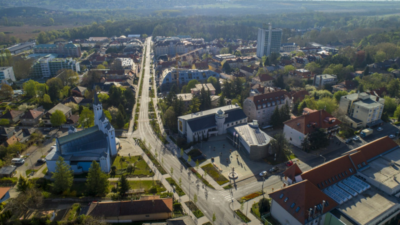
The Be Ready (UrBan Heat Islands Resilience, PrepAreDness and mitigation Strategy) project deals with the climate change capabilities of the Danube region, taking ecosystem-based approaches into account. The common challenge is urban heat islands (UHIs). The recent unprecedented heat waves show the urgent need to strengthen the preparedness and adaptability of society. cope with the impacts of climate change and promote resilience at the urban level.
The Municipality of Hévíz City participates as a consortium partner in the project, where a total of 19 partners from 12 countries joined together to jointly develop solutions to mitigate the effects of heat islands in the urban environment. Partner cities, including Hévíz, develop action plans to tackle urban heat islands through data analysis, urban planning solutions, regulations, increased awareness and infrastructure measures. In connection with this, the local workshop will be held on November 6, 2024, where the work of the relevant professional and civil organizations will begin. During the program, they get to know the overall goals of the project, the research that has already been completed as part of it, the methodology of the risk assessment prepared by the partners, and its use. They create some sort of joint pact to reduce urban heat islands.

BEREADY PROJECT in HÉVÍz!
Elimination of urban heat islands in order to improve the quality of life of the population and guests.
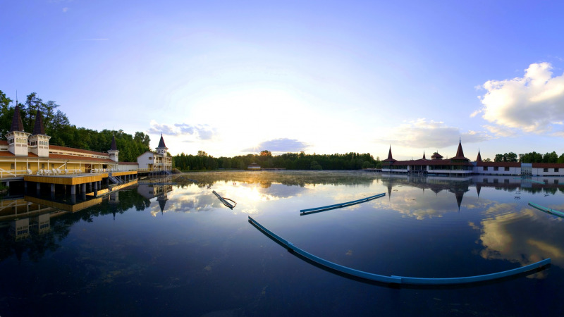
The Be Ready (UrBan Heat Islands - UHI - Resilience, PrepAreDness and mitigation Strategy) project deals with the climate change capabilities of the Danube region. The Municipality of Hévíz City participates as a consortium partner in the project, where a total of 19 partners from 12 countries joined together to jointly develop solutions to mitigate the effects of heat islands in the urban environment.
Representatives of the following organizations participated in the workshop:
Hévíz City Municipality
Hévíz St. Andrew's Rheumatology Hospital and Spa
Balaton Uplands National Park
Hévíz Entrepreneurs' Association
Hévíz Room Publishers' Association
Liget Hévíz Ltd.
Hévíz Television Ltd.
Bonvital Gastro & Wellness Hotel
Noppa Ltd.
Kisalföldi Enterprise Development Foundation
Hévíz Palace Hotel
BOKU University, Vienna
What is the project about in brief?
The partner cities, including Hévíz, develop action plans to combat urban 'hotspots' using data analysis, urban planning solutions, regulations and infrastructure measures.
As the average summer temperature rises, urban heat islands (UHI) are increasingly forming, which pose a health risk to residents and visitors, especially among the oldest and youngest, as well as sick people. The unprecedented heat waves experienced recently show that there is an urgent need to strengthen the preparedness and adaptability of society and to consciously (re)shape our living spaces in defense against the heat.
The aim of the project in Hévíz is to assess the city's hottest spots and develop solutions for their effective cooling or elimination. Efforts must be made to ensure that, within the framework of the 2-year program, there are immediate solutions, unique model projects and long-term strategic proposals at the local level as well.
The BeReady project consists of 5 phases, of which the III. stage preparation is underway in Hévíz. In Phase I, the research institutes assessed the general characteristics of the heat islands and are working on methods to map them. The II. the partners got to know the methods. The current III. with the involvement of the localities, locally affected partners, professional organizations, experts and the population, they will assess their own heat islands based on the methodology and their risk in order to be able to formulate proposals to prevent the formation of heat islands or eliminate existing ones. This will be followed by IV. phase, in which specific tasks and pilot projects must be implemented to reduce heat islands, the results of which will have to be reported and the results published in phase V.

Experts from public institutions, scientific institutions, civil organizations and businesses came together to learn about the risks of urban heat islands and to actively participate in the further activities of the project, the elimination of heat islands on the 6th November 2024 for a local workshop. The crowd of 18 guests got familar with the whole project, and started to learn the about the metodology which will used to measure and collect the local datas to provide the UHI vulnerability of Hévíz.
https://www.heviz.hu/en/news/news/beready-project-in-heviz
Urban heat islands vulnerability and risk assessment of Hévíz
Raising Awareness of Urban Heat Islands in Hévíz through the BeReady Project
As part of the BeReady project (Urban Heat Islands Resilience, Preparedness and Mitigation Strategy), the City of Hévíz has completed a vulnerability assessment related to urban heat islands (UHI).
The assessment was based on a methodology jointly developed by expert partners involved in the project (Urban Planning Institute of Slovenia, BOKU, STUBA, Science and Technology Park Niš), with the goal of reducing risks related to the heat island effect.
The aim of the report is to map the vulnerability and preparedness of the city of Hévíz in the face of increasingly frequent summer heatwaves and extreme temperature events. The city’s analysis was carried out using four key criteria: exposure, sensitivity, preparedness, and adaptive capacity.
The assessment highlighted the urban areas most exposed to the heat island effect—particularly densely built commercial zones and areas with low green space coverage. In the next phase of the project, concrete adaptation and UHI mitigation measures will be developed with the involvement of the local community, paying special attention to the needs of vulnerable population groups.
BeReady – Online Platform for Vulnerability Assessment Tools
Within the framework of the BeReady project, an online platform offering Urban Heat Island (UHI) Vulnerability Assessment Tools has been made available. This platform supports municipalities and professional stakeholders in identifying and managing the risks and vulnerabilities related to the heat island effect.
Its purpose is to assist local authorities and relevant actors in assessing the level of their UHI vulnerability, raising awareness of at-risk groups, and identifying opportunities for development within relevant policies, practices, and in terms of adaptive capacity and preparedness.
The platform offers a simplified self-assessment tool that allows cities to evaluate their UHI exposure, sensitivity, preparedness, and adaptive capacity based on their own data. The methodology is built around four core elements: exposure, sensitivity, preparedness, and adaptive capacity.
In addition, the platform showcases good and promising practices for mitigating UHI impacts and encourages the exchange of experiences and solutions between cities.
Users of the platform also have access to a glossary that helps them understand the technical terms and abbreviations used. Where needed, BeReady partners provide direct support and mentoring through the platform.
The BeReady project aims to provide research-based, assessment, and operational tools to help local and regional authorities better understand the UHI phenomenon, identify its causes, and develop effective adaptation and mitigation strategies.
The platform is available at the following link: https://be-uhi-ready.net/vulnerability-assessment-tools/
title: BeReady Project
description:
címkék:
fókusz kulcsszó:
szinoníma címkék:
12. Cserszegtomaj Delights
Last modification: 2025. November. 26. 09:41
Pickles, fermented vegetables, smoky zakuska, homemade jams, and roasted hazelnuts — all crafted from homegrown produce, free of additives, just like grandma used to make.
Találati relevancia adatok
megtalálta: szöveg (1) | összesen: 1 pont
Tárolt adatok:
cím: Cserszegtomaj Delights
lead: Pickles, fermented vegetables, smoky zakuska, homemade jams, and roasted hazelnuts — all crafted from homegrown produce, free of additives, just like grandma used to make.
tartalom: + 1 From garden to jar Have you ever tasted roasted hazelnuts? Tried pickled turnips? Love fermented vegetables? At Cserszegtomaj Delights, the family’s homegrown fruits and vegetables are transformed into delicious jams, healthy pickles, rich vegetable spreads — and even roasted hazelnuts, one of the key ingredients in Nutella. Éva Mózerné Merics and her family have been growing their own produce for decades. By expanding into small-scale processing, they now manage every step from seed to jar themselves. A legacy rooted in grandmother’s kitchen The farm is built on generations of family knowledge and experience. What started as growing food for personal use gradually turned into selling surplus at local markets. For years, Éva’s grandmother sold their homemade products at the Keszthely market. As demand for preservative-free, homemade goods grew, Éva left her previous job and dedicated herself full-time to farming and processing. Today, the family cultivates several hectares of orchards, vegetable plots, and a hazelnut grove in Cserszegtomaj. Thanks to increased processing capacity, their products are now available year-round — though seasonal ingredients ensure constant variety. Traditional methods, modern values The product range includes classic pickles, fermented vegetables, vegetable spreads, jams, and roasted Turkish hazelnuts — plain, salted, or chocolate-coated. Depending on the season, Éva might also bring fresh produce to market: pumpkins in autumn, persimmons or quince paste in winter. Éva learned the art of preserving, fermenting, and natural processing from her mother-in-law. Many of her products are made without preservatives or additives, using traditional methods — just like grandma did. Fermented and pickled products — like turnips, cabbage, beets, or broad beans — are unpasteurized, retaining their natural nutrients and rich flavors. All vegetables are grown on the family’s land. Every step — slicing, bottling, labeling — is done by hand in their workshop in Cserszegtomaj. "Good things take time" That philosophy could easily be Cserszegtomaj Delights’ slogan. Éva believes that patience is the key to creating truly healthy, high-quality foods — whether preserving, pickling, or fermenting. More than a farm: an experience Besides their Cserszegtomaj farm, the family also maintains plantations in Alsópáhok, where they operate two guesthouses. Soon, they will open a demonstration garden, offering thematic programs and hands-on workshops where visitors can learn the secrets of homemade preserves. A mission, not just a job “What the garden gives, I want to turn into more than just flavor. I want to create life.” For Éva, farming is not just work, but a calling. She firmly believes that what we eat affects our quality of life, which is why knowing where food comes from — and how it’s made — truly matters. Product highlights Zakuska This traditional vegetable spread is made from fire-roasted eggplants, homemade ground peppers, and their own tomato puree — all free of additives. The eggplants are roasted over fruitwood coals, giving them a signature smoky flavor. Every step is done by hand: peeling the eggplants, harvesting garden-grown peppers and onions, simmering the tomatoes. Seasoned simply but boldly, the zakuszka showcases the true taste of vegetables. Thick and creamy, it’s vegan, gluten-free, and perfect on bread, toast, or as a flavorful side dish. Each jar captures the essence of a Cserszegtomaj season. Roasted hazelnuts On their plantation, Éva’s son Gergő and his family tend to over 700 hazelnut bushes, using eco-friendly, chemical-free methods. After harvesting, the nuts are dried, cracked, hand-sorted, and roasted in small batches to ensure maximum flavor and crunch. They are available plain, salted, or coated in chocolate for those with a sweet tooth. Gergő also produces cold-pressed hazelnut oil — a rare delicacy in Hungary. Where to buy Hévíz Farmers’ Market Szezonkosár (Seasonal Basket Initiative) More information & Contact: Facebook
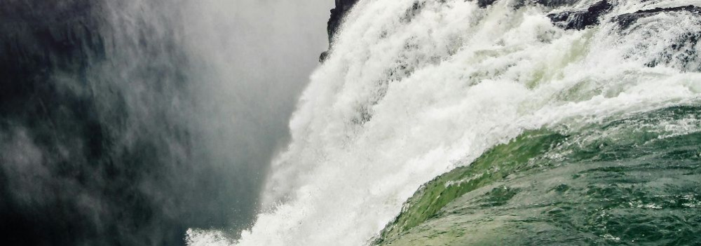 [galeria]
The Legacy of the Ancient Pannonian Lake
Imagine a vast body of water — over 1,000 meters deep and more than 400 times the size of Lake Balaton — once rippling across this land. The story of the Pannonian Lake is not just a fascinating chapter of geological history, but a legacy that continues to shape the region: it left behind mineral resources, fertile soils, and even inspired legends. Discover how an ancient lake transformed Transdanubia — and why its impact is still felt today.
An Inland Sea for Millions of Years
At its greatest extent, the Pannonian Lake covered an enormous area, far surpassing the size of today’s Balaton. For millions of years (approximately 12 to 8.5 million years ago), it dominated the region. As surrounding mountain ranges gradually rose, the lake became cut off from the world’s oceans. Its water slowly turned fresh, and its basin began to fill with sediments. Because of its isolation, the lake developed a unique ecosystem with many endemic species.
The Lake Didn’t Appear Overnight
The Pannonian Lake didn’t simply “appear” in the Carpathian Basin. Its formation was the result of millions of years of tectonic activity and shifting climate. It emerged as an independent, enclosed body of water — no longer connected to the open seas.
Deep Waters, Varied Shores
In some areas, the lake reached depths of over 1,000 meters. Elsewhere, shallower zones supported lagoons, river deltas, and small, isolated lakes. During high water periods, rocky shorelines formed along the mountain fringes — traces of which can still be found today in the Keszthely Hills and the Mecsek Mountains.
The Lake’s Retreat — and Sediment Legacy
Despite its size, the lake was eventually filled in by immense volumes of sediment, carried mainly by rivers flowing from the Alps and the Carpathians. Over the course of 6.5 million years, it gradually disappeared from the landscape.
What did it leave behind?
Its sediments — composed mostly of sand, clay, and fine silt — became the so-called “Pannonian formations,” which today hold key mineral resources (such as petroleum) and aquifers. These formations define much of the surface geology of Transdanubia, including the Zala Hills.
Fertile soils later formed on the laminated silty and clay-rich deposits of the Somló Formation. Even the legendary “Tihany goat’s hoof” fossils — actually worn shell fragments of the Congeria ungulacaprae mollusk — can still be found embedded in these ancient layers.
The Final Lakes and a Gradual Goodbye
Because most of the sediment entered from the northwest, north, and northeast, the lake slowly retreated toward the south and southeast — as if it were “withdrawing” from what is now Hungary.
Small remnant lakes persisted for much longer in areas of present-day Slavonia (Croatia) and northern Serbia, but due to their different scale, character, and fauna, they are not considered true successors of the ancient Pannonian Lake.
Waters That Carve Slopes, Sediments That Tell Time
About 10,000 years ago, rapid climate warming triggered a cascade of natural responses: torrential floods, landslides, and intense rock weathering. The landscape we walk on today was not shaped over mere centuries, but by the dramatic forces of climate and water, working together. Did you know that the Zala Valley floor is made up of sediments deposited by a kind of "river of time"? Discover how the Earth’s surface became one of the most sensitive indicators of climate change.
Climate Change: Not Just a Modern Phenomenon
We often associate climate change with contemporary issues, but Earth’s climate has shifted many times throughout its history — sometimes quite rapidly. Within large-scale climatic cycles, alternating periods of warming and cooling have long been part of the planet’s natural rhythm.
When Climate Changes, Everything Reacts
A change in climate sets off a chain reaction of environmental processes. It’s not just animals and plants that respond — so does the landscape itself.
Around 10,000 years ago, as the climate warmed significantly, rainfall became more intense.
More rain meant more erosion: stormwater began washing away sediment from hills and valleys into riverbeds. The rivers, now carrying more water and more sediment, flooded more often and spread these materials across the landscape.
Shaping the Terrain
This had a major impact on topography: the land surface became more fragmented and dynamic. Warming temperatures also sped up chemical and physical weathering, breaking down bedrock and helping fertile soil layers to develop.
In short, natural geological processes that had long been underway suddenly accelerated — and reshaped the surface of the land.
Young Sediments at the Base of the Slopes
Today, in many areas of the region, the lower slopes and valley edges are coated with sediment — debris washed down from higher ground, largely within the last 10,000–20,000 years. In the Zala Valley, for instance, these deposits have spread so far that they now reach the center of the valley floor.
The original bedrock source of these sediments varies: in Zala, it’s typically Pannonian sand (Somló Formation), while in the Keszthely Hills, marine-origin carbonates dominate — mostly dolomite, with some limestone. These sediments now appear as fine gravel, pebbles, or coarse sand, quietly recording the environmental changes of the recent past.
title: Cserszegtomaj Delights
description: Pickles, fermented vegetables, smoky zakuska, homemade jams, and roasted hazelnuts — all crafted from homegrown produce, free of additives, just like grandma used to make.
címkék:
fókusz kulcsszó:
szinoníma címkék:
13. Csizmás Syrup
Last modification: 2025. November. 26. 09:42
The unique highlight of Csizmás Syrup is their lightly herbal syrup made from homegrown hemp, but their raspberry, strawberry, and sour cherry syrups are also well worth a taste.
Találati relevancia adatok
megtalálta: szöveg (1) | összesen: 1 pont
Tárolt adatok:
cím: Csizmás Syrup
lead: The unique highlight of Csizmás Syrup is their lightly herbal syrup made from homegrown hemp, but their raspberry, strawberry, and sour cherry syrups are also well worth a taste.
tartalom: + 1 Handmade, all-natural, fruit-packed In a small workshop on Egregyi Wine Hill, gently overlooking Hévíz, Csizmás Syrups are born. Their defining feature? Real fruit, no artificial flavors or sweeteners. László Németh, the founder and creator, wanted to revive the authentic taste of syrups he grew up with — the kind where “raspberry tastes like raspberry.” If you too remember the taste of real, homemade syrup, László’s creations will bring back that countryside nostalgia with every sip. Everything was in place — It just had to begin Gastronomy and hospitality have always been close to László’s heart, having worked in these fields abroad before returning home to Hungary. His family grows fruit in Pankasz, a village in the Őrség region, so when there was surplus fruit, László experimented with making his own raspberry, strawberry, and sour cherry syrups. After much trial and error, the Csizmás Syrup brand was born — and customer feedback quickly confirmed its place in the market. Real fruit, real taste, without compromise. Ingredients from trusted sources Since its founding in 2018, Csizmás Syrup has followed one simple principle: only bottle what László himself would happily consume. Most of the ingredients come from family production: raspberries, strawberries, and sour cherries are grown in Pankasz, Vas County. Elderflowers are foraged by László himself each May, far from roads and pollution. Hemp is grown right behind his workshop on the Egregyi Wine Hill. Traditional craftsmanship, no compromises Every step of the process is done by hand — from milling the fruit to bottling — ensuring the highest quality. Csizmás Syrups are made cold-pressed, without pasteurization or cooking, preserving the fruits’ authentic flavor, color, and vitamin content. The juices retain fruit pulp and seeds, adding body and richness: raspberry seeds remain in the syrup, strawberry bits stay in the juice. The fruit content is impressively high — at least 40%. Only minimal preservatives and just enough sugar are used to achieve the desired taste profile. As László says: “Never skimp on the fruit and work as quickly as possible.” The result is a product that captures nature’s true flavors — no artificial aromas, just lasting, real taste. Real fruit, lasting flavors The product range includes raspberry, strawberry, sour cherry, elderflower, and the unique hemp syrup. The hemp version is lightly herbal, calming, and many enjoy it as a relaxing evening drink. László only releases products he’s personally satisfied with — if a recipe doesn’t meet his high standards, it doesn’t make it to market. Product highlights Hemp Syrup Hemp syrup is a true rarity, unique in both taste and effect. Made from industrial hemp (Cannabis sativa) grown without chemicals on Egregyi Wine Hill, László harvests the female hemp flowers in autumn and cold-processes them to preserve their valuable active compounds — known for their calming and stress-relieving properties. The syrup’s flavor is gently spiced, refreshingly herbal, and balanced with a hint of lemon. It contains only natural ingredients and a minimal amount of sugar. Perfect as a refreshing drink diluted with water or soda, but many also enjoy it before bedtime for its soothing effects. Serving Tip: For best taste, mix Csizmás Syrup with water or soda in a 1:8 ratio. Where to buy Hévíz Farmers’ Market
[galeria]
The Legacy of the Ancient Pannonian Lake
Imagine a vast body of water — over 1,000 meters deep and more than 400 times the size of Lake Balaton — once rippling across this land. The story of the Pannonian Lake is not just a fascinating chapter of geological history, but a legacy that continues to shape the region: it left behind mineral resources, fertile soils, and even inspired legends. Discover how an ancient lake transformed Transdanubia — and why its impact is still felt today.
An Inland Sea for Millions of Years
At its greatest extent, the Pannonian Lake covered an enormous area, far surpassing the size of today’s Balaton. For millions of years (approximately 12 to 8.5 million years ago), it dominated the region. As surrounding mountain ranges gradually rose, the lake became cut off from the world’s oceans. Its water slowly turned fresh, and its basin began to fill with sediments. Because of its isolation, the lake developed a unique ecosystem with many endemic species.
The Lake Didn’t Appear Overnight
The Pannonian Lake didn’t simply “appear” in the Carpathian Basin. Its formation was the result of millions of years of tectonic activity and shifting climate. It emerged as an independent, enclosed body of water — no longer connected to the open seas.
Deep Waters, Varied Shores
In some areas, the lake reached depths of over 1,000 meters. Elsewhere, shallower zones supported lagoons, river deltas, and small, isolated lakes. During high water periods, rocky shorelines formed along the mountain fringes — traces of which can still be found today in the Keszthely Hills and the Mecsek Mountains.
The Lake’s Retreat — and Sediment Legacy
Despite its size, the lake was eventually filled in by immense volumes of sediment, carried mainly by rivers flowing from the Alps and the Carpathians. Over the course of 6.5 million years, it gradually disappeared from the landscape.
What did it leave behind?
Its sediments — composed mostly of sand, clay, and fine silt — became the so-called “Pannonian formations,” which today hold key mineral resources (such as petroleum) and aquifers. These formations define much of the surface geology of Transdanubia, including the Zala Hills.
Fertile soils later formed on the laminated silty and clay-rich deposits of the Somló Formation. Even the legendary “Tihany goat’s hoof” fossils — actually worn shell fragments of the Congeria ungulacaprae mollusk — can still be found embedded in these ancient layers.
The Final Lakes and a Gradual Goodbye
Because most of the sediment entered from the northwest, north, and northeast, the lake slowly retreated toward the south and southeast — as if it were “withdrawing” from what is now Hungary.
Small remnant lakes persisted for much longer in areas of present-day Slavonia (Croatia) and northern Serbia, but due to their different scale, character, and fauna, they are not considered true successors of the ancient Pannonian Lake.
title: Csizmás Syrup
description: The unique highlight of Csizmás Syrup is their lightly herbal syrup made from homegrown hemp, but their raspberry, strawberry, and sour cherry syrups are also well worth a taste.
címkék:
fókusz kulcsszó:
szinoníma címkék:
14. Dédi nyomában Biogarden
Last modification: 2025. November. 26. 09:43
Homemade delicacies made from sun-ripened, chemical-free vegetables — straight from the pantry.
Találati relevancia adatok
megtalálta: szöveg (1) | összesen: 1 pont
Tárolt adatok:
cím: Dédi nyomában Biogarden
lead: Homemade delicacies made from sun-ripened, chemical-free vegetables — straight from the pantry.
tartalom: + 1 A pantry experience from Zala Drying herbs on the terrace, ripe tomatoes in the greenhouse, the scent of fresh jam in the kitchen — Dédi nyomában Biogarden started as a self-sufficiency project, a lifestyle choice rooted in a close connection to nature. It’s a small homestead where everything is made from what the garden yields, just a little more than you would preserve for yourself. And what will you find on the pantry shelves? Vegetable spreads, pickled vegetables, mixed salads, jams, and syrups for sure. Inspired by tradition Szabina’s family comes from the Bakony region. After living in Pilis, she moved to Zala County in 2022, choosing a new path with gardening at its heart — cultivating 4,000 m² of land. Initially experimenting with bio-intensive vegetable farming, she soon realized her true calling was not large-scale production, but crafting small batches of homestead delicacies with care and joy.The greenhouse, crop rotation, chickens, runner ducks, and composting all reflect her mindful approach to farming. Bio-intensive, chemical-free farming Every section of Szabina’s garden serves a purpose, the result of thoughtful planning. Fixed garden beds and a greenhouse are the core, where she practices regular crop rotation, enriches the soil with compost and mulch, and grows most plants from her own collected seeds, adapted to their environment. She uses well water for irrigation. For pest and disease management, she relies on natural methods: companion planting, insect netting, and biological solutions. Ducks and chickens happily assist by controlling snails and pests — no chemicals involved. Open the pantry & explore Szabina’s products include syrups, jams, dried herbs, pickles, and vegetable spreads — all made in small quantities, available seasonally and in varied selection. The charm of Dédi nyomában Biogarden lies in its simplicity: only as much is produced as the garden and nature provide — and only what Szabina herself enjoys making. While the farm’s name evokes old times, Szabina incorporates modern techniques too. She uses a canning machine to preserve syrups and pickles, ensuring shelf life and efficiency. Jams are made with sugar and gelling agents, while syrups and pickles are preserved without chemical additives, using the canning method. Herbs like lemon balm, mint, lavender, rose, and violet are handpicked, dried, and crushed. Vegetable spreads, pestos, and tomato sauces are always processed fresh — and they tend to sell out quickly! Product highlights Vegetable spread Dédi nyomában Biogarden’s vegetable spreads are always made from whatever the garden currently yields — zucchini, tomatoes, peppers, or eggplant. What’s guaranteed in every jar is the essence of sun-ripened vegetables. Szabina grows her vegetables chemical-free, hand-harvests, chops, steams, or oven-roasts them, seasons to taste, and blends into a creamy, spreadable texture. Flavors change with the seasons and what’s available in the pantry: wild garlic, garlic, fresh herbs, or a mildly spicy kick. Each batch is unique and delicious. The spreads contain no preservatives or additives and are often produced in very limited quantities — sometimes just a few jars. Where to buy Online Store More information & Contact: Facebook
[galeria]
Waters That Carve Slopes, Sediments That Tell Time
About 10,000 years ago, rapid climate warming triggered a cascade of natural responses: torrential floods, landslides, and intense rock weathering. The landscape we walk on today was not shaped over mere centuries, but by the dramatic forces of climate and water, working together. Did you know that the Zala Valley floor is made up of sediments deposited by a kind of "river of time"? Discover how the Earth’s surface became one of the most sensitive indicators of climate change.
Climate Change: Not Just a Modern Phenomenon
We often associate climate change with contemporary issues, but Earth’s climate has shifted many times throughout its history — sometimes quite rapidly. Within large-scale climatic cycles, alternating periods of warming and cooling have long been part of the planet’s natural rhythm.
When Climate Changes, Everything Reacts
A change in climate sets off a chain reaction of environmental processes. It’s not just animals and plants that respond — so does the landscape itself.
Around 10,000 years ago, as the climate warmed significantly, rainfall became more intense.
More rain meant more erosion: stormwater began washing away sediment from hills and valleys into riverbeds. The rivers, now carrying more water and more sediment, flooded more often and spread these materials across the landscape.
Shaping the Terrain
This had a major impact on topography: the land surface became more fragmented and dynamic. Warming temperatures also sped up chemical and physical weathering, breaking down bedrock and helping fertile soil layers to develop.
In short, natural geological processes that had long been underway suddenly accelerated — and reshaped the surface of the land.
Young Sediments at the Base of the Slopes
Today, in many areas of the region, the lower slopes and valley edges are coated with sediment — debris washed down from higher ground, largely within the last 10,000–20,000 years. In the Zala Valley, for instance, these deposits have spread so far that they now reach the center of the valley floor.
The original bedrock source of these sediments varies: in Zala, it’s typically Pannonian sand (Somló Formation), while in the Keszthely Hills, marine-origin carbonates dominate — mostly dolomite, with some limestone. These sediments now appear as fine gravel, pebbles, or coarse sand, quietly recording the environmental changes of the recent past.
title: Dédi nyomában Biogarden
description: Homemade delicacies made from sun-ripened, chemical-free vegetables — straight from the pantry.
címkék:
fókusz kulcsszó:
szinoníma címkék:
15. Emese Cheese Workshop
Last modification: 2025. November. 26. 09:45
High-quality, artisanal goat milk products straight from sunny Cserszegtomaj — available in both savory and sweet varieties. Find your favorite!
Találati relevancia adatok
megtalálta: szöveg (1) | összesen: 1 pont
Tárolt adatok:
cím: Emese Cheese Workshop
lead: High-quality, artisanal goat milk products straight from sunny Cserszegtomaj — available in both savory and sweet varieties. Find your favorite!
tartalom: + 1 Where happy goats give you cheese, yogurt, and kefir At her small-batch workshop in Cserszegtomaj, Emese Tusz handcrafts cheeses and dairy products without additives, using milk from goats raised on her family farm. What began as a solution to her son’s dietary needs has grown into a beloved craft, allowing many others to enjoy high-quality dairy products again. If you’re looking for clean, pure, and lactose-sensitive-friendly delights — start your tasting journey here. A former German teacher, Emese started experimenting with goat’s milk when her son was diagnosed with dairy protein and lactose intolerance. Her home experiments quickly turned into a passion, then a profession. She completed a two-year dairy processing course in Csermajor and established her own workshop in Cserszegtomaj. Today, her son — who has grown up around goats — also takes part in the daily farm work. For sensitive stomachs and gourmet palates At Emese’s market stall, you’ll find fresh goat cheeses flavored with herbs, aged Jersey cow cheeses, yogurt, kefir, and occasionally butter and cottage cheese — all made with milk from her own farm. Her goat herd currently numbers around 80, with about three-quarters producing milk. All products are made with pasteurized milk, natural rennet, and selected cultures, ensuring a clean, mild flavor with no strong "goaty" taste. Emese cares for her goats with expertise and attention, knowing that healthy, clean animals are key to quality cheese. She uses no additives, flavor enhancers, or preservatives. Each product is made by hand — from shaping the cheese to seasoning it. Emese adapts her recipes daily, responding to the natural variations in milk: “Every day, the milk behaves differently. Its taste, texture, everything changes — you can’t force it into a formula, you have to follow its lead.” Fresh cheeses are often seasoned with smoked paprika or herbs. The yogurt is thick yet silky, while the kefir is light but full-flavored. Aged cheeses offer a deeper, more complex taste profile. Emese also keeps a Jersey cow, whose A2 beta-casein-rich milk broadens her product range — perfect for sensitive customers. Her aged cheeses and limited-edition yogurts often come from this milk, crafted with separate recipes to suit its unique character. Seasonal production Goats naturally begin producing milk after spring births, with milking season typically lasting through autumn. As a result, fresh goat milk products — like cheese, yogurt, and kefir — are only available during certain times of the year. In winter, when the goats rest, production pauses. Only at the market — Always personal You can find Emese’s products exclusively at the Hévíz Farmers’ Market. For her, meeting customers is part of the experience. She loves to talk about her cheeses, her goats, and how everything is made — often sharing pairing tips as well. “If it’s good enough for my son, it’s good enough for anyone.” This simple philosophy sums up what makes Emese’s products so special: they are healthy, natural, delicious — and crafted with honesty, heart, and care. Product highlights Goat cheeses in a variety of flavors Fresh cheeses, creamy spreads, yogurt, and kefir — all made from milk sourced from Emese’s own goats, crafted with over a decade of experience. Every product is made with pasteurized goat’s milk, natural rennet, and carefully selected cultures. Fresh cheeses are prepared just before market days to guarantee freshness. In addition to plain, natural cheeses, you’ll find exciting flavors: garlic, chili, red onion, fenugreek, chives, and even a dessert cheese with walnuts and cranberries. Emese emphasizes quality and gluten-free safety, using Lukullusz ingredients to ensure her cheeses are safe for gluten-sensitive customers. No additives, no colorings, no preservatives. Smoked varieties are cold-smoked over beechwood, preserving their soft texture and natural aromas. Goat cheese pairs perfectly with a slice of sourdough bread, tossed into a fresh salad, or served alongside crisp apples. Where to buy Hévíz Farmers’ Market More information & Contact: Phone: +36 30 709 3640
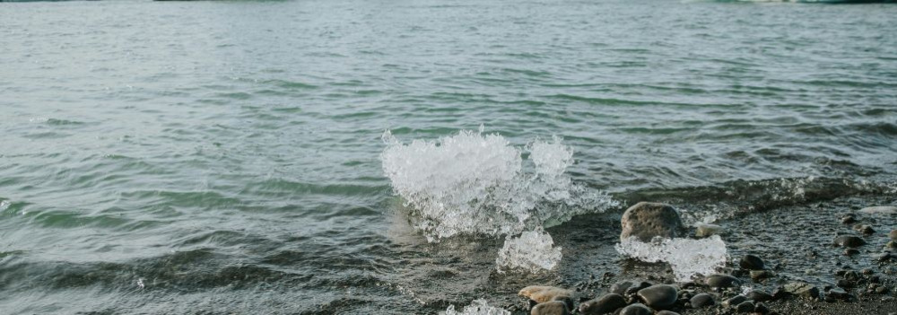 [galeria]
The Life-Giving Winds of the Ice Age
The Life-Giving Winds of the Ice Age: How Loess Shaped the Land
Did you know that Transdanubia’s rich, golden soils are actually a gift from the winds of the Ice Age? Loess isn’t just a dry geological term — it’s an ancient natural recipe that gave rise to some of the most fertile soils in the Carpathian Basin. Where vineyards grow today and birds nest in loess cliffs, strong winds once carried yellow dust across the landscape — for thousands of years. Learn how this unique sediment shaped the land and why loess is still essential for sustainable farming today.
What Is Loess and How Did It Form?
The term loess comes from the German word lose, meaning "loose." Loess is a fine-grained, yellowish sediment that was deposited during the Pleistocene epoch (2.58–0.01 million years ago), particularly during glacial periods. It formed in periglacial environments south of the great Scandinavian ice sheet — cold, dry landscapes with little or no vegetation.
The dust was carried by strong Ice Age winds from floodplains and barren steppes, and slowly accumulated over tens of thousands of years. Eventually, calcium carbonate cemented these layers into loess, which developed characteristic vertical fissures.
It’s important to note that the Pleistocene wasn't a single “Ice Age,” but a period that included alternating cold and warm phases — some even warmer than today.
Loess and the Landscape
Loess gave the Carpathian Basin — especially Transdanubia — its distinct terrain.
Steep loess cliffs (sometimes up to 10 meters high), caves that provide nesting sites for bee-eaters and sand martins, centuries-old sunken roads carved into hillsides, and exposed root systems are all part of the landscape’s geological legacy.
Together, they define the unique character of this region — shaped by time, wind, and stone.
Fertility and Water Retention
Loess-rich areas have produced some of the most fertile soils in the region. Many local producers farm on land that sits atop loess. This creates an excellent foundation for agriculture — not just because of the high humus content, but also because loess has outstanding water-holding capacity. Its vertical pores allow moisture to penetrate deeply and remain in the soil, even during dry periods.
A Modern Echo — Dust from the Sahara
Interestingly, the fine Saharan dust that now reaches Central Europe more frequently can be seen as a modern counterpart to loess-forming material. It’s a reminder that the powerful natural forces that shaped the land long ago are still at work today — just on a different scale.
title: Emese Cheese Workshop
description: High-quality, artisanal goat milk products straight from sunny Cserszegtomaj — available in both savory and sweet varieties. Find your favorite!
címkék:
fókusz kulcsszó:
szinoníma címkék:
16. Valley of Herbs
Last modification: 2025. November. 26. 09:58
Herbs become teas and infused oils, fruits turn into dried snacks and pure juices — all crafted from natural ingredients using modern methods. Step into their “witch’s kitchen” and discover how nature’s gifts are transformed.
Találati relevancia adatok
megtalálta: szöveg (1) | összesen: 1 pont
Tárolt adatok:
cím: Valley of Herbs
lead: Herbs become teas and infused oils, fruits turn into dried snacks and pure juices — all crafted from natural ingredients using modern methods. Step into their “witch’s kitchen” and discover how nature’s gifts are transformed.
tartalom: + 1 Small-scale organic rarming in Zala Péter Bakos and his wife Zsuzsa left their former careers behind to start farming, building their model farm step by step. Here, they grow and process herbs, fruits, and spices into 100% pure juices, dried fruits, infused oils, essential oils, and floral waters. What makes them unique is their commitment to human-scale, artisanal production.Visitors can tour the workshop, taste natural delicacies, and learn firsthand about the healing power of herbs. Where people, animals, and plants thrive together Drawn to a sustainable, nature-connected lifestyle, Péter and Zsuzsa settled in Zalaszentlászló. Though they once lived in Budapest, their love for nature and interest in herbalism had always been there. When they found their property in the Zala Valley, they quickly realized its potential — wild herbs flourished everywhere. Over time, this blossomed into the Valley of Herbs. Their vision was simple: create a place where nature sets the rhythm, and the family only takes what each season offers. To deepen her knowledge, Zsuzsa completed formal phytotherapy training, gaining a deep understanding of the valley’s medicinal plants. Tradition meets modern processing In their “witch’s kitchen,” Valley of Herbs produces infused oils, dried fruits, pure juices, and herbal teas — all from natural, carefully selected ingredients. Modern pressing technology ensures minimal intervention for juices, while crafting infused oils, drying fruits, and preparing teas remains a hands-on, meticulous process. Every herb, spice, and fruit is sorted by hand before it goes into oils, dehydrators, or drying racks. Unlike industrial producers, Péter and Zsuzsa focus on quality over quantity. They use only their own crops or ingredients from trusted local farmers. Herbs are homegrown or wild-harvested from their land. Their infused oils are blended with omega-3 rich Hungarian oil and flavored with homegrown basil, garlic, tarragon, and thyme.Dried fruits — apricots, plums, apples, sour cherries — are gently dehydrated at low temperatures to preserve their natural flavor and nutrients. Juices are pressed from seasonal harvests — apples, grapes, rowanberries, currants, beets, and pumpkins — without added sugars or preservatives. A little of everything in one place Their 15-hectare farm is a vibrant mix of wild meadows, orchards, herb gardens, and a fragrant spice patch. Chickens, roosters, and horses are part of daily life, cared for by Zsuzsa with joy. The farm also includes a small on-site shop, where, by appointment, visitors can buy their favorite products, join herb walks, and attend educational workshops. Product highlights Dried fruits – Local, natural, handcrafted Valley of Herbs dried fruits are made exclusively from local, hand-selected produce. Only the best fruits are used — anything bruised or overripe is carefully excluded to maintain top quality in taste and appearance. Apples, pears, and plums are hand-picked, pitted, sliced, and gently dehydrated using an eco-friendly, small-scale drying system. Dried slowly at low temperatures (45–55°C) over several hours or even days, the fruits retain their color, vitamins, and natural sweetness. No added sugar, no preservatives — just the pure, sun-ripened flavor and aroma of the fruit. Where to buy the products: 8788 Zalaszentlászló, Vörösmajor 0154 Google Maps More information & Contact: Facebook Website Phone: +36 30 952 6024
[galeria]
The Life-Giving Winds of the Ice Age
The Life-Giving Winds of the Ice Age: How Loess Shaped the Land
Did you know that Transdanubia’s rich, golden soils are actually a gift from the winds of the Ice Age? Loess isn’t just a dry geological term — it’s an ancient natural recipe that gave rise to some of the most fertile soils in the Carpathian Basin. Where vineyards grow today and birds nest in loess cliffs, strong winds once carried yellow dust across the landscape — for thousands of years. Learn how this unique sediment shaped the land and why loess is still essential for sustainable farming today.
What Is Loess and How Did It Form?
The term loess comes from the German word lose, meaning "loose." Loess is a fine-grained, yellowish sediment that was deposited during the Pleistocene epoch (2.58–0.01 million years ago), particularly during glacial periods. It formed in periglacial environments south of the great Scandinavian ice sheet — cold, dry landscapes with little or no vegetation.
The dust was carried by strong Ice Age winds from floodplains and barren steppes, and slowly accumulated over tens of thousands of years. Eventually, calcium carbonate cemented these layers into loess, which developed characteristic vertical fissures.
It’s important to note that the Pleistocene wasn't a single “Ice Age,” but a period that included alternating cold and warm phases — some even warmer than today.
Loess and the Landscape
Loess gave the Carpathian Basin — especially Transdanubia — its distinct terrain.
Steep loess cliffs (sometimes up to 10 meters high), caves that provide nesting sites for bee-eaters and sand martins, centuries-old sunken roads carved into hillsides, and exposed root systems are all part of the landscape’s geological legacy.
Together, they define the unique character of this region — shaped by time, wind, and stone.
Fertility and Water Retention
Loess-rich areas have produced some of the most fertile soils in the region. Many local producers farm on land that sits atop loess. This creates an excellent foundation for agriculture — not just because of the high humus content, but also because loess has outstanding water-holding capacity. Its vertical pores allow moisture to penetrate deeply and remain in the soil, even during dry periods.
A Modern Echo — Dust from the Sahara
Interestingly, the fine Saharan dust that now reaches Central Europe more frequently can be seen as a modern counterpart to loess-forming material. It’s a reminder that the powerful natural forces that shaped the land long ago are still at work today — just on a different scale.
title: Valley of Herbs
description: Herbs become teas and infused oils, fruits turn into dried snacks and pure juices — all crafted from natural ingredients using modern methods. Step into their “witch’s kitchen” and discover how nature’s gifts are transformed.
címkék:
fókusz kulcsszó:
szinoníma címkék:
17. KakasBonbon
Last modification: 2025. November. 26. 10:01
If you’ve never loved chocolate before, KakasBonbon is the place that will change your mind. Just follow the weathercock.
Találati relevancia adatok
megtalálta: szöveg (1) | összesen: 1 pont
Tárolt adatok:
cím: KakasBonbon
lead: If you’ve never loved chocolate before, KakasBonbon is the place that will change your mind. Just follow the weathercock.
tartalom: + 1 A treat for all your senses You might not expect a magical chocolate experience among the rolling hills of Zala near Lake Balaton — but it’s true! At KakasBonbon in Felsőpáhok, every bonbon transports you to distant lands while celebrating local flavors. The chocolate shell gently cracks, the filling melts in your mouth. Everything you need for an unforgettable tasting. The story of the weathercock & chocolate The story of KakasBonbon began over 15 years ago when János Szabó and Andrea Tésenyi left their old lives behind and found a new calling in chocolate-making. The iconic weathercock originally perched atop a farmhouse in Máriagyűd, now serves as their symbol and guide in the world of chocolate. The family’s journey took them from Máriagyűd to Sopron, and finally to Felsőpáhok — much to the delight of locals and visitors alike. Today, their workshop and “bonbon apothecary” welcome chocolate lovers from near and far. A special gift for pairing flavors Andrea is the creative force behind the chocolates. Beyond mastering the craft, she possesses a refined sense for pairing flavors and designing memorable forms. For her, making bonbons is less a job and more a form of meditation. Prunes, pumpkin seed & apple, yuzu — and more KakasBonbon offers over 70 flavors, though not all are available year-round. The selection changes with the seasons, ensuring every bonbon is fresh and its aromas at their peak. In harvest season, grape flavors take the spotlight. Winter brings rich cocoa creations, while summer features citrus and berries. Andrea also crafts milk and dark chocolate bars, hot chocolate bombs, and festive shapes for special occasions. All chocolates share the same pure foundation: select single-origin cacao beans, cream (or a lactose-free alternative), and natural fruit or spice essences. The cacao is sourced from diverse regions — Italy, France, Spain, Vietnam, South America — while the fillings highlight local ingredients. Their recipes are clean and simple, as are their elegant decorations. Visit the weathercock in Felsőpáhok! At their Felsőpáhok home, you’ll find a shop, workshop, terrace, and cellar — a perfect setting to taste their creations and meet the makers. You can also join Bor & Bonbon events, where chocolates are paired with carefully selected wines, creating either a delightful evening or an extraordinary journey of flavors. Product highlights Hazelnut KakasBonbon Chocolate Bar This artisan chocolate bar features roasted hazelnuts from Cserszegtomaji Finomságok — carefully selected and small-batch roasted for an authentic, rich flavor. Andrea hand-tempers single-origin chocolate and pours it into molds with practiced precision. Thanks to its high cacao content, this bar is not only delicious but also beneficial for your health, rich in flavonoids and antioxidants. In this chocolate bar, two worlds meet in perfect harmony: locally grown hazelnuts from the Zala hills and premium cacao beans sourced from thousands of kilometers away. Where to buy 8395 Felsőpáhok, Dózsa Street 3 Google Maps More Information & Contact: Instagram: @kakasbonbon66 Facebook Website Phone: +36 70 608 2013
[galeria]
The Legacy of the Ancient Pannonian Lake
Imagine a vast body of water — over 1,000 meters deep and more than 400 times the size of Lake Balaton — once rippling across this land. The story of the Pannonian Lake is not just a fascinating chapter of geological history, but a legacy that continues to shape the region: it left behind mineral resources, fertile soils, and even inspired legends. Discover how an ancient lake transformed Transdanubia — and why its impact is still felt today.
An Inland Sea for Millions of Years
At its greatest extent, the Pannonian Lake covered an enormous area, far surpassing the size of today’s Balaton. For millions of years (approximately 12 to 8.5 million years ago), it dominated the region. As surrounding mountain ranges gradually rose, the lake became cut off from the world’s oceans. Its water slowly turned fresh, and its basin began to fill with sediments. Because of its isolation, the lake developed a unique ecosystem with many endemic species.
The Lake Didn’t Appear Overnight
The Pannonian Lake didn’t simply “appear” in the Carpathian Basin. Its formation was the result of millions of years of tectonic activity and shifting climate. It emerged as an independent, enclosed body of water — no longer connected to the open seas.
Deep Waters, Varied Shores
In some areas, the lake reached depths of over 1,000 meters. Elsewhere, shallower zones supported lagoons, river deltas, and small, isolated lakes. During high water periods, rocky shorelines formed along the mountain fringes — traces of which can still be found today in the Keszthely Hills and the Mecsek Mountains.
The Lake’s Retreat — and Sediment Legacy
Despite its size, the lake was eventually filled in by immense volumes of sediment, carried mainly by rivers flowing from the Alps and the Carpathians. Over the course of 6.5 million years, it gradually disappeared from the landscape.
What did it leave behind?
Its sediments — composed mostly of sand, clay, and fine silt — became the so-called “Pannonian formations,” which today hold key mineral resources (such as petroleum) and aquifers. These formations define much of the surface geology of Transdanubia, including the Zala Hills.
Fertile soils later formed on the laminated silty and clay-rich deposits of the Somló Formation. Even the legendary “Tihany goat’s hoof” fossils — actually worn shell fragments of the Congeria ungulacaprae mollusk — can still be found embedded in these ancient layers.
The Final Lakes and a Gradual Goodbye
Because most of the sediment entered from the northwest, north, and northeast, the lake slowly retreated toward the south and southeast — as if it were “withdrawing” from what is now Hungary.
Small remnant lakes persisted for much longer in areas of present-day Slavonia (Croatia) and northern Serbia, but due to their different scale, character, and fauna, they are not considered true successors of the ancient Pannonian Lake.
title: KakasBonbon
description: If you’ve never loved chocolate before, KakasBonbon is the place that will change your mind. Just follow the weathercock.
címkék:
fókusz kulcsszó:
szinoníma címkék:
18. Margit Kreiner
Last modification: 2025. November. 26. 10:32
It’s not often you get to taste quail eggs — especially ones marinated in aromatic olive oil. Another must-try specialty is the wild garlic pesto, an irresistible highlight of the farm.
Találati relevancia adatok
megtalálta: szöveg (1) | összesen: 1 pont
Tárolt adatok:
cím: Margit Kreiner
lead: It’s not often you get to taste quail eggs — especially ones marinated in aromatic olive oil. Another must-try specialty is the wild garlic pesto, an irresistible highlight of the farm.
tartalom: + 1 Unique delicacies preserved in a jar At Margit Kreiner’s stand at the Hévíz Farmers’ Market, you can sample smoked, spiced quail eggs, wild garlic pesto, paprika creams, syrups, and jams. In Raposka, a quiet corner of the Balaton Uplands at the foot of Szent György Hill, nearly 400 quails chirp daily under the care of Margit and her daughter, thanking them with hundreds of tiny, nutritious eggs. Quail eggs are considered a healthy delicacy, but when smoked and preserved in olive oil, they become a true gourmet treat. Farming as a passion Margit has been immersed in agriculture and homestead farming her whole life. Over the years, she has gained extensive experience in animal husbandry. Previously, her family lived in Káptalantóti, where they raised hundreds of poultry and sheep, produced herbal teas, and cultivated lavender and roses. After moving to Raposka, she continued her passion on a smaller scale. Inspired by an experienced friend, she began raising quails, learning everything through reading, hands-on experience, and trial and error. Today, she and her daughter care for several hundred quails, providing them with fresh water and high-quality feed daily. From the start, Margit has avoided industrial feeds, sourcing natural grains — corn, wheat, barley, peas, soy — from a nearby farm. This ensures the quails remain healthy and their eggs retain a rich, characteristic flavor. As Margit says “Anyone who has tasted eggs from industrially-fed poultry and then tries one from a home-raised bird fed with natural grains will immediately notice the difference.” Not only is the taste superior, but the appearance is too. The yolk has a deeper, more vibrant color that remains golden even after cooking. Artisan processing, creative flavors After boiling, the quail eggs are soaked in brine for several hours, then smoked over beechwood. The firm, white eggs are then preserved in olive oil with garlic, chili, wild garlic, or other seasonal herbs. Each flavor is the result of Margit’s own experiments — nothing reaches the market until she deems it 100% perfect. The most popular flavors include plain, garlic, and chili. Tip: Don’t discard the marinade — the aromatic olive oil can be used for cooking after the eggs are gone! Customers often suggest new flavor ideas, which Margit gladly tries to bring to life. While the smoked quail eggs are the flagship product, Margit also makes wild garlic pesto, sweet and spicy paprika creams from homegrown vegetables, and fruit-based jams and syrups. Product highlights Wild garlic pesto Made from freshly harvested wild garlic at its seasonal peak, this pesto combines finely chopped leaves with olive oil, salt, and either walnuts or chili. Margit uses only the leafy parts to preserve the fresh, mildly garlicky aroma. She collects the wild garlic herself from trusted local spots, sometimes with the help of family. The versions with walnuts or chili add a distinctive twist to this spring delicacy. Perfect for pasta, spread on toast, as a meat accompaniment, or as a salad dressing. No preservatives are used. Spiced smoked quail eggs in olive oil One of Margit’s most unique creations, these smoked quail eggs preserved in olive oil are a true delicacy. The quails are home-raised on natural feed, resulting in eggs rich in vitamins and minerals. Preparing these tiny treasures is a meticulous process: The eggs are soaked in vinegar water to remove natural pigments, then boiled in salted water, cooled, and peeled by hand. After that, they are smoked over beechwood for three hours. The prepared eggs are then submerged in olive oil, plain or flavored with garlic, chili, or seasonal herbs. The oil acts not only as a preservative but also captures the smoky and spicy aromas, making it perfect for later culinary use. Made exclusively with natural ingredients, free from additives and preservatives, this product has a shelf life of six months. Enjoy as an appetizer, finger food, or salad topping — a true homemade delicacy from Raposka. Where to buy Hévíz Farmers’ Market Liliomkert Market, Káptalantóti
[galeria]
The Life-Giving Winds of the Ice Age
The Life-Giving Winds of the Ice Age: How Loess Shaped the Land
Did you know that Transdanubia’s rich, golden soils are actually a gift from the winds of the Ice Age? Loess isn’t just a dry geological term — it’s an ancient natural recipe that gave rise to some of the most fertile soils in the Carpathian Basin. Where vineyards grow today and birds nest in loess cliffs, strong winds once carried yellow dust across the landscape — for thousands of years. Learn how this unique sediment shaped the land and why loess is still essential for sustainable farming today.
What Is Loess and How Did It Form?
The term loess comes from the German word lose, meaning "loose." Loess is a fine-grained, yellowish sediment that was deposited during the Pleistocene epoch (2.58–0.01 million years ago), particularly during glacial periods. It formed in periglacial environments south of the great Scandinavian ice sheet — cold, dry landscapes with little or no vegetation.
The dust was carried by strong Ice Age winds from floodplains and barren steppes, and slowly accumulated over tens of thousands of years. Eventually, calcium carbonate cemented these layers into loess, which developed characteristic vertical fissures.
It’s important to note that the Pleistocene wasn't a single “Ice Age,” but a period that included alternating cold and warm phases — some even warmer than today.
Loess and the Landscape
Loess gave the Carpathian Basin — especially Transdanubia — its distinct terrain.
Steep loess cliffs (sometimes up to 10 meters high), caves that provide nesting sites for bee-eaters and sand martins, centuries-old sunken roads carved into hillsides, and exposed root systems are all part of the landscape’s geological legacy.
Together, they define the unique character of this region — shaped by time, wind, and stone.
Fertility and Water Retention
Loess-rich areas have produced some of the most fertile soils in the region. Many local producers farm on land that sits atop loess. This creates an excellent foundation for agriculture — not just because of the high humus content, but also because loess has outstanding water-holding capacity. Its vertical pores allow moisture to penetrate deeply and remain in the soil, even during dry periods.
A Modern Echo — Dust from the Sahara
Interestingly, the fine Saharan dust that now reaches Central Europe more frequently can be seen as a modern counterpart to loess-forming material. It’s a reminder that the powerful natural forces that shaped the land long ago are still at work today — just on a different scale.
title: Margit Kreiner
description: It’s not often you get to taste quail eggs — especially ones marinated in aromatic olive oil. Another must-try specialty is the wild garlic pesto, an irresistible highlight of the farm.
címkék:
fókusz kulcsszó:
szinoníma címkék:
19. LídRind Porta
Last modification: 2025. November. 26. 10:34
At Lídrind Porta, every bite comes from home-raised cattle, crafted naturally and by hand, without additives.
Találati relevancia adatok
megtalálta: szöveg (1) | összesen: 1 pont
Tárolt adatok:
cím: LídRind Porta
lead: At Lídrind Porta, every bite comes from home-raised cattle, crafted naturally and by hand, without additives.
tartalom: + 1 Beef specialties from Csáford Berkovics-Tarsoly Lídia has combined family heritage with accounting precision to build her small-scale operation, where every meat product reflects genuine care and expertise. There are no additives, no shortcuts—only natural ingredients, time, and attention. Thanks to their nature-friendly livestock farming, Lídia creates products that are flavorful on their own. A visit to their farm introduces you to a family who treats their animals with deep respect. Come and taste their authentic flavors! Back to the roots Lídia grew up immersed in farming life. Her father raised cattle and processed meat, so slaughtering, feeding, and all aspects of animal husbandry were part of her everyday world. Spending time alongside her father, she learned first-hand what it means to raise animals responsibly, process meat, and create quality food. Although she studied accounting and initially worked in that field, she soon found her way back to farming. What started as a hobby—raising cattle for family use—soon grew into a business. Today, she runs her own farm, guided by the knowledge passed down from her father. Respect for animals shows in product quality At Lídrind Porta, animals live in free-range conditions, grazing along the banks of the Zala River. Their well-being directly impacts the quality of the meat. The family also grows their own feed, ensuring complete control over what goes into their products. Their goal: to raise healthy, well-cared-for animals that provide high-quality meat for their handcrafted products. Butchering, cutting, curing, and smoking are all done by hand at their small-scale facility in Csáford. Natural beef specialties LídRind Porta's signature products include smoked beef ham, sausage, and salami. They have also expanded into pork products and offer fresh farm eggs. A recent specialty is their basturma—a spiced, air-dried beef rolled in an aromatic herb crust. Served with sourdough bread and homemade cheese, it’s a true delicacy. Lídia follows a natural approach not only in animal husbandry but also in meat processing. Preservation is done simply with salt, deliberately avoiding nitrites, artificial colors, and fast-curing methods. Smoking is carried out with acacia and beech wood. Hams are cured slowly, developing their distinct flavors and textures naturally—unlike industrial products where shortcuts are the norm. Seasonings are made from natural ingredients, often home-grown, such as paprika for their spicy salami and juniper berries for unique flavor profiles. Farm-to-table on the Csáford Vineyard At Lídrind Porta, you’re not only welcome to buy their products—you can taste them right on the farm. Their countryside dining experience includes generous cold platters, hearty hot dishes, and homemade desserts, like traditional Zala-style pork fat pastries. The heart of their hospitality lies in sharing good food and memorable experiences. A visit to Lídrind Porta offers more than a meal; it’s an invitation into the world of small-scale farming, meat processing, and artisanal production. Visits are by appointment, so be sure to book ahead by phone. Product highlights Smoked beef ham & sausage LídRind Porta’s beef sausage and smoked ham are crafted for those who appreciate traditional flavors and pure ingredients. Made from free-range, home-raised cattle, the sausages are seasoned with classic spices—paprika, garlic, pepper, and salt—without any artificial additives. They are hand-stuffed into natural casings and smoked over beech and acacia wood. The smoked beef ham undergoes a long, cold-smoking process and is preserved using only natural salt. Cuts such as thigh, shoulder, and neck are cured individually for optimal flavor and texture. Slow curing and gentle smoking give LídRind Porta products their distinct character. No preservatives, colorants, or fast-cure methods are used. Where to Find LídRind Porta: 8795 Zalaszentgrót, W3G9+37 Google Maps More information & Contact: Facebook Phone: +36 30 792 2968
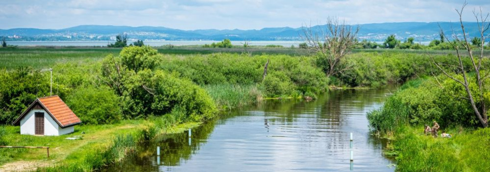 [galeria]
The Life-Giving Zala
Did you know the Zala River once flowed into the Drava and only later “found” Lake Balaton?
The history of western Hungary’s water systems is not just a fascinating geological puzzle — it reads like an epic of Earth history: riverbeds shift, rivers “consume” one another, and even Lake Balaton doesn’t enter the scene until the final chapter. Discover how nature reshaped this landscape stroke by stroke — and how the Zala became Balaton’s most vital source of water.
The Quaternary Period and the Power of Landscape Formation
What sets the Quaternary Period (2.58 million years ago to the present) apart from earlier geological epochs is that the surface-shaping processes of this time — and the landforms they produced — continue to define our geographic environment today.
Pleistocene Changes: Riverbed Migrations and Terraces
One of the most pivotal surface processes during the Pleistocene (2.58 to 0.01 million years ago) was the migration of riverbeds and the formation of terraces and alluvial fans. These changes were closely tied to the slow retreat of the Pannonian Lake, which once filled much of the Carpathian Basin (see also: The Legacy of the Ancient Pannonian Lake).
The Ancient Danube Moves West
The early Danube initially flowed westward across what is now western Hungary, draining into the retreating Pannonian Lake. This westward course likely remained until the early Pleistocene.
A River’s Great Turning Point
The most dramatic hydrological change in the Carpathian Basin occurred between the Pliocene and Pleistocene: the formation of the Danube’s Visegrád Gorge (today’s Danube Bend), which diverted the river toward the center of the country and what is now the Pest Plain.
This shift profoundly affected all its former western tributaries — including the Zala.
The Story of the Zala: Migration and Capture
The river system of Central Transdanubia evolved in surprising ways, and the Zala’s journey is one of its most remarkable chapters. The Rába River already flowed northeastward toward the Little Hungarian Plain. The ancient Marcal, running northward, flowed into the Rába — and into it, in turn, flowed the ancient Zala.
But nature redrew the map — using the Zala as its brush. A now-vanished river flowing from north to south (its remnants visible today between Zalaszentgrót and Zalavár) cut into the landscape through a process called headward erosion — where rivers erode backward into the terrain, much like a hot knife slicing through butter. Eventually, it cut into the ancient Zala’s valley and “captured” the river, diverting it into its own course.
A New Path — and the Birth of Lake Balaton
From then on, the Zala made a sharp turn south at Türje and — with no Lake Balaton yet in existence — initially emptied into the Drava. Later, as the depression that would one day become Lake Balaton deepened, the Zala was gradually drawn toward it.
Lake Balaton, as a continuous body of water, is only about 5,000 years old — but for millions of years before, the Zala had already been on a winding journey that ultimately made it Balaton’s primary source of water, and the most life-giving river in the region today.
title: LídRind Porta
description: At Lídrind Porta, every bite comes from home-raised cattle, crafted naturally and by hand, without additives.
címkék:
fókusz kulcsszó:
szinoníma címkék:
20. Osgyán Mustard
Last modification: 2025. November. 26. 10:38
Bold flavors, daring spices — mustard like you’ve never tasted before.
Találati relevancia adatok
megtalálta: szöveg (1) | összesen: 1 pont
Tárolt adatok:
cím: Osgyán Mustard
lead: Bold flavors, daring spices — mustard like you’ve never tasted before.
tartalom: + 1 A symphony of flavors in every jar Handcrafted mustard, grown in Hungary In Hungary, only a handful of producers make mustard from locally grown seeds. Osgyán Mustard is special because its key ingredient — mustard seed — comes from Hungarian soil. But it’s not just about the origin. Osgyán László’s small-batch mustards offer more than twenty unique flavor combinations, blending bold creativity with the soul of Hungarian cuisine. If you love trying new, exciting flavors, these small jars of golden goodness are made for you. A new beginning — One mustard at a time László began his mustard journey after leaving a career in pharmaceutical development. Seeking to break free from routine, he turned a long-time passion into his life’s work. Inspired by French, English, German, and Transylvanian mustards, he studied recipes from Roman times to Jamie Oliver, mixing tradition with his own creative twist. This fusion became the signature taste of Osgyán Mustard. Every mustard is unique Each variety has its own carefully developed recipe and process. Whether spicy or mild, every mustard starts with the same three ingredients: mustard seeds, vinegar, and 100% grape juice. László grinds the mustard seeds fresh for every batch. Flavors are added during cooking, not after, ensuring rich, integrated aromas. Precise temperature control is key: spicy mustards are handled differently than milder ones to perfect the balance of heat and flavor. Local ingredients, honest taste Osgyán Mustard contains no preservatives, artificial colors, or flavor enhancers. Natural ingredients are non-negotiable. László sources pears, onions, horseradish, and pumpkins from local Zala County farmers whenever possible. Some specialty ingredients, like anchovies, are imported but chosen with strict quality standards. Part of the mustard seed supply comes from László’s own fields in Szolnok, Eastern Hungary — the perfect environment for growing mustard. He uses a traditional Hungarian yellow mustard variety for an authentic taste. Product highlights Osgyán Mustard – Over 20 flavors to explore The collection now includes more than twenty flavors, with some staples available year-round and others appearing seasonally. Best-sellers include caramelized onion, parmesan, chili, whiskey, and fig mustards. Autumn brings pumpkin mustard, while Christmas features festive blends like ginger-cardamom or star anise. You’ll also find gluten-free, lactose-free, and sugar-free options — with clear, transparent labeling. While László grows his own mustard seeds in Szolnok, other ingredients like pears and onions are sourced locally. The 100% grape juice, a key element of his recipes, comes from Dobosi Winery in Szentantalfa. Osgyán Mustard isn’t just a condiment — it’s a culinary experience. Enjoy it on meats, cheeses, or simply on fresh bread. Where to buy Hévíz Farmers’ Market More information & Contact: Website Phone: +36 30 912 5541
[galeria]
Waters That Carve Slopes, Sediments That Tell Time
About 10,000 years ago, rapid climate warming triggered a cascade of natural responses: torrential floods, landslides, and intense rock weathering. The landscape we walk on today was not shaped over mere centuries, but by the dramatic forces of climate and water, working together. Did you know that the Zala Valley floor is made up of sediments deposited by a kind of "river of time"? Discover how the Earth’s surface became one of the most sensitive indicators of climate change.
Climate Change: Not Just a Modern Phenomenon
We often associate climate change with contemporary issues, but Earth’s climate has shifted many times throughout its history — sometimes quite rapidly. Within large-scale climatic cycles, alternating periods of warming and cooling have long been part of the planet’s natural rhythm.
When Climate Changes, Everything Reacts
A change in climate sets off a chain reaction of environmental processes. It’s not just animals and plants that respond — so does the landscape itself.
Around 10,000 years ago, as the climate warmed significantly, rainfall became more intense.
More rain meant more erosion: stormwater began washing away sediment from hills and valleys into riverbeds. The rivers, now carrying more water and more sediment, flooded more often and spread these materials across the landscape.
Shaping the Terrain
This had a major impact on topography: the land surface became more fragmented and dynamic. Warming temperatures also sped up chemical and physical weathering, breaking down bedrock and helping fertile soil layers to develop.
In short, natural geological processes that had long been underway suddenly accelerated — and reshaped the surface of the land.
Young Sediments at the Base of the Slopes
Today, in many areas of the region, the lower slopes and valley edges are coated with sediment — debris washed down from higher ground, largely within the last 10,000–20,000 years. In the Zala Valley, for instance, these deposits have spread so far that they now reach the center of the valley floor.
The original bedrock source of these sediments varies: in Zala, it’s typically Pannonian sand (Somló Formation), while in the Keszthely Hills, marine-origin carbonates dominate — mostly dolomite, with some limestone. These sediments now appear as fine gravel, pebbles, or coarse sand, quietly recording the environmental changes of the recent past.
title: Osgyán Mustard
description: Bold flavors, daring spices — mustard like you’ve never tasted before.
címkék:
fókusz kulcsszó:
szinoníma címkék: