Search
Kizárt szavak
Tiltott szavak
- cialis
- viagra
- php
- sql
- html
- https
- http
- chr
- script
- sex
- porn
- sexmassage
Alternatív kifejezések
- =
1. VIP
Last modification: 2022. September. 26. 09:11
Találati relevancia adatok
Tárolt adatok:
2. Margit Kreiner
Last modification: 2025. November. 26. 10:32
It’s not often you get to taste quail eggs — especially ones marinated in aromatic olive oil. Another must-try specialty is the wild garlic pesto, an irresistible highlight of the farm.
Találati relevancia adatok
Tárolt adatok:
The Life-Giving Winds of the Ice Age: How Loess Shaped the Land
Did you know that Transdanubia’s rich, golden soils are actually a gift from the winds of the Ice Age? Loess isn’t just a dry geological term — it’s an ancient natural recipe that gave rise to some of the most fertile soils in the Carpathian Basin. Where vineyards grow today and birds nest in loess cliffs, strong winds once carried yellow dust across the landscape — for thousands of years. Learn how this unique sediment shaped the land and why loess is still essential for sustainable farming today.
What Is Loess and How Did It Form?
The term loess comes from the German word lose, meaning "loose." Loess is a fine-grained, yellowish sediment that was deposited during the Pleistocene epoch (2.58–0.01 million years ago), particularly during glacial periods. It formed in periglacial environments south of the great Scandinavian ice sheet — cold, dry landscapes with little or no vegetation.
The dust was carried by strong Ice Age winds from floodplains and barren steppes, and slowly accumulated over tens of thousands of years. Eventually, calcium carbonate cemented these layers into loess, which developed characteristic vertical fissures.
It’s important to note that the Pleistocene wasn't a single “Ice Age,” but a period that included alternating cold and warm phases — some even warmer than today.
Loess and the Landscape
Loess gave the Carpathian Basin — especially Transdanubia — its distinct terrain.
Steep loess cliffs (sometimes up to 10 meters high), caves that provide nesting sites for bee-eaters and sand martins, centuries-old sunken roads carved into hillsides, and exposed root systems are all part of the landscape’s geological legacy.
Together, they define the unique character of this region — shaped by time, wind, and stone.
Fertility and Water Retention
Loess-rich areas have produced some of the most fertile soils in the region. Many local producers farm on land that sits atop loess. This creates an excellent foundation for agriculture — not just because of the high humus content, but also because loess has outstanding water-holding capacity. Its vertical pores allow moisture to penetrate deeply and remain in the soil, even during dry periods.
A Modern Echo — Dust from the Sahara
Interestingly, the fine Saharan dust that now reaches Central Europe more frequently can be seen as a modern counterpart to loess-forming material. It’s a reminder that the powerful natural forces that shaped the land long ago are still at work today — just on a different scale.
3. Osgyán Mustard
Last modification: 2025. November. 26. 10:38
Bold flavors, daring spices — mustard like you’ve never tasted before.
Találati relevancia adatok
Tárolt adatok:
About 10,000 years ago, rapid climate warming triggered a cascade of natural responses: torrential floods, landslides, and intense rock weathering. The landscape we walk on today was not shaped over mere centuries, but by the dramatic forces of climate and water, working together. Did you know that the Zala Valley floor is made up of sediments deposited by a kind of "river of time"? Discover how the Earth’s surface became one of the most sensitive indicators of climate change.
Climate Change: Not Just a Modern Phenomenon
We often associate climate change with contemporary issues, but Earth’s climate has shifted many times throughout its history — sometimes quite rapidly. Within large-scale climatic cycles, alternating periods of warming and cooling have long been part of the planet’s natural rhythm.
When Climate Changes, Everything Reacts
A change in climate sets off a chain reaction of environmental processes. It’s not just animals and plants that respond — so does the landscape itself.
Around 10,000 years ago, as the climate warmed significantly, rainfall became more intense.
More rain meant more erosion: stormwater began washing away sediment from hills and valleys into riverbeds. The rivers, now carrying more water and more sediment, flooded more often and spread these materials across the landscape.
Shaping the Terrain
This had a major impact on topography: the land surface became more fragmented and dynamic. Warming temperatures also sped up chemical and physical weathering, breaking down bedrock and helping fertile soil layers to develop.
In short, natural geological processes that had long been underway suddenly accelerated — and reshaped the surface of the land.
Young Sediments at the Base of the Slopes
Today, in many areas of the region, the lower slopes and valley edges are coated with sediment — debris washed down from higher ground, largely within the last 10,000–20,000 years. In the Zala Valley, for instance, these deposits have spread so far that they now reach the center of the valley floor.
The original bedrock source of these sediments varies: in Zala, it’s typically Pannonian sand (Somló Formation), while in the Keszthely Hills, marine-origin carbonates dominate — mostly dolomite, with some limestone. These sediments now appear as fine gravel, pebbles, or coarse sand, quietly recording the environmental changes of the recent past.
4. Skapér Apiary
Last modification: 2025. November. 26. 11:11
Over fifty years of beekeeping expertise, apitherapy knowledge, and pure Hungarian honey from Zalaszentgrót — at Skapér Apiary, every drop matters.
Találati relevancia adatok
Tárolt adatok:
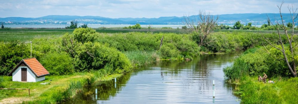
Did you know the Zala River once flowed into the Drava and only later “found” Lake Balaton?
The history of western Hungary’s water systems is not just a fascinating geological puzzle — it reads like an epic of Earth history: riverbeds shift, rivers “consume” one another, and even Lake Balaton doesn’t enter the scene until the final chapter. Discover how nature reshaped this landscape stroke by stroke — and how the Zala became Balaton’s most vital source of water.
The Quaternary Period and the Power of Landscape Formation
What sets the Quaternary Period (2.58 million years ago to the present) apart from earlier geological epochs is that the surface-shaping processes of this time — and the landforms they produced — continue to define our geographic environment today.
Pleistocene Changes: Riverbed Migrations and Terraces
One of the most pivotal surface processes during the Pleistocene (2.58 to 0.01 million years ago) was the migration of riverbeds and the formation of terraces and alluvial fans. These changes were closely tied to the slow retreat of the Pannonian Lake, which once filled much of the Carpathian Basin (see also: The Legacy of the Ancient Pannonian Lake).
The Ancient Danube Moves West
The early Danube initially flowed westward across what is now western Hungary, draining into the retreating Pannonian Lake. This westward course likely remained until the early Pleistocene.
A River’s Great Turning Point
The most dramatic hydrological change in the Carpathian Basin occurred between the Pliocene and Pleistocene: the formation of the Danube’s Visegrád Gorge (today’s Danube Bend), which diverted the river toward the center of the country and what is now the Pest Plain.
This shift profoundly affected all its former western tributaries — including the Zala.
The Story of the Zala: Migration and Capture
The river system of Central Transdanubia evolved in surprising ways, and the Zala’s journey is one of its most remarkable chapters. The Rába River already flowed northeastward toward the Little Hungarian Plain. The ancient Marcal, running northward, flowed into the Rába — and into it, in turn, flowed the ancient Zala.
But nature redrew the map — using the Zala as its brush. A now-vanished river flowing from north to south (its remnants visible today between Zalaszentgrót and Zalavár) cut into the landscape through a process called headward erosion — where rivers erode backward into the terrain, much like a hot knife slicing through butter. Eventually, it cut into the ancient Zala’s valley and “captured” the river, diverting it into its own course.
A New Path — and the Birth of Lake Balaton
From then on, the Zala made a sharp turn south at Türje and — with no Lake Balaton yet in existence — initially emptied into the Drava. Later, as the depression that would one day become Lake Balaton deepened, the Zala was gradually drawn toward it.
Lake Balaton, as a continuous body of water, is only about 5,000 years old — but for millions of years before, the Zala had already been on a winding journey that ultimately made it Balaton’s primary source of water, and the most life-giving river in the region today.